ZCZC MIATWOAT ALL
TTAA00 KNHC DDHHMM

Tropical Weather Outlook
NWS National Hurricane Center Miami FL
800 AM EDT Tue Jun 11 2024

For the North Atlantic...Caribbean Sea and the Gulf of Mexico:

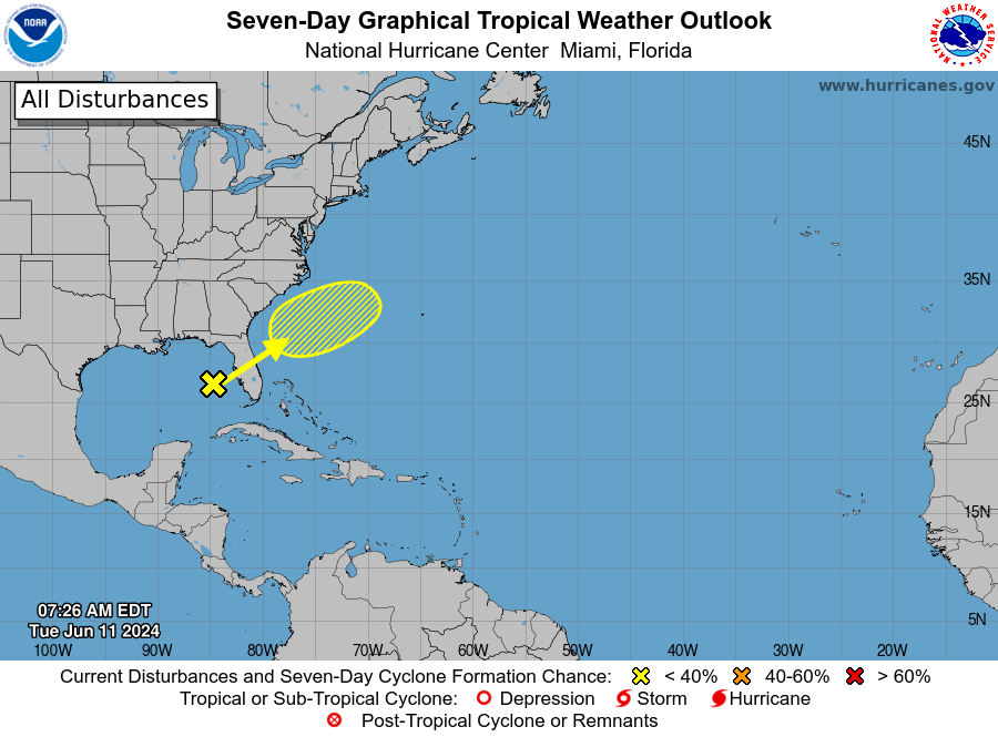
1. Eastern Gulf of Mexico and Offshore Southeast U.S.:
A trough of low pressure over the eastern Gulf of Mexico is
producing a large area of disorganized showers and thunderstorms.
This system is expected to move northeastward across Florida during
the next day or so and offshore of the U.S. Southeast coast later
this week.  Environmental conditions are expected to be generally
unfavorable, although some slow development is possible when the
system is offshore of the U.S. Southeast coast.  Regardless of
development, heavy rainfall is expected across portions of Florida
during the next few days.  For more information, see products issued
by the Weather Prediction Center and local National Weather Service
Forecast Offices.
* Formation chance through 48 hours...low...near 0 percent.
* Formation chance through 7 days...low...20 percent.


Weather Prediction Center products can be found at
www.wpc.ncep.noaa.gov and National Weather Service forecast
information can be found at www.weather.gov

Forecaster Cangialosi/Kelly


