


NHC Graphical Outlook Archive
« Earliest Available ‹ Earlier Later › Latest Available »
Place your mouse cursor over areas of interest for more information
| GIS data: .shp |
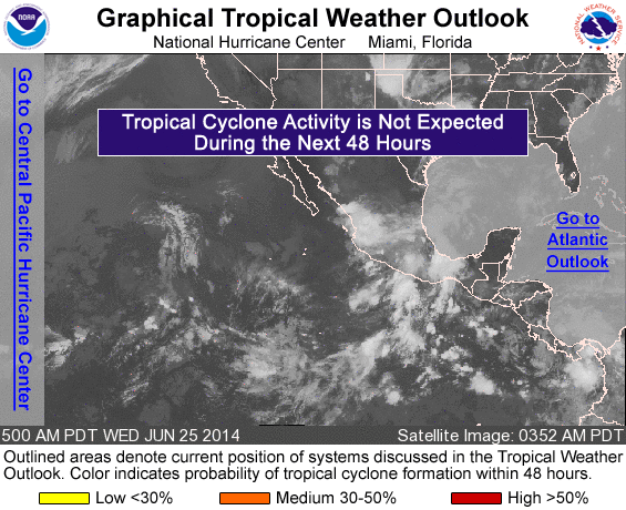
ZCZC MIATWOEP ALL
TTAA00 KNHC DDHHMM

TROPICAL WEATHER OUTLOOK
NWS NATIONAL HURRICANE CENTER MIAMI FL
500 AM PDT WED JUN 25 2014

For the eastern North Pacific...east of 140 degrees west longitude:

An area of low pressure is expected to form to the south of the
coast of Mexico in a couple of days, and conditions appear favorable
for some development of this system by the weekend while it moves
west-northwestward.
* Formation chance through 48 hours...low...near 0 percent.
* Formation chance through 5 days...medium...50 percent.

$$
Forecaster Pasch/Berg
NNNN
List of all Atlantic Outlooks
List of all East Pacific Outlooks