


NHC Graphical Outlook Archive
« Earliest Available ‹ Earlier Later › Latest Available »
Place your mouse cursor over areas of interest for more information
| GIS data: .shp |
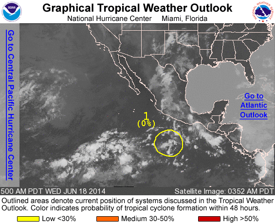
ZCZC MIATWOEP ALL
TTAA00 KNHC DDHHMM

TROPICAL WEATHER OUTLOOK
NWS NATIONAL HURRICANE CENTER MIAMI FL
500 AM PDT WED JUN 18 2014

For the eastern North Pacific...east of 140 degrees west longitude:

1. Disorganized cloudiness and thunderstorms, associated with a
tropical wave, are located several hundred miles south-southwest of
Acapulco, Mexico.  Although development is not anticipated during
the next couple of days, some development of this system is still
possible by later this weekend while it moves west-northwestward at
5 to 10 mph.
* Formation chance through 48 hours...low...near 0 percent.
* Formation chance through 5 days...low...20 percent.

Forecaster Avila
List of all Atlantic Outlooks
List of all East Pacific Outlooks