


NHC Graphical Outlook Archive
« Earliest Available ‹ Earlier Later › Latest Available »
Place your mouse cursor over areas of interest for more information
| GIS data: .shp |
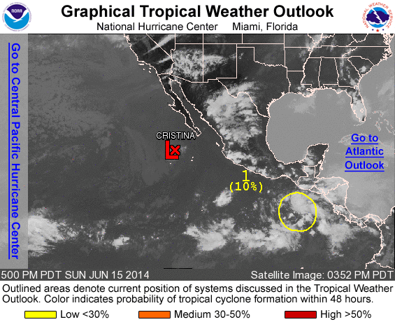
ZCZC MIATWOEP ALL
TTAA00 KNHC DDHHMM

TROPICAL WEATHER OUTLOOK
NWS NATIONAL HURRICANE CENTER MIAMI FL
500 PM PDT SUN JUN 15 2014

For the eastern North Pacific...east of 140 degrees west longitude:

The National Hurricane Center has issued the last advisory on
Post-Tropical Cyclone Cristina, located a few hundred miles
southwest of the southern tip of the Baja California peninsula of
Mexico.

1. A tropical wave located a few hundred miles south of the coast of
Guatemala continues to produce disorganized shower and thunderstorm
activity. Environmental conditions are favorable for gradual
development of this system during the next several days at it moves
westward and then west-northwestward at around 10 mph.
* Formation chance through 48 hours...low...10 percent.
* Formation chance through 5 days...medium...30 percent.

Forecaster Kimberlain
List of all Atlantic Outlooks
List of all East Pacific Outlooks