


NHC Graphical Outlook Archive
« Earliest Available ‹ Earlier Later › Latest Available »
Place your mouse cursor over areas of interest for more information
| GIS data: .shp |
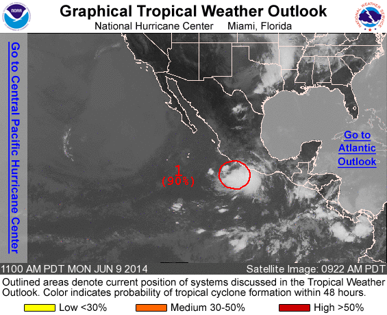
ZCZC MIATWOEP ALL
TTAA00 KNHC DDHHMM

TROPICAL WEATHER OUTLOOK
NWS NATIONAL HURRICANE CENTER MIAMI FL
1100 AM PDT MON JUN 9 2014

For the eastern North Pacific...east of 140 degrees west longitude:

1. Thunderstorm activity associated with a well-defined low pressure
system located about 150 miles south-southwest of Zihuatanejo,
Mexico, has continued to increase and become better organized
during the past several hours. Environmental conditions are
conducive for continued development, and this system will likely
become a tropical depression later this afternoon or tonight. The
low is expected to move generally west-northwestward at 5 to 10 mph,
which will keep the strongest winds away from the coast of
southwestern Mexico.
* Formation chance through 48 hours...high...90 percent.
* Formation chance through 5 days...high...90 percent.

Forecaster Stewart
List of all Atlantic Outlooks
List of all East Pacific Outlooks