


NHC Graphical Outlook Archive
« Earliest Available ‹ Earlier Later › Latest Available »
Place your mouse cursor over areas of interest for more information
| GIS data: .shp |
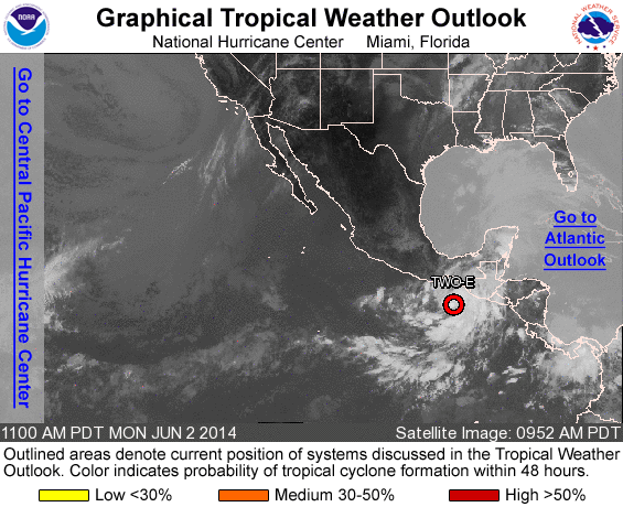
ZCZC MIATWOEP ALL
TTAA00 KNHC DDHHMM

TROPICAL WEATHER OUTLOOK
NWS NATIONAL HURRICANE CENTER MIAMI FL
1100 AM PDT MON JUN 2 2014

For the eastern North Pacific...east of 140 degrees west longitude:

1. Showers and thunderstorms associated with a low pressure area
located about 250 miles south-southeast of Salina Cruz, Mexico, have
continued to become better organized this morning.  Environmental
conditions are conducive for additional development and a tropical
depression is likely to form later today or tonight as the low moves
slowly northeastward or northward. Locally heavy rainfall associated
with this system is already affecting portions of western Central
America, and is expected to spread over southeastern Mexico during
the next couple of days.  These rains could cause life-threatening
flash floods and mud slides in areas of mountainous terrain.
* Formation chance through 48 hours...high...90 percent
* Formation chance through 5 days...high...90 percent

Forecaster Brown
List of all Atlantic Outlooks
List of all East Pacific Outlooks