


NHC Graphical Outlook Archive
« Earliest Available ‹ Earlier Later › Latest Available »
Place your mouse cursor over areas of interest for more information
| GIS data: .shp |
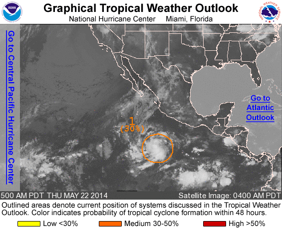
ZCZC MIATWOEP ALL
TTAA00 KNHC DDHHMM

TROPICAL WEATHER OUTLOOK
NWS NATIONAL HURRICANE CENTER MIAMI FL
500 AM PDT THU MAY 22 2014

For the eastern North Pacific...east of 140 degrees west longitude:

1. Showers and thunderstorms continue to increase near an area of low
pressure located several hundred miles south-southwest of
Manzanillo, Mexico.  Environmental conditions appear conducive for
additional development of this system during the next few days while
it moves northwestward or west-northwestward at 5 to 10 mph.
* Formation chance through 48 hours...medium...30 percent
* Formation chance through 5 days...medium...50 percent

Forecaster Berg
List of all Atlantic Outlooks
List of all East Pacific Outlooks