000
AXPZ20 KNHC 160255
TWDEP

Tropical Weather Discussion
NWS National Hurricane Center Miami FL
0405 UTC Thu Jul 16 2026

Tropical Weather Discussion for the eastern Pacific Ocean from
03.4S to 30N, east of 120W including the Gulf of California, and
from the Equator to 30N, between 120W and 140W. The following
information is based on satellite imagery, weather observations,
radar, and meteorological analysis.

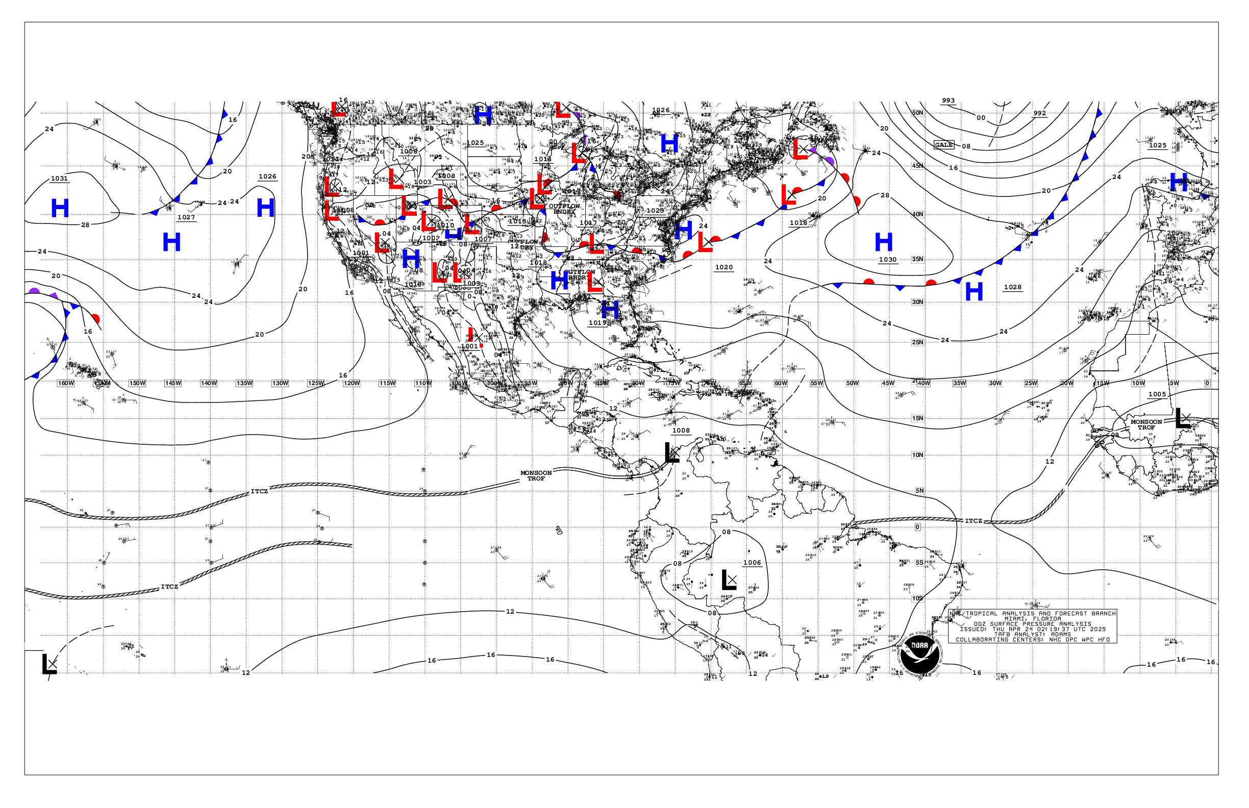
Based on 0000 UTC surface analysis and satellite imagery through
0200 UTC.

...SPECIAL FEATURES...

Tropical Storm Elida is centered near 15.4N 115.2W at 16/0300
UTC, moving west at 11 kt. Estimated minimum central pressure is
997 mb. Maximum sustained wind speed is 50 kt with gusts to 60
kt. Peak seas are currently around 16 ft or 5.0 m. Numerous
moderate to strong convection is noted within 120 nm in the east
semicircle, and within 60 nm in the west semicircle. Similar
convection is noted between 180 nm and 360 nm in the south
quadrant. Numerous moderate isolated strong convection is noted
elsewhere within 420 nm in the northeast quadrant, 900 nm in a
band in the southeast quadrant, in a band between 240 nm and 810
nm in the southwest quadrant, and within 300 nm in the northwest
quadrant of Elida. Elida is moving toward the west, and a turn
toward the west-northwest is expected on Thu, followed by a
northwestward motion beginning on Fri and continuing through the
weekend. Additional strengthening is expected during the next
couple of days, and Elida could become a hurricane by Thu night
or early Fri. Please read the latest HIGH SEAS FORECAST issued
by the National Hurricane Center at website -
https://www.nhc.noaa.gov/text/MIAHSFEP2.shtml and the latest
Elida NHC Forecast/Advisory and Public Advisory at
www.hurricanes.gov for more details.

...TROPICAL WAVES...

A tropical wave is along 97W, north of 02N to across southern
Mexico over Oaxaca, moving westward at around 10 kt. Scattered
moderate isolated strong convection is noted from 02N to 12N
between 88W and 102W.

...INTERTROPICAL CONVERGENCE ZONE/MONSOON TROUGH...

The monsoon trough extends from 10N74W to 10N86W to 08N95W to
15N111W, then resumes southwest of Elida from 12N118W to 09N126W
to low pressure, 1007 mb, near 11.5N139W to beyond 11N140W.
Other than the convection mentioned with Elida and the tropical
wave above, scattered moderate isolated strong convection is
noted from 05N to 15N between 125W and 140W.

...OFFSHORE WATERS WITHIN 250 NM OF MEXICO...

Please refer to the Special Features section for details on Tropical
Storm Elida, centered about 539 nautical miles southwest of the
southern tip of Baja California.

Fresh to strong winds and rough seas associated with the periphery
of T.S. Elida are reaching the Revillagigedo Islands. Seas just
south of the islands are 8 to 14 ft. Meanwhile, fresh to strong
northerly winds are across the Tehuantepec region with seas of 6
to 7 ft. A broad ridge prevails elsewhere offshore of Baja
California and to the northwest of Elida, while a NW to SE
surface trough is analyzed across the Baja California Peninsula.
This pattern is supporting gentle to moderate NW to N winds and
3 to 7 ft seas across the Baja offshore waters away from Elida.
In the Gulf of California, gentle to moderate SE to S winds and
seas of 1 to 3 ft prevail, higher near the entrance. An upper-
level low spinning over Baja California Sur is generating some
cloudiness and a few showers and thunderstorms across parts of
the Baja California Peninsula, as well as over portions of NW
mainland Mexico. Additional convection is present off southern
Mexico near a tropical wave as described above.

For the forecast, Tropical Storm Elida will move to 15.7N 116.7W
Thu morning, strengthen to a hurricane near 16.2N 118.6W Thu
evening, 17.0N 120.0W Fri morning, 18.1N 121.4W Fri evening,
19.3N 122.8W Sat morning, and 20.6N 124.0W Sat evening. Elida
will weaken to a tropical storm over 23.1N 126.4W late Sun.
Otherwise, a broad ridge will continue to dominate the offshore
forecast waters of Baja California through Thu, allowing for
gentle to moderate NW to N winds to continue along with moderate
seas in mixed swell. In the Gulf of California, moderate to
locally fresh southerly winds are expected to pulse out of the
southwest to west through gaps across portions of the Gulf
through at least Fri, locally strong in the northern Gulf Fri
night. Fresh to strong northerly winds will pulse in the Gulf of
Tehuantepec through at least the upcoming weekend, strongest
during the late night and early morning hours, with locally rough
seas at times.

Looking ahead, an area of low pressure is expected to form later
this week several hundred nautical miles south of the coast of
southern Mexico. Environmental conditions appear conducive for
gradual development of this system thereafter, and a tropical
depression is likely to form by this weekend into early next week
while it moves generally west-northwestward well offshore of
Mexico. Increasing winds and building seas will be possible again
in and around the Revillagigedo Islands late in the weekend into
early next week.

...OFFSHORE WATERS WITHIN 250 NM OF CENTRAL AMERICA, COLOMBIA,
AND WITHIN 750 NM OF ECUADOR...

Fresh to strong NE to E winds continue across the Papagayo region
and downwind to near 89W, with moderate to fresh easterly winds
elsewhere from 08.5N to 12N. Seas are 5 to 7 ft downstream of
Papagayo. Moderate to fresh northerly winds are in the Gulf of
Panama. Moderate or weaker winds and moderate seas, primarily
in SW swell, dominate the remainder of the offshore waters.

For the forecast, fresh to strong NE to E winds and moderate to
rough seas will prevail across the Papagayo region, peaking at
night through Sun night, possibly increasing to near gale-force
early next week. Moderate to fresh northerly winds will pulse
across the Gulf of Panama tonight and Thu night. Moderate or
weaker winds and moderate seas in SW swell are expected
elsewhere, except in the immediate lee of the Galapagos Islands
and nearshore western Colombia where slight seas are forecast.

...REMAINDER OF THE AREA...

Please refer to the Special Features section for details on Tropical
Storm Elida, centered about 539 nautical miles southwest of the
southern tip of Baja California.

A ridge dominates the waters north of 10N and west of 120W, or
ahead of Tropical Storm Elida. The pressure gradient between the
ridge and Elida supports moderate to fresh N to NE winds and 4 to
7 ft seas in mixed swells. A growing band of fresh to strong SW
winds and 7 to 9 ft seas are found south of the monsoon trough
and wrapping into the circulation of Elida, from roughly 03N to
08N between 112W and 130W. Moderate to fresh winds are found
elsewhere south of 07N and east of 125W along with 6 to 8 ft
seas. Mainly moderate or weaker winds and moderate seas prevail
across the remainder of the open waters.

For the forecast, Tropical Storm Elida will move to 15.7N 116.7W
Thu morning, strengthen to a hurricane near 16.2N 118.6W Thu
evening, 17.0N 120.0W Fri morning, 18.1N 121.4W Fri evening,
19.3N 122.8W Sat morning, and 20.6N 124.0W Sat evening. Elida
will weaken to a tropical storm over 23.1N 126.4W late Sun.
Looking ahead, an area of low pressure is expected to form later
this week several hundred nautical miles south of the coast of
southern Mexico. Environmental conditions appear conducive for
gradual development of this system thereafter, and a tropical
depression is likely to form by this weekend into early next week
while it moves generally west-northwestward well offshore of
Mexico. Increasing winds and building seas will be possible again
in and around the Revillagigedo Islands late in the weekend into
early next week. Otherwise, little change in winds and seas
overall is expected through the next several days.

$$
Lewitsky


 NHC on Facebook
 NHC on X
 NHC on YouTube
 NHC Blog: