000
AXPZ20 KNHC 270855
TWDEP

Tropical Weather Discussion
NWS National Hurricane Center Miami FL
1005 UTC Tue Oct 27 2026

Tropical Weather Discussion for the eastern Pacific Ocean from
03.4S to 30N, east of 120W including the Gulf of California, and
from the Equator to 30N, between 120W and 140W. The following
information is based on satellite imagery, weather observations,
radar, and meteorological analysis.

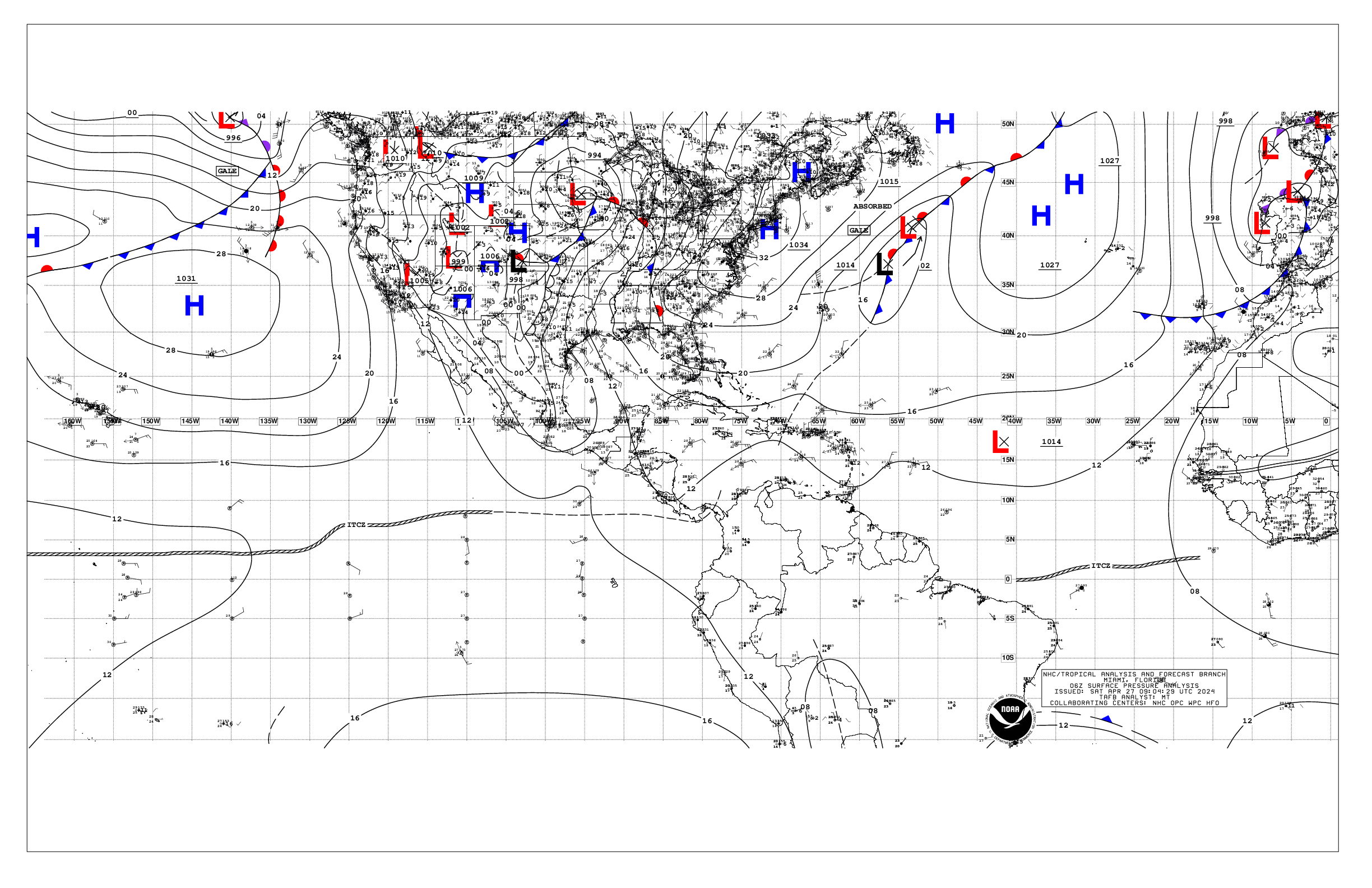
Based on 0600 UTC surface analysis and satellite imagery through
0600 UTC.

...SPECIAL FEATURES...

Tropical Storm Vance is centered near 15.9N 106.9W at 27/0900
UTC, moving northwest at 7 kt. Estimated minimum central
pressure is 1002 mb. Maximum sustained wind speed is 40 kt with
gusts to 50 kt. Peak seas are currently around 18 ft or 5.5 m.
Vance remains a sheared tropical cyclone with convection limited
to the E side of the system. Numerous moderate to strong is noted
between 75 nm and 210 nm in the E through SE quadrants. Vance is
moving toward the northwest. A northwestward motion is expected
to continue today, followed by a gradual turn northward on
Wed. Little change in strength is expected during the next day
or so, followed by gradual weakening. Periods of heavy rainfall
associated with Vance will impact portions of western Mexico
during much of this week. This rainfall may produce flooding and
mudslides across central and southern Sinaloa, western Durango,
and coastal sections of Nayarit and Jalisco, especially in areas
along steep terrain. Swells generated by Vance will affect
portions of the coast of southern, southwestern and west-central
Mexico during the next few days. These swells are likely to cause
life-threatening surf and rip current conditions. Please consult
products from your local weather office. Please read the latest
HIGH SEAS FORECAST issued by the National Hurricane Center at
website - https://www.nhc.noaa.gov/text/MIAHSFEP2.shtml and the
latest Vance NHC Forecast/Advisory and Public Advisory at
www.hurricanes.gov for more details.

Gulf of Tehuantepec Gale Warning: A tight pressure gradient over
the region along with nocturnal drainage flow is resulting in
N-NE minimal gale force winds in the Gulf of Tehuantepec with
rough seas. Winds are forecast to diminish below gale force by
mid-morning. Please read the latest High Seas Forecast issued by
the National Hurricane Center at website
https://www.nhc.noaa.gov/text/MIAHSFEP2.shtml for further
details.

...INTERTROPICAL CONVERGENCE ZONE/MONSOON TROUGH...

The monsoon trough axis extends from the SW Caribbean Sea at
12N75W to along the border of Colombia and Panama to 07N81W to
08N86W to well SE of Tropical Storm Vance at 08N08W. It resumes
well SSW of Vance from 09N109W to 06N120W to 1011 mb low pressure
at 07N133W to 04N140W. Widely scattered moderate isolated strong
convection is noted from 03.4S to 01N between 77W and 84W, and
from 01N to 07N between 84W and 114W. Similar convection is noted
from 00N to 06N between 130W and 140W.

...OFFSHORE WATERS WITHIN 250 NM OF MEXICO...

Please see the Special Features section above for information on
Tropical Storm Vance and on a Gale Warning in the Gulf of
Tehuantepec.

Away from Vance and the Gulf of Tehuantepec, winds are mainly
moderate or weaker, except locally fresh offshore Baja California
Norte from near Punta Eugenia northward. Seas are moderate away
from those Special Features areas, except slight in the northern
and central Gulf of California, higher in the SE Gulf due to
swells associated with Vance.

For the forecast, Tropical Storm Tropical Storm Vance will move
to 17.0N 107.8W this afternoon, 18.6N 108.4W Wed morning, 20.2N
108.6W Wed afternoon, 21.7N 108.5W Thu morning, weaken to a
remnant low near 23.9N 107.9W Thu afternoon, and dissipate Fri
morning.. Gale force northerly winds in the Gulf of Tehuantepec
will diminish to fresh to near gale force mid-morning, pulsing at
those speeds through Thu night, then pulsing at moderate to
fresh thereafter. Moderate to locally fresh winds offshore Baja
California Norte will diminish Wed. Looking ahead, a developing
low pressure and frontal system may impact the Baja California
Peninsula waters late in the upcoming weekend with the potential
for increasing winds and building seas. Moderate or weaker winds
and moderate seas will prevail otherwise.

...OFFSHORE WATERS WITHIN 250 NM OF CENTRAL AMERICA, COLOMBIA,
AND WITHIN 750 NM OF ECUADOR...

Moderate to fresh NE winds are in and downwind of the Gulf of
Papagayo. Moderate to fresh NW to N winds are in the Gulf of
Panama. Moderate seas dominate the offshore waters, except slight
nearshore Colombia. Active convection is present from offshore
southern Costa Rica southeastward to Ecuador, with the potential
for locally higher winds and seas.

For the forecast, fresh NE winds in and downstream of the Gulf
of Papagayo will pulse to moderate to fresh speeds through the
end of the week and into the upcoming weekend. Moderate to fresh
northerly winds will pulse in the Gulf of Panama through the end
of the week, locally strong at times through mid-week. Otherwise,
moderate or weaker winds and moderate seas will continue
elsewhere, except mainly slight nearshore Colombia. Looking
ahead, seas may build to a rough state in SW swell S of the
Equator by the end of the week.

...REMAINDER OF THE AREA...

See Special Features section above for information on Tropical
Storm Vance.

High pressure covers the area generally north of about 18N. A
frontal system remains mainly WNW of the area, with an associated
cold front touching 30N140W. Fresh to strong SE to S winds and
rough seas are just ahead of the front in the far NW waters just
SE of 30N140W. Meanwhile, 1010 mb low pressure is embedded in the
monsoon trough near 07N133W with a surface trough analyzed off to
the NE. The pressure gradient between these features and the high
supports moderate to fresh trades from roughly 13N to 21N
between 115W and 135W. Winds are moderate or weaker across the
remainder of the open waters, except locally fresh S of 03N
between 95W and 115W. Moderate seas prevail away from Vance and
the NW corner, except to rough S of 03N between 95W and 125W in
incoming SW swell mixing with NE swells generated from Tropical
Storm Vance.

For the forecast, Tropical Storm Vance will move to 17.0N 107.8W
this afternoon, 18.6N 108.4W Wed morning, 20.2N 108.6W Wed
afternoon, 21.7N 108.5W Thu morning, weaken to a remnant low near
23.9N 107.9W Thu afternoon, and dissipate Fri morning.
Meanwhile, fresh to locally strong SE to S winds over the NW part
of the area will diminish to mostly fresh speeds by early on Wed
as the warm front pulls away from the region. Incoming SW swell
will continue to spread into a portion of the S-central waters
through late Wed, building seas to the range of 7-10 ft S of
about 04N and between 105W and 128W by late Wed night, while
mixing with old NE swells generated by Vance. These seas are
expected to linger through at least Fri night, likely subsiding
by the start of the weekend. Elsewhere, moderate or weaker winds
and moderate seas will persist through at least mid- week.

Looking ahead, a developing low pressure and frontal system may
impact the waters N of 20N by the end of the week into the
upcoming weekend with the potential for increasing winds and
building seas as the system shifts eastward.

$$
Lewitsky


 NHC on Facebook
 NHC on X
 NHC on YouTube
 NHC Blog: