000
AXPZ20 KNHC 210316
TWDEP

Tropical Weather Discussion
NWS National Hurricane Center Miami FL
0405 UTC Wed Oct 21 2026

Tropical Weather Discussion for the eastern Pacific Ocean from
03.4S to 30N, east of 120W including the Gulf of California, and
from the Equator to 30N, between 120W and 140W. The following
information is based on satellite imagery, weather observations,
radar, and meteorological analysis.

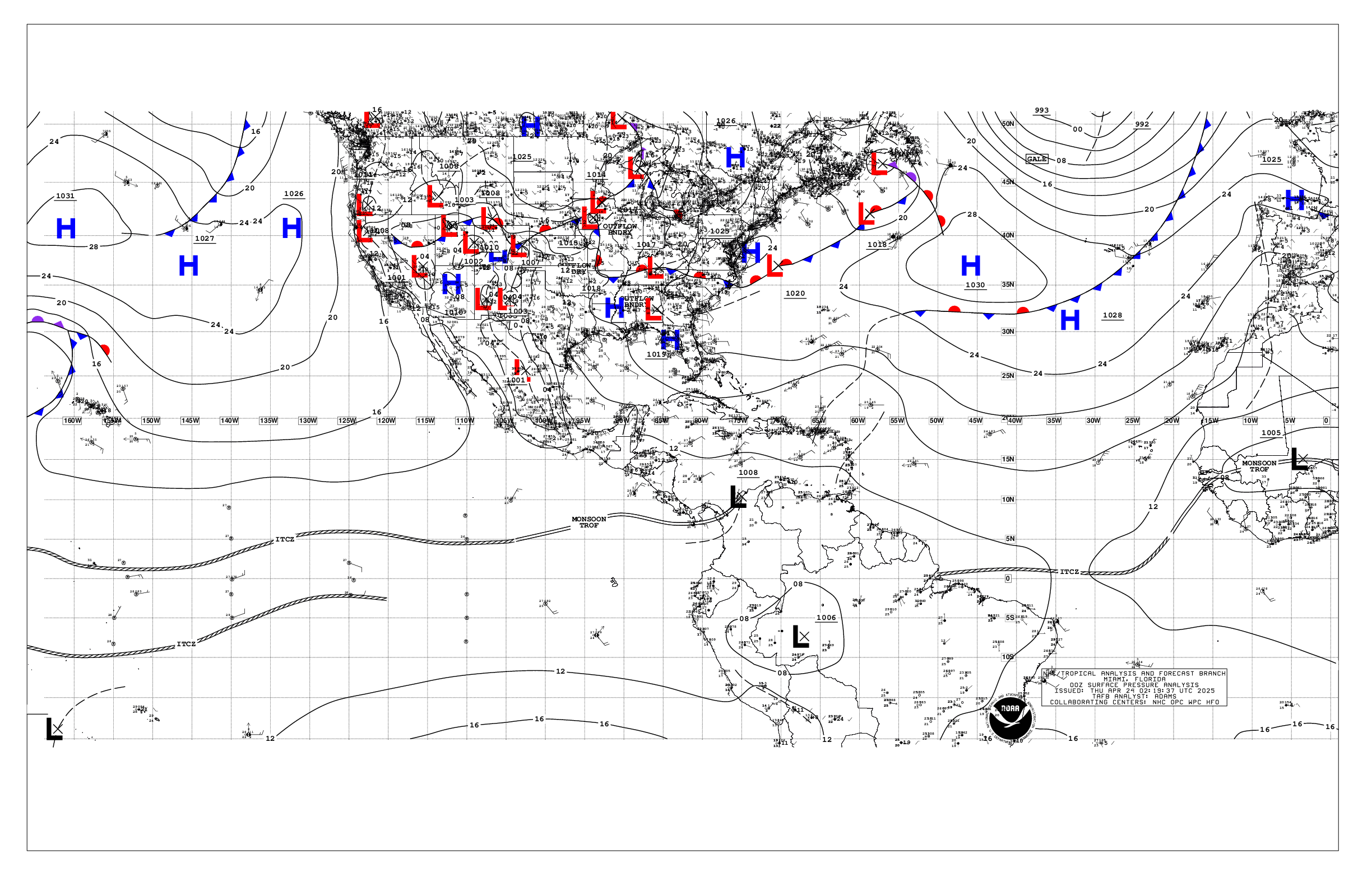
Based on 0000 UTC surface analysis and satellite imagery through
0300 UTC.

...SPECIAL FEATURES...

Gulf of Tehuantepec Gale Warning: High pressure settled over
Mexico will continue to funnel northerly gap winds of gale-force
into the Gulf of Tehuantepec through tonight. Seas in these
waters are rough. Fresh to strong winds will persist into Thu,
then increase to gales again Thu night into Fri night.

Gale Warning South of Southern Mexico (Invest EP94): A low-
pressure system located a few hundred miles south of the Gulf of
Tehuantepec is producing a large area of showers and
thunderstorms that are gradually becoming better organized, and a
tropical depression is forecast to form during the next day or
so. This system is expected to move westward to west-
northwestward at 5 to 10 kt during the next few days, remaining
well offshore of southern Mexico. A large area of fresh to strong
winds and rough seas surround this low center, and these winds
and seas are expected to increase over the next day or so. A Gale
Warning has been issued as a result, for Wed into Thu. There is
a high chance of tropical formation of this low within the next
48 hours.

Please read the latest High Seas Forecast issued by the National
Hurricane Center at website
https://www.nhc.noaa.gov/text/MIAHSFEP2.shtml for further
details.

...INTERTROPICAL CONVERGENCE ZONE/MONSOON TROUGH...

The monsoon trough extends from 11N85W to 1007 mb low pressure
(EP94) near 10N97W, then onward to 06N105W. The ITCZ extends from
05N105W to 06N140W. Scattered moderate to isolated strong
convection is noted from 05N to 13N between 95W and 105W, and
from 05N to 08N between 130W and 140W.

...OFFSHORE WATERS WITHIN 250 NM OF MEXICO...

Please see the Special Features section above for information on
the Gale Warning in the Gulf of Tehuantepec.

Elsewhere, 1007 mb low pressure, the remnant of Simon, is
centered between Cabo Corrientes and the Revillagigedo Islands
near 19N108W. is leading to moderate NW winds across Socorro
Island. Elsewhere, light to gentle winds and moderate seas
prevail, except for slight seas in the Gulf of California.

For the forecast, high pressure settled over Mexico is funneling
northerly gap winds of gale-force into the Gulf of Tehuantepec
this evening. Seas in these waters are rough. Winds will diminish
to strong by Wed, but will increase to gales again Thu night into
Sat. A low- pressure system located a few hundred miles south of
the Gulf of Tehuantepec is producing a large area of showers and
thunderstorms that are gradually becoming better organized, and a
tropical depression is forecast to form during the next day or
so. This system is expected to move westward to west-
northwestward at 5 to 10 kt during the next few days, remaining
well offshore of southern Mexico. There is a high chance of
tropical formation of this low within the next 48 hours

...OFFSHORE WATERS WITHIN 250 NM OF CENTRAL AMERICA, COLOMBIA,
AND WITHIN 750 NM OF ECUADOR...

Rough seas coming from gale-force gap winds in the Gulf of
Tehuantepec continue to impact waters well offshore Guatemala.
Otherwise, gentle to moderate winds and moderate seas prevail.

For the forecast, rough seas well offshore Guatemala deriving
from gap winds in the Gulf of Tehuantepec will decay tonight.
Winds will pulse nightly to fresh in the Papagayo region.
Moderate or weaker winds and moderate seas will prevail
elsewhere.

...REMAINDER OF THE AREA...

See Special Features section above for information on a Gale
Warning issued in association with a low pressure system that has
a potential for tropical development.

Elsewhere, fresh NW winds and rough seas are increasing behind a
cold front that extends from 30N124W to 25N130W. Moderate or
weaker winds and moderate seas dominate the remainder of the
basin.

For the forecast, as the cold front moves to the southeast
tonight, fresh to strong winds and very rough seas will impact
waters north of 25N through Wed, with rough seas reaching as far
south as 20N Thu. A low- pressure system located a few hundred
miles south of the Gulf of Tehuantepec is producing a large area
of showers and thunderstorms that are gradually becoming better
organized, and a tropical depression is forecast to form during
the next day or so. This system is expected to move westward to
west- northwestward at 5 to 10 kt during the next few days,
remaining well offshore of southern Mexico. A large area of fresh
to strong winds and rough seas surround this low center, and
these winds and seas are expected to increase over the next day
or so. A Gale Warning has been issued as a result, for Wed into
Thu. There is a high chance of tropical formation of this low
within the next 48 hours.

$$
Christensen


 NHC on Facebook
 NHC on X
 NHC on YouTube
 NHC Blog: