Q & A with NHC - Michael Lowry
 Michael Lowry
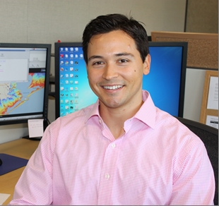
Meteorologist
Storm Surge Unit
National Hurricane Center
By Dennis Feltgen
Public Affairs Officer
NOAA Communications & External Affairs
National Hurricane Center
As a member of the storm surge team, you're a busy man.
No doubt our plate is full. There are many things we are working on, and even more visible products coming down the pipe that I've had a hand in developing.
Is storm surge your real interest?
Well, what got me into meteorology are hurricanes. I grew up in New Orleans, and obviously storm surge is a large component of the hurricane threat.
Have you ever experienced a hurricane-induced storm surge?
I haven't personally experienced it, but I have had the opportunity to see the damage and effects first hand. That is a real eye-opener. It is one thing to do the research, but to actually see it and be faced with its scope can be overwhelming.
Where was your academic training?
I earned my Bachelor of Science in 2005, followed by my Masters, both at Florida State University. Attending FSU turned out to be a very good decision for me. When I was an undergrad, I began doing research under Professor James O'Brien. He let me balance my research with volunteer work for the Florida Division of Emergency Management.
That's unusual. What were you doing at the EM?
Every year, there is a statewide hurricane exercise and that was my primary activity as a volunteer. Through that, I met Matthew Green who was the state meteorologist and got to talking with him. He hired me as an intern in the state meteorological support unit. Matthew left shortly thereafter upon receiving a job at the hurricane center as its liaison to FEMA. I continued the internship under his successor, Ben Nelson, who took over as the state meteorologist. I continued to work with him through graduate school, including those active seasons for Florida in 2004 and 2005. I often say that Hollywood could make a movie or miniseries about life in emergency management during this time. EMs are true unsung heroes for whom I have profound respect. Needless to say for a young meteorologist it was a truly incredible experience.
How did you enter professional life?
Once I graduated with my Masters, I accepted a position in Washington DC with the Department of Defense doing transport and dispersion modeling. It was an entirely different world there and an awesome experience for me. I stayed for several years, then applied for and accepted a job at the hurricane center, right into the storm surge unit.
The storm surge unit has a much more visible role now.
I think so. The part of the hurricane that is most visible to folks tends to be the wind. We are trying to put a renewed emphasis and focus on storm surge because it is the storm surge, not the wind, which has the greatest potential for large loss of life. As such storm surge is also the primary reason emergency managers order hurricane evacuations. If you look at our current suite of products, we don't have a whole lot out there for the general public, so right now we are working on ideas to make this more visible so people can actually realize the threat.
Such as?
We are currently vetting a "storm surge warning" which would be separate from the hurricane warning itself. One of the ideas behind it is the fact that storm surge is not simply confined to the radius of maximum winds. Often times you can get storm surge well away from the center of the storm. We saw this in 2005 when Hurricane Dennis made landfall near Pensacola, with a storm surge of 6 to 9 feet occurring some 150 miles east at St. Marks. The surge devastated the community, yet it was located outside of the hurricane warning at the time of landfall. We want to convey the risk that exists outside of the immediate hurricane landfall area.
This brings to mind 2008's Hurricane Ike.
Exactly. It was a large hurricane making landfall on one side of the Gulf of Mexico with storm surge impacts on the other side. The Gulf Coast of the U.S. is particularly vulnerable to storm surge because of the bathymetry and the layout of the coast. When there is a large and intense storm such as Ike, you can see storm surge along almost the entire Gulf Coast.
Is there something that you personally would like to see?
Right now, I think people have difficulty visualizing storm surge. What I'd like to see are some inundation graphics which leverage tools such as Google Earth so that people can actually see how much water they could potentially get during a landfall event.
What's been the limitation?
We haven't had the resolution in the models to provide a refined picture for users in their neighborhood or community to visualize what the potential water level would be from a landfalling hurricane. I think as we improve the resolution of the models and our capabilities improve, we will be able to move in that direction.
The common question is "How much water am I going to get?"
It is. The difficulty with storm surge is the large uncertainty. The challenge for the forecaster is conveying that level of uncertainty. It can vary widely based on how large the storm is, which direction and how fast it is moving, shape of the coastline, all of these parameters. This can sometimes mean the difference between a storm surge of zero to one of 20 feet at any given location. We are going to give a conservative estimate, a worse-case scenario for the potential amount of water you could see in your area.
Is there life for you outside of this building?
It's important to have that, especially with weather because it is all around. There is the temptation when you go home to look at model data, especially during an event. But honestly, when I go home, the last thing I want to do is sit in front of the TV or computer.
What do you do then?
I have a lot of varied hobbies. I'm a big sports enthusiast - I'm into biking, running, working out, swimming, anything outdoors. I play quite a bit of tennis and golf, too.
Do you have ambitions beyond storm surge?
Coming from a background in research, then stepping into the emergency management arena, and now dealing with storm surge, I've enjoyed studying the various aspects of hurricanes. I would not want to limit myself and am open to possibilities down the road.
What's the best part of your job?
Storm surge is a fairly young arena with a lot of headway to be made. It is just an exciting time.
What's the worst part?
I don't know if it's the worst part of the job, but the most challenging is conveying the science in such a way that the general public can relate. We have great science, we have these great models. But if the message to the general public is not being conveyed in such a manner that they can understand and know where to go, then the science goes for naught.
Send comments to: NHC.Public.Affairs@noaa.gov
Return to Q & A index of stories