| Special Message from NHC/TAFB Issued 19 Nov 2018 09:24 UTC |
For a quick reference to many of the products listed below, you may download our trifold brochure. (También está disponible en español.)
| Atlantic | Eastern Pacific | |
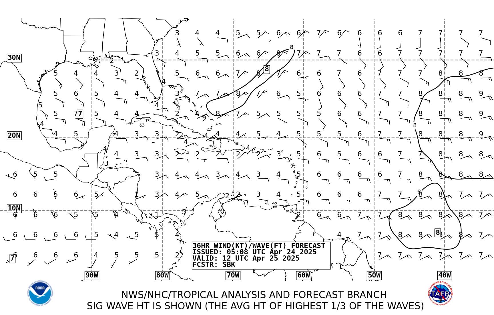
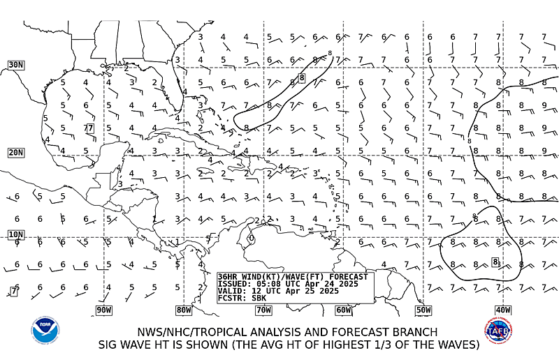
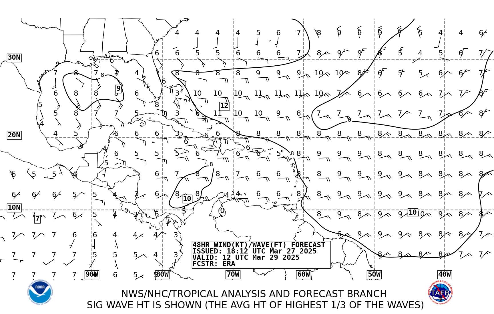
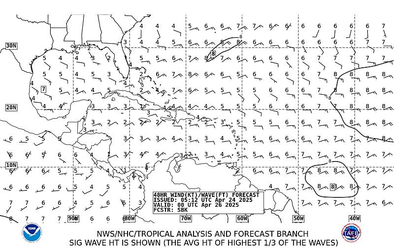
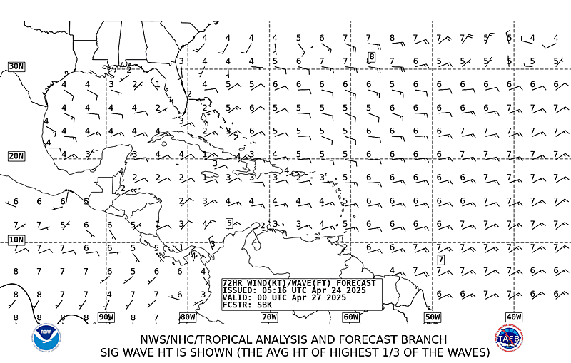
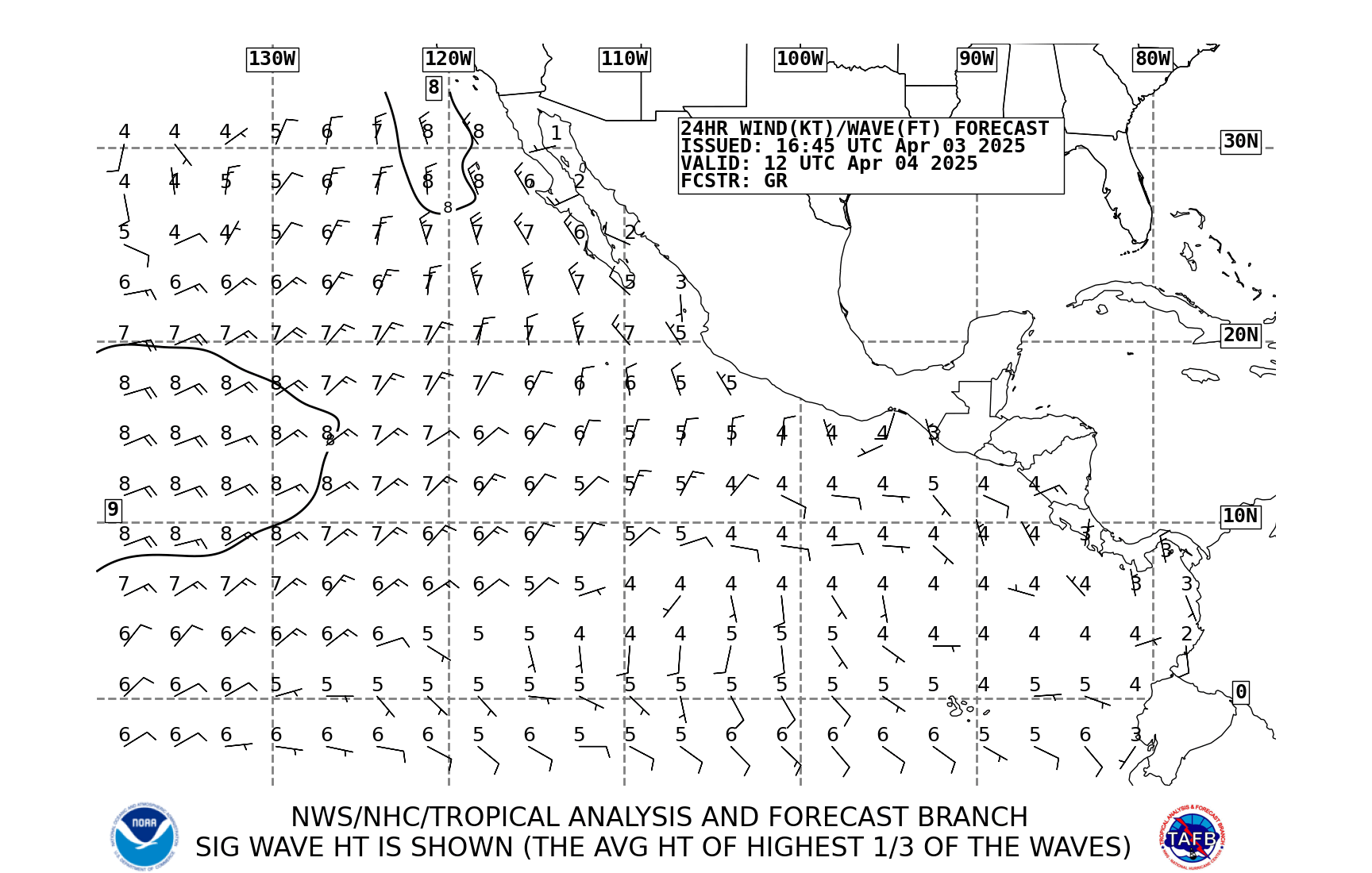
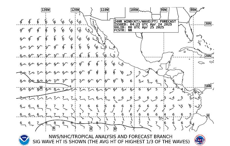
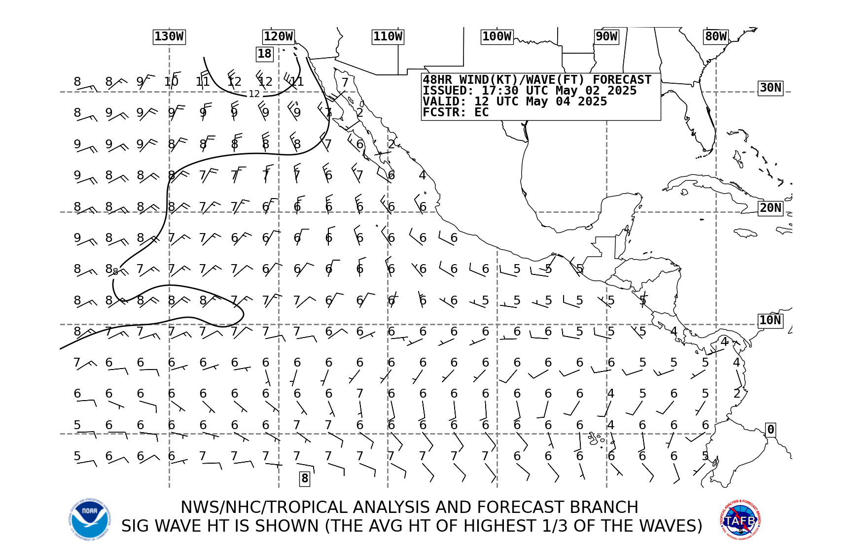
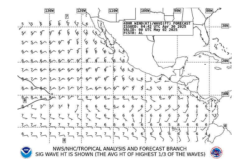
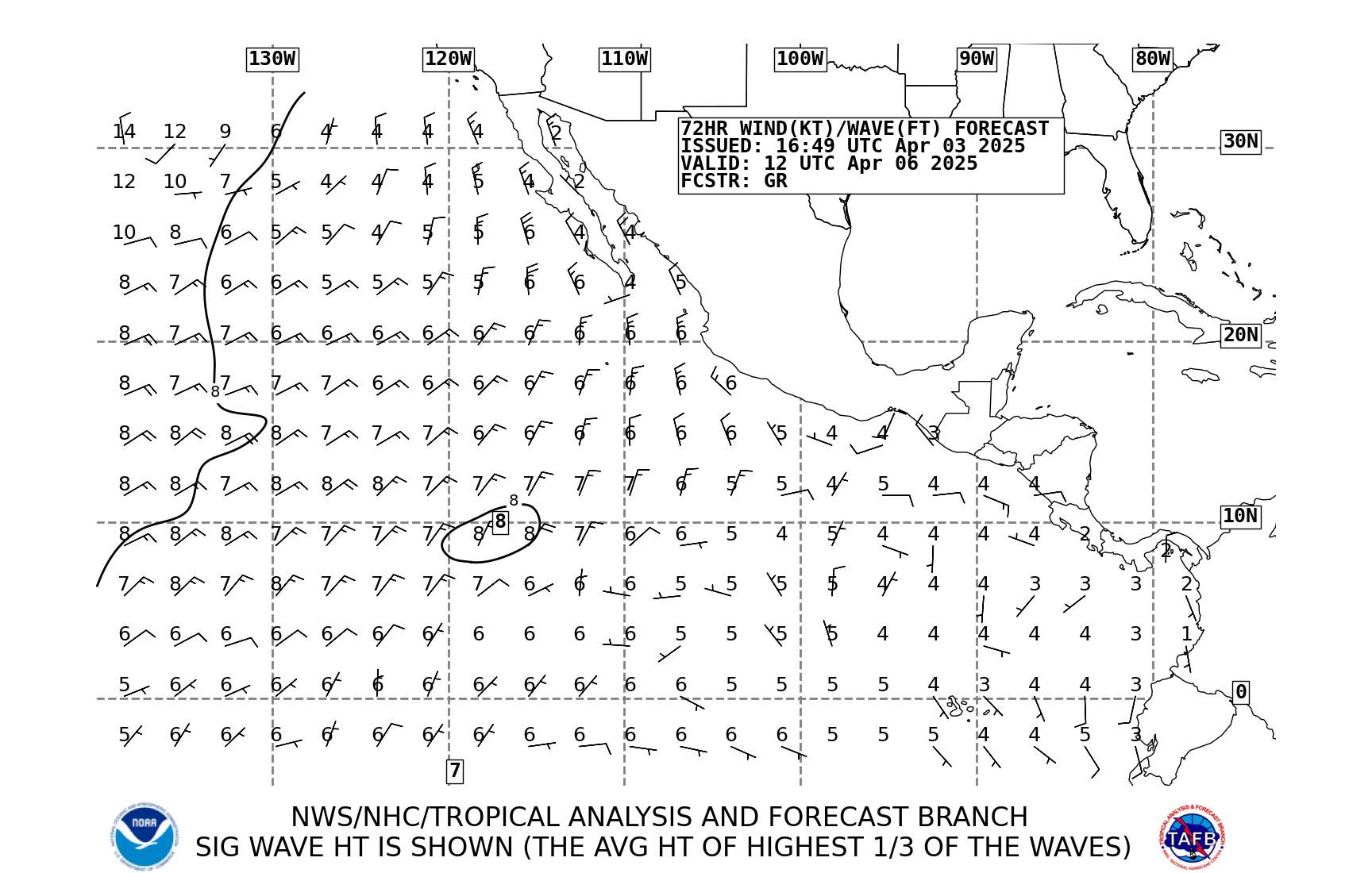
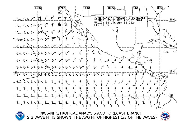
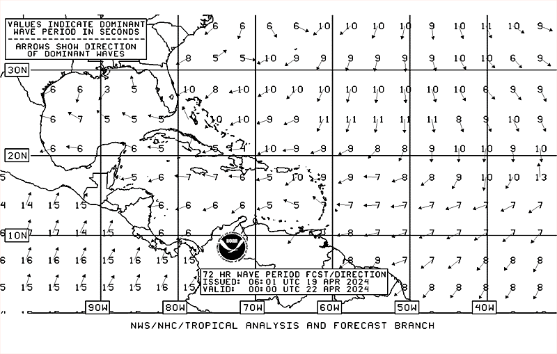
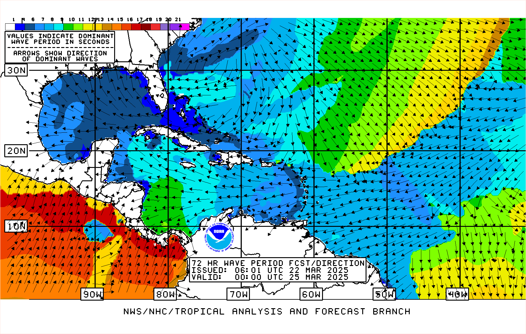
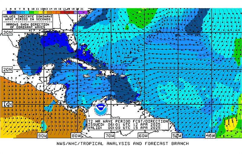
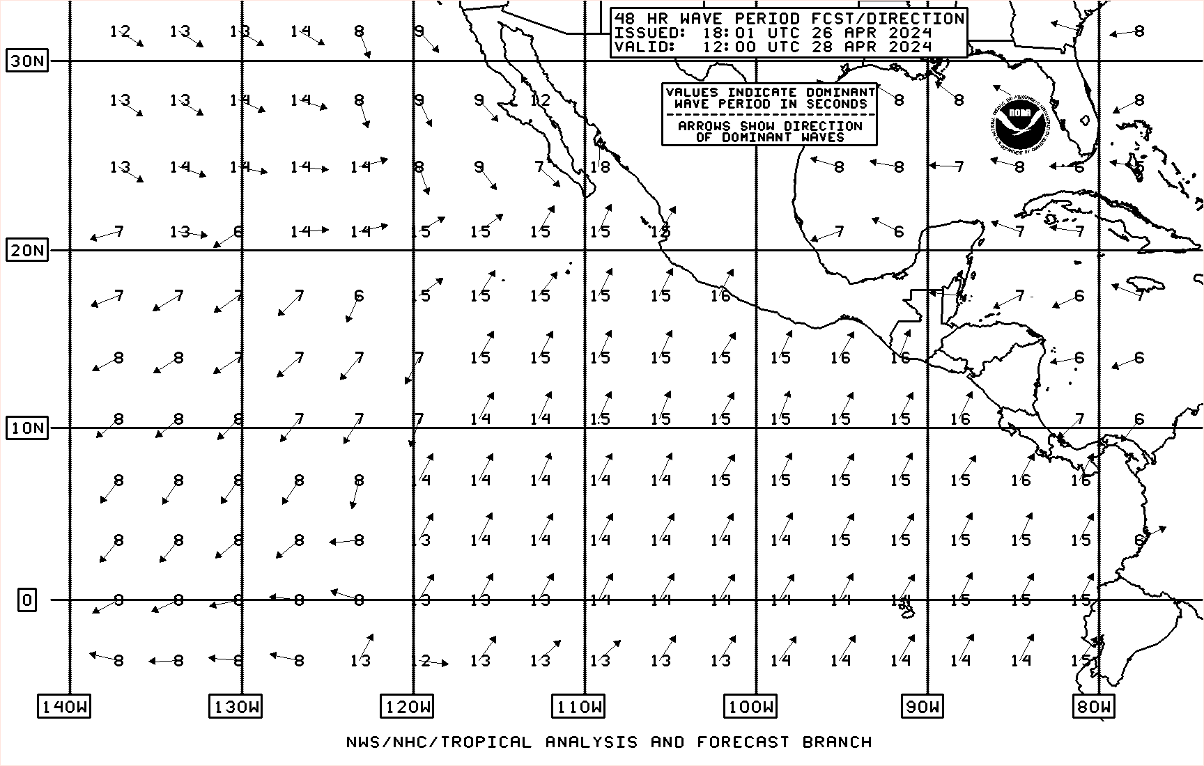
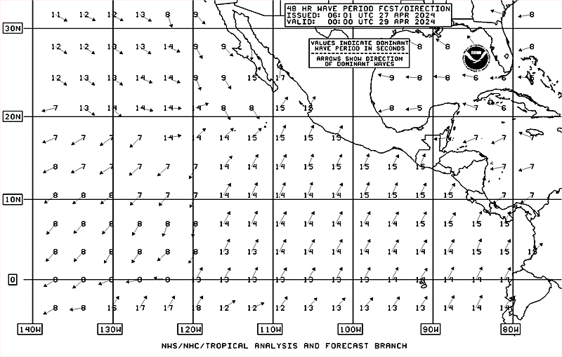
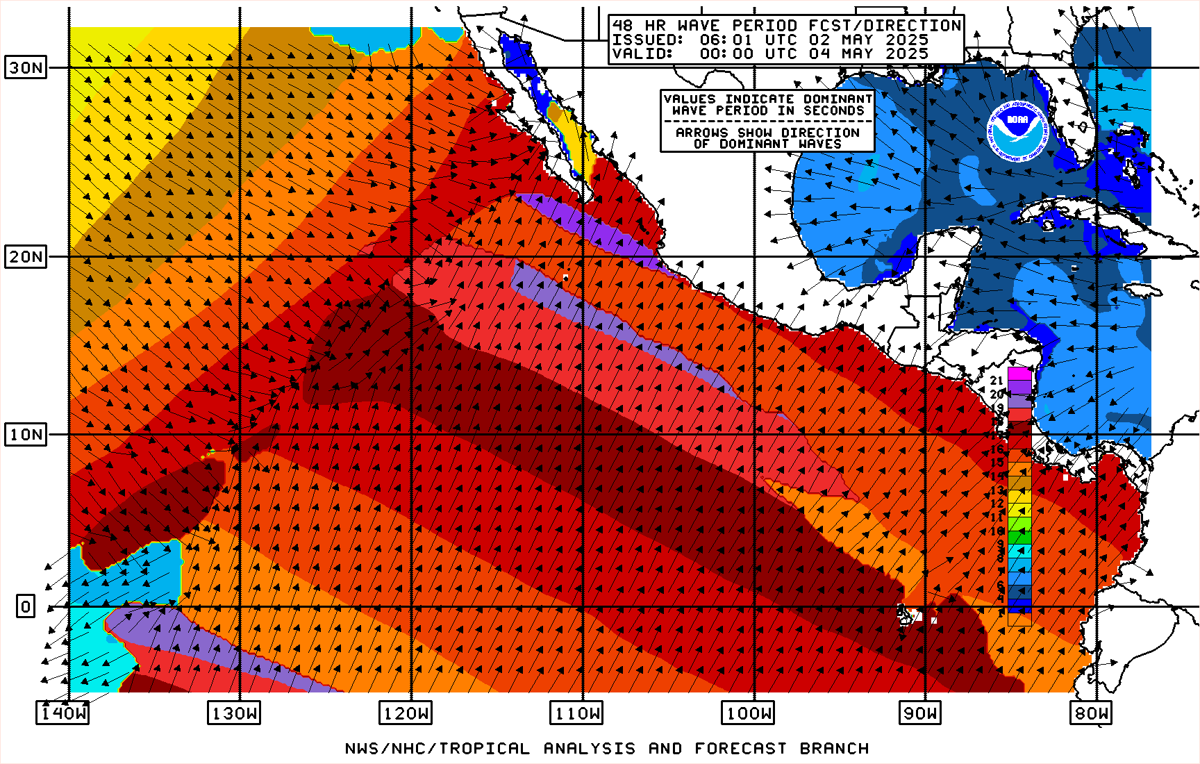
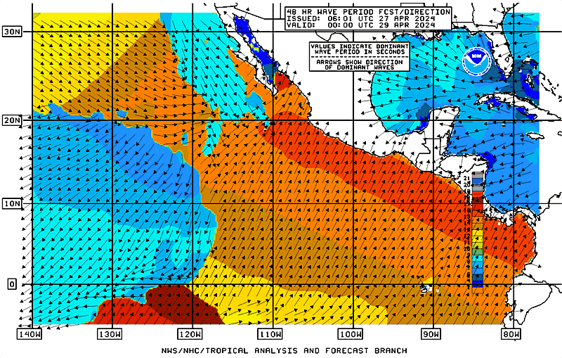
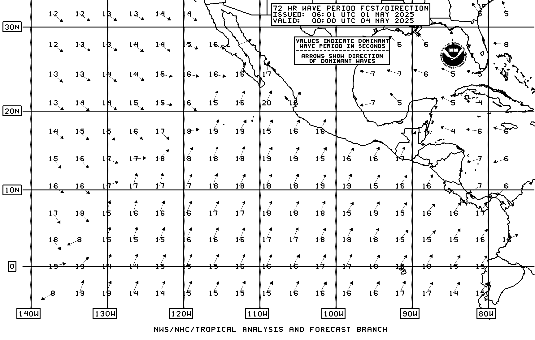
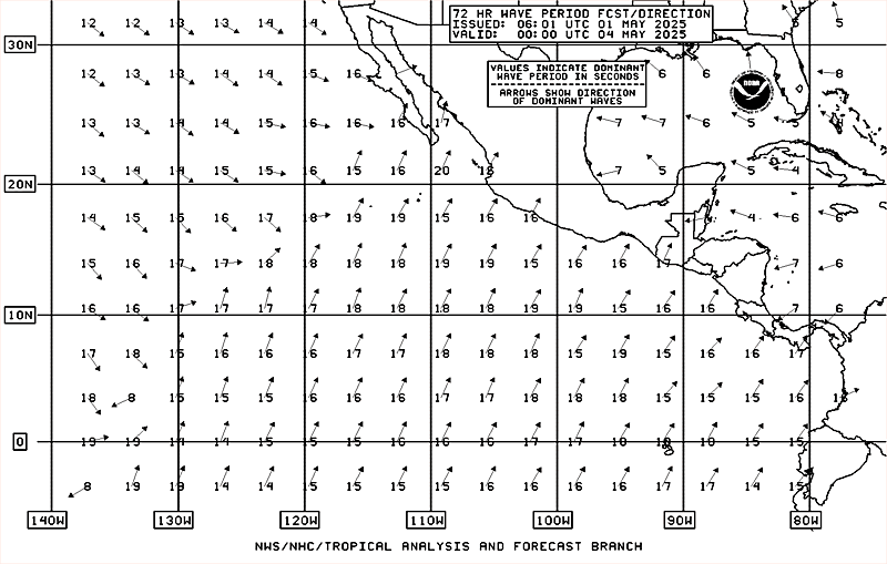
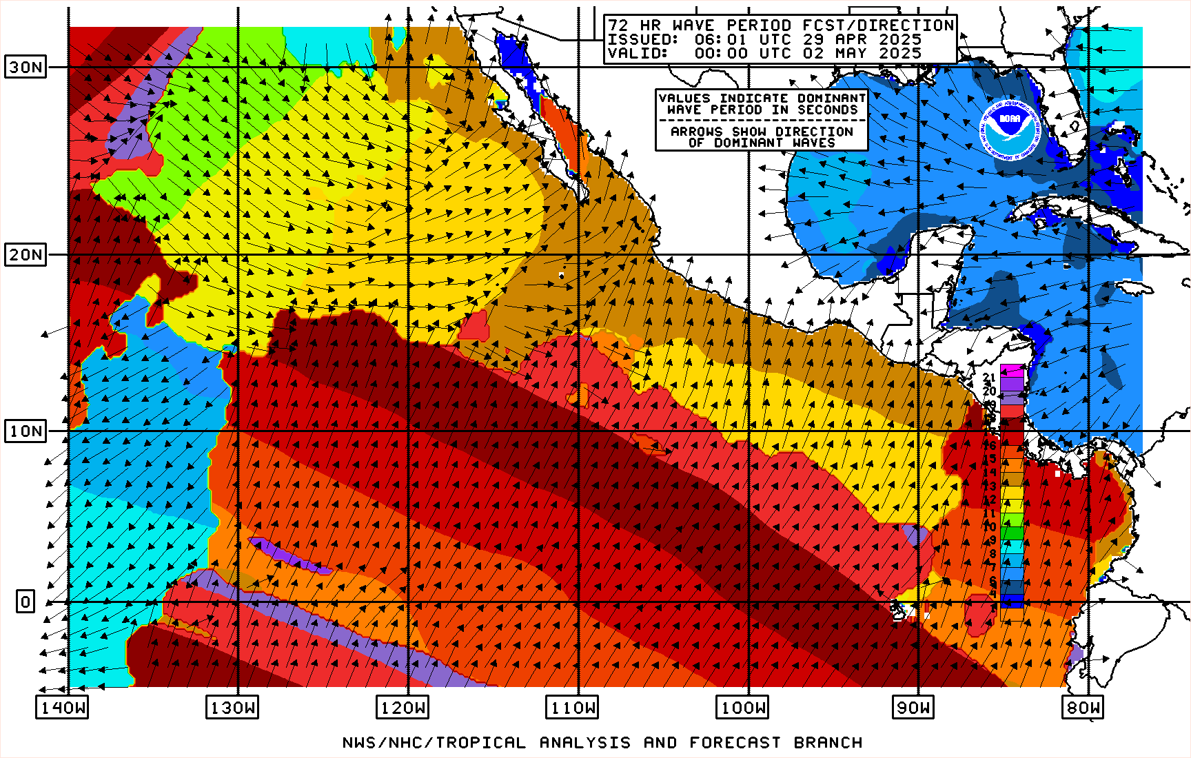
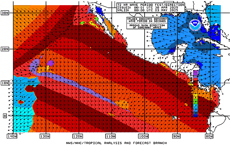
| Surface (10-m) Winds Surface (10-m) Wind Gusts Significant Wave Heights Marine Hazards description |
 NHC Display (for low-bandwidth users)  Access NDFD Grids |
|
| Event-Driven Marine Spot Forecasts description |
NWS Spot Forecast Page | |
| Atlantic | Eastern Pacific | |
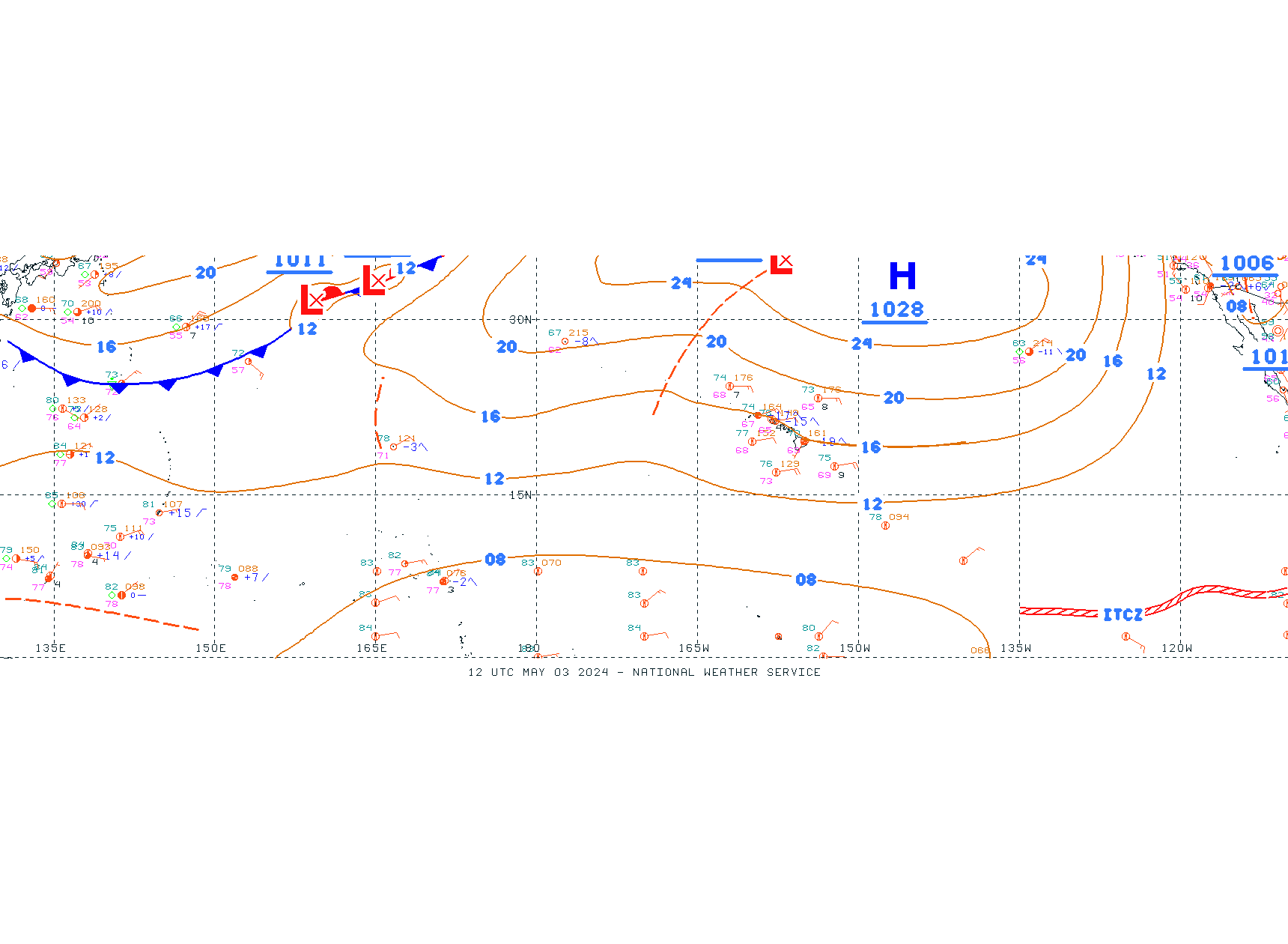
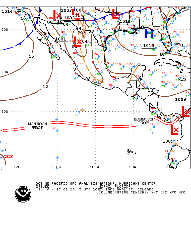
| Tropical Weather Discussion description | pdf |
Atlantic | Eastern Pacific |
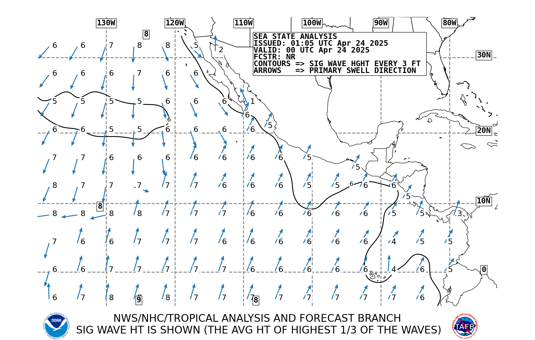
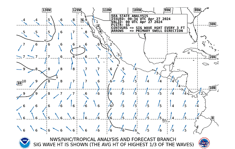
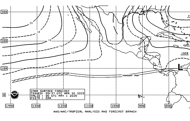
| High Seas Forecast description | pdf |
Atlantic | NE Pacific |
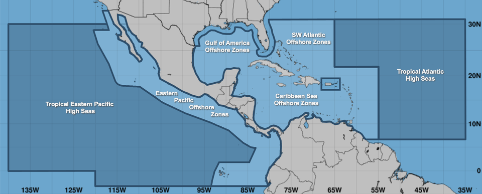
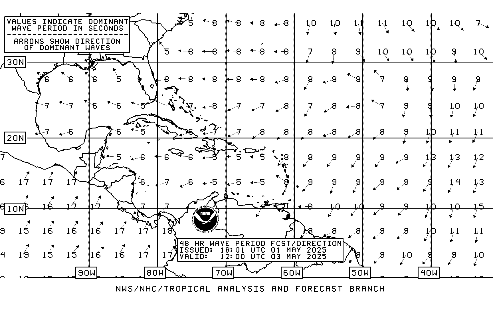
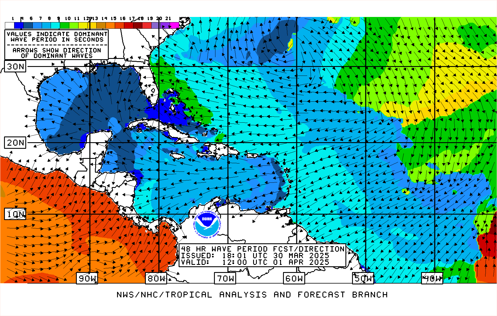
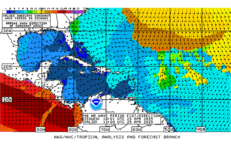
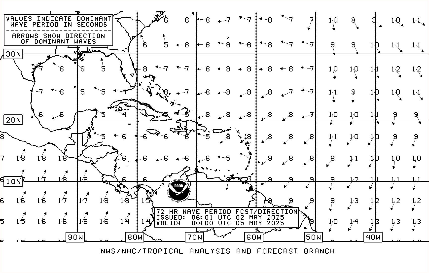
| Offshore Waters Forecasts Atlantic: description | pdf Eastern Pacific: description (pdf) |
Interactive Zones Map Caribbean/Tropical N Atlantic west of 55W Gulf of Mexico N Atlantic from 19N to 31N west of 55W |
Interactive Zones Map Mexico Central America/Colombia/Ecuador |
| NAVTEX Marine Forecasts description | pdf |
New Orleans, LA transmitter Miami, FL transmitter San Juan, PR transmitter |
– |
| High Frequency (HF) Voice Broadcasts - VOBRA description | pdf |
Caribbean/SW North Atlantic Gulf of Mexico |
– |
| Pan-American Temperature & Precipitation description | pdf |
Selected Pan American Locations | |
NOTICE - Unified Surface Analysis Changes:
Monsoon Trough - Effective 1 June 2011
Tropical Cyclone Boxes - Effective 15 July 2013
Alternate Formats
About Alternates -
E-Mail Advisories -
RSS Feeds
Cyclone Forecasts
Latest Advisory -
Past Advisories -
About Advisories
Marine Forecasts
Latest Products -
About Marine Products
Tools & Data
Satellite Imagery -
US Weather Radar -
Aircraft Recon -
Local Data Archive -
Forecast Verification -
Deadliest/Costliest/Most Intense
Learn About Hurricanes
Storm Names
Wind Scale -
Prepare -
Climatology -
NHC Glossary -
NHC Acronyms -
Frequently Asked Questions -
AOML Hurricane-Research Division
About Us
About NHC -
Mission/Vision -
Other NCEP Centers -
NHC Staff -
Visitor Information -
NHC Library
NOAA/
National Weather Service
National Centers for Environmental Prediction
National Hurricane Center
11691 SW 17th Street
Miami, Florida, 33165-2149 USA
nhcwebmaster@noaa.gov
Disclaimer
Privacy Policy
Credits
About Us
Glossary
Career Opportunities
Page last modified: Wednesday, 10-Apr-2024 17:06:00 UTC
