000
AXPZ20 KNHC 310836
TWDEP

Tropical Weather Discussion
NWS National Hurricane Center Miami FL
1005 UTC Sat Oct 31 2026

Tropical Weather Discussion for the eastern Pacific Ocean from
03.4S to 30N, east of 120W including the Gulf of California, and
from the Equator to 30N, between 120W and 140W. The following
information is based on satellite imagery, weather observations,
radar, and meteorological analysis.

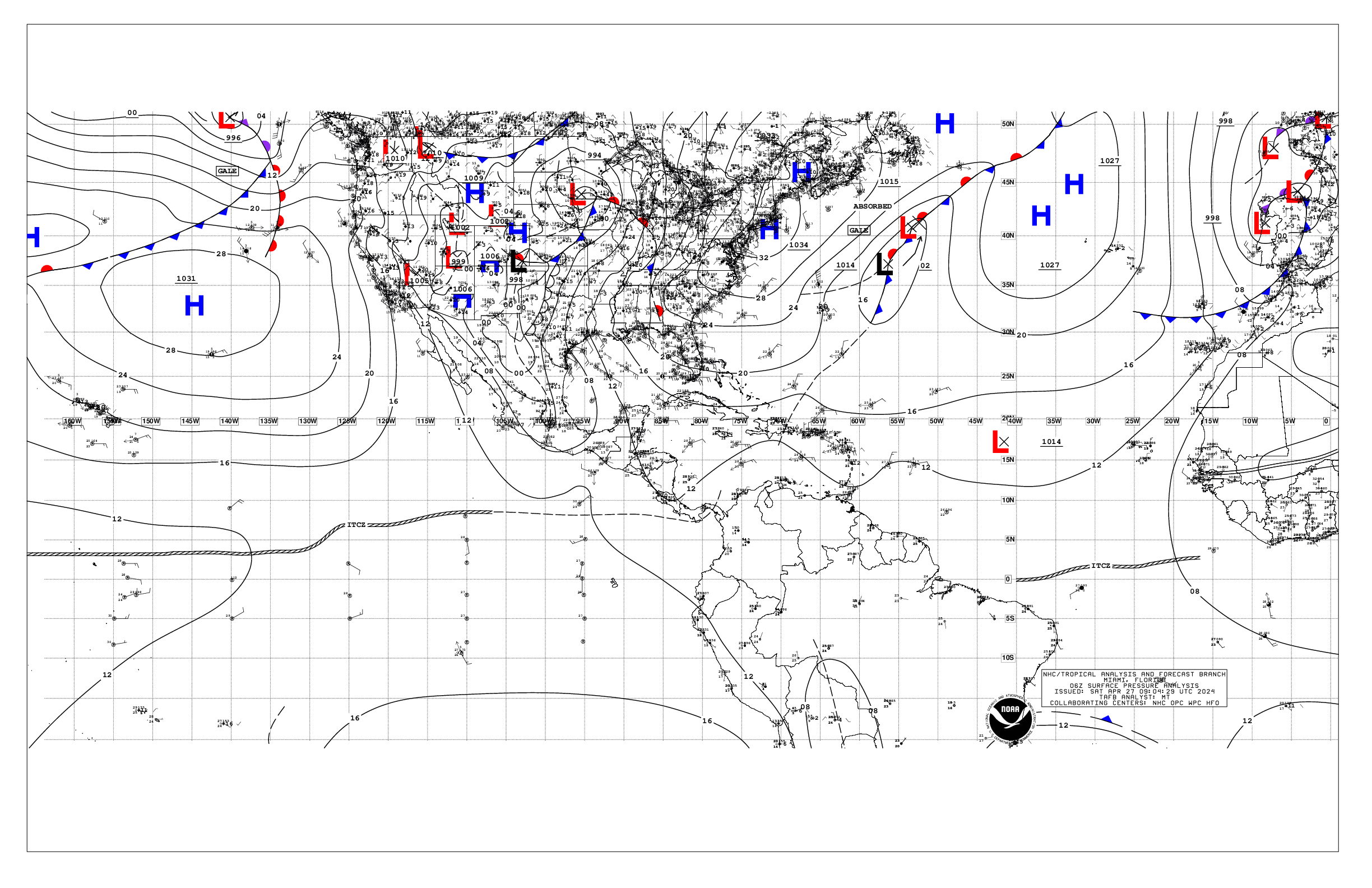
Based on 0600 UTC surface analysis and satellite imagery through
0830 UTC.

...INTERTROPICAL CONVERGENCE ZONE/MONSOON TROUGH...

The monsoon trough extends from 08N79W to 05N97W. A trough is
analyzed from 03N78W to 00N94W. The ITCZ is analyzed from
05N97W to 08N120W. Another trough is analyzed from 10N131W to
01N131W. A 1011 mb low is near 07N137W. Scattered moderate
convection is depicted S of 05N and E of 120W. Scattered
moderate to strong convection is S of 15N and W of 125W.

...OFFSHORE WATERS WITHIN 250 NM OF MEXICO...

Fresh to strong N to NE gap winds are occurring over the Gulf of
Tehuantepec with seas 5-7 ft. The pressure gradient between
higher pressures over Mexico and a trough along the Gulf of
California is supporting moderate S to SW winds over the southern
and northern parts of the Gulf. Elsewhere, winds are moderate or
weaker with 4-6 ft over the Pacific waters, 2-5 ft over the N
and central Gulf of California.

For the forecast, fresh to strong N gap winds over the Gulf of
Tehuantepec will continue through early next week, diminishing
by Mon night. A developing extratropical cyclone should move into
the waters west of the Baja California peninsula and over the N
Gulf of California tonight into Sun with fresh to strong SE to
SW winds and seas to 9 ft. Fresh to strong SW winds along with
seas to 5 ft should occur over the Gulf of California on Sun in
the wake of the extratropical cyclone. Moderate or weaker winds
will likely return to the offshore waters Sun into Mon.

...OFFSHORE WATERS WITHIN 250 NM OF CENTRAL AMERICA, COLOMBIA,
AND WITHIN 750 NM OF ECUADOR...

Fresh NE to E gap winds are occurring over the Gulf of Papagayo
region with seas 4 to 7 ft. Moderate N winds along seas to 6 ft
are present over the Gulf of Panama. Elsewhere, winds are
moderate or weaker. Seas are 4-6 ft. Scattered moderate
convection is occurring S of 08N east of 93W.

For the forecast, fresh to strong NE to E gap winds over the
Gulf of Papagayo region should continue through Mon. Fresh N
winds over the Gulf of Panama should continue today before
weakening on Sat. Large, long-period SW swell have reached the
equatorial waters, and will diminish on Sun.

...REMAINDER OF THE AREA...

A 1007 mb low is centered near 26N129W, with a cold front
extending southwestward to 15N137W. Fresh to strong northeast to
east winds prevail north of the low with seas to 8 ft. Moderate
southwest winds are found along the cold front. Elsewhere, the
pressure gradient between weak ridging north of our waters and
lower pressure over the monsoon trough is forcing only moderate
or weaker trades across the forecast waters. Large, long-period
SW swell is reaching northward across the equator to 08N between
87W-135W. Elsewhere, seas are 4-7 ft.

For the forecast, the low will become a strong extratropical
cyclone and then move slowly eastward this weekend. The system
should move over the offshore zones west of the Baja California
peninsula on Sun with winds and seas diminishing by Sun night.

$$
ERA


 NHC on Facebook
 NHC on X
 NHC on YouTube
 NHC Blog: