548
AXNT20 KNHC 190232
TWDAT

Tropical Weather Discussion
NWS National Hurricane Center Miami FL
0615 UTC Sat Sep 19 2026

Tropical Weather Discussion for North America, Central America
Gulf of America, Caribbean Sea, northern sections of South
America, and Atlantic Ocean to the African coast from the
Equator to 31N. The following information is based on satellite
imagery, weather observations, radar and meteorological analysis.

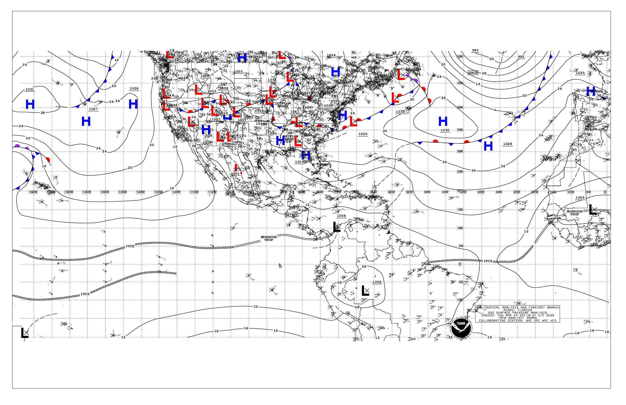
Based on 0000 UTC surface analysis and satellite imagery through
0140 UTC.

...TROPICAL WAVES...

A central Atlantic tropical wave has its axis along 43.5W from 06N
to 21N, moving westward around 10 kt. Scattered moderate isolated
strong convection is noted from 12N to 19N between 38W and 44W.

A western Caribbean tropical wave has its axis roughly along 82W
south of 19N near the Cayman Islands to near the border of Costa
Rica and Panama, moving westward around 20 kt. Scattered
moderate to isolated strong convection is from 13N to 20N between
77W and 85W. Additional deep convection is present to the south
along the intersection of the wave and the eastern Pacific
monsoon trough, across the coastal waters and inland portions of
Costa Rica and Panama.

...MONSOON TROUGH/ITCZ...

The monsoon trough axis enters the Atlantic along the coast of
Senegal near 14N16W and continues southwestward to 11N26W then
northwestward to 14N42W. The ITCZ extends from 13N45W to 1009 mb
low pressure seen by a very recent ASCAT scatterometer pass at
13N51W to along the NE coast of Venezuela at 10N65W. A surface
trough is analyzed south of the monsoon trough from 12N18W to
07N39W. Aside from convection associated to the tropical wave
described above, isolated to widely scattered moderate to strong
convection is seen on conventional satellite imagery within 180 nm
either side of the surface trough. Scattered moderate to strong
convection is near the surface low, from 12N to 15N between 48W
and 53W.

...GULF OF AMERICA...

A few surface troughs are analyzed and impacting the Gulf. One
extends across Central Florida to west of Tampa Bay, and another
to the south from 25N84W to 25N95W. Isolated to widely scattered
showers and thunderstorms are near both troughs. Moderate to
locally fresh winds are north of the 25N trough and west of 85W,
along with 3-6 ft seas. Gentle to moderate winds and 1-3 ft seas
prevail elsewhere. Meanwhile, the diurnal surface trough is over
the western Yucatan Peninsula with convection present over the
peninsula.

For the forecast, a ridge will dominate the Gulf region
supporting gentle to moderate winds and slight to moderate seas
through Sun. Winds will then ease to light to gentle speeds early
next week, with seas remaining slight. Meanwhile, a broad upper-
level low currently located over northeastern Florida will move
into the NE Gulf on Sat. This feature will lead to increasing
shower and thunderstorm activity over the eastern and central Gulf
waters.

...CARIBBEAN SEA...

Please refer to the tropical wave section for details on a wave in
the western Caribbean including associated convection.

The pressure gradient between broad high pressure north of the
basin and relatively lower pressure in northern South America is
allowing for fresh to strong trades over the central Caribbean
from 11N to 17N between 66W and 77W, where seas are 6-9 ft.
Moderate to fresh trades are found elsewhere from 11N to 18N
between 64W and 80W, along with seas of 4-7 ft. Gentle to
moderate winds, and seas of 3-5 ft remain across the remainder of
the basin, except for 1-3 ft seas in the NW Caribbean.

For the forecast, the pressure gradient between high pressure
over the western Atlantic and the Colombian Low will generally
maintain fresh to strong trades along with moderate to locally
rough seas over most of the central Caribbean through early Sat
morning. Winds will diminish to moderate to fresh speeds
thereafter as the pressure gradient relaxes across the area.
Moderate or weaker winds and slight to moderate seas are forecast
elsewhere.

...ATLANTIC OCEAN...

Please refer to the tropical wave section for details on a wave in
the central Atlantic including associated convection, as well as
convection near the monsoon trough/ITCZ and nearby features.

The remnants of a stationary front as a frontal trough extend from
31N74W to near Cape Canaveral, Florida. Some isolated to widely
scattered showers are near the trough. South of the trough, upper-
level disturbances riding along a jet stream branch from across
the northwest Caribbean to the Bahamas are supporting scattered
moderate convection from 18N to 28N between 61W and 77W. Another
surface trough is in the central Atlantic, from 31N43W to 23N57W
as seen by recent ASCAT scatterometer data. Scattered moderate
convection is noted within 120 nm either side of the trough. A
relatively weak pressure gradient is the result of the above
features across the basin resulting in winds of moderate or
weaker. Moderate to fresh localized winds are over the SE Bahamas
and Turks and Caicos with similar winds near the NE coast of South
America, and north of 17N between Africa and 23W where the
normally locally tight pressure gradient exists. Seas of 3-4 ft in
mainly long period SE swell dominates the waters west of 55W
across the offshore waters zones. Similar seas are found north of
23N between 30W and 55W in mainly NE swell. Seas are 5-7 ft from
13N to 20N between Africa and the Cabo Verde Islands, with similar
heights north of 27N between Africa and 23W, and 3-5 ft in mixed
NE and SE swells across the remainder of the waters.

For the forecast west of 55W, a frontal trough extending from
near 31N74W to Cape Canaveral, Florida will dissipate overnight.
High pressure will become the dominant feature across the basin
during the weekend into early next week, promoting light to gentle
winds with slight to moderate seas, with the exception of
moderate to locally fresh E to SE winds and moderate seas offshore
Hispaniola. Meanwhile, abundant tropical moisture, combined with
an upper- level low now located over NE Florida, will continue to
support scattered to numerous showers and thunderstorms, across
the central and southern Bahamas, and between the central Bahamas
and Bermuda, through at least Sun.

$$
Lewitsky


 NHC on Facebook
 NHC on X
 NHC on YouTube
 NHC Blog: