000
AXNT20 KNHC 281634
TWDAT

Tropical Weather Discussion
NWS National Hurricane Center Miami FL
1815 UTC Mon Sep 28 2026

Tropical Weather Discussion for North America, Central America
Gulf of America, Caribbean Sea, northern sections of South
America, and Atlantic Ocean to the African coast from the
Equator to 31N. The following information is based on satellite
imagery, weather observations, radar and meteorological analysis.

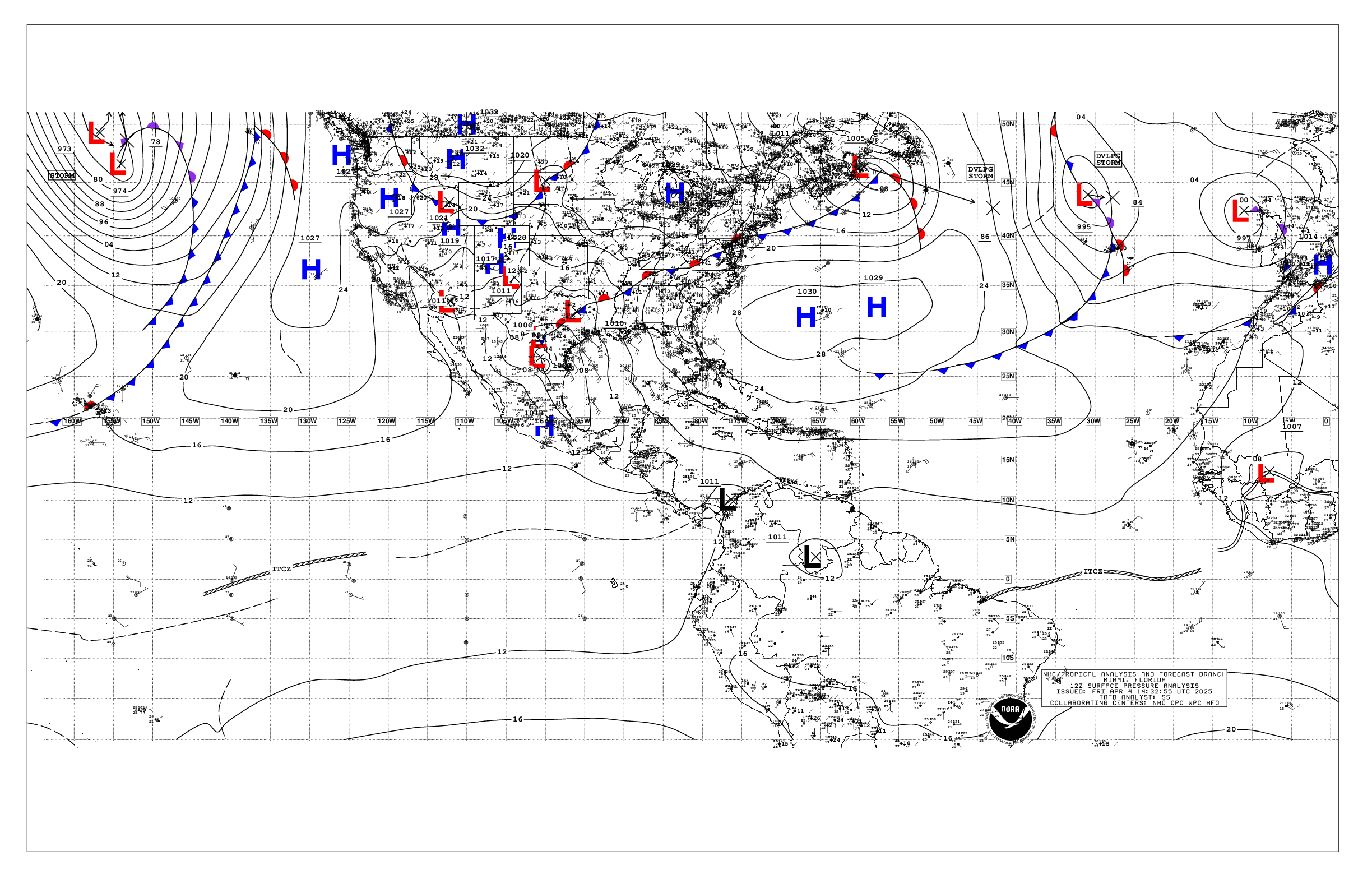
Based on 1200 UTC surface analysis and satellite imagery through
1600 UTC.

...SPECIAL FEATURES...

Tropical Depression Fay is centered near 27.1N 44.6W at 28/1500
UTC or 1100 nm WSW of the Azores, moving SSW at 8 kt. Estimated
minimum central pressure is 1011 mb. Maximum sustained wind
speed is 30 kt with gusts to 40 kt. Seas to 8 ft are within 90 nm
across the NW quadrant of the depression. Numerous moderate
isolated strong convection is from 25N to 28N between 43W and
45.5W. The T.D. is expected to move southwest and then to the
west-southwest, along with an increase in forward motion. Little
change in strength is forecast during the next day or so, and Fay
is forecast to become a post-tropical cyclone on Tuesday.

Please read the latest HIGH SEAS FORECAST issued by the National
Hurricane Center at website
- https://www.nhc.noaa.gov/text/MIAHSFAT2.shtml and the latest
Fay NHC Forecast/Advisory and Public Advisory at
www.hurricanes.gov for more details.

...TROPICAL WAVES...

A tropical wave is in the Caribbean analyzed along 72.5W, south
of 16N into western Colombia, moving west at 10 kt. There is no
convection over the central basin associated with this wave at
this time.

...MONSOON TROUGH/ITCZ...

The monsoon trough extends from 20N16W to 07N41W. The ITCZ
extends from 07N41W to 09N59.5W. Scattered moderate convection is
from 09N to 15N between 22W and 35.5W. Similar convection is
depicted from 05.5N to 13N between 43W and 55W.

...GULF OF AMERICA...

Abundant low level moisture embedded in southeasterly flow from
the Yucatan is converging over the SE Gulf, under favorable upper
level conditions is producing numerous moderate isolated strong
convection S of 25.5N between 83W and 91W southward to 21N. At
the surface, a lingering surface trough extends across the SW
basin along about 96W. A weak stationary front is depicted over the
coastal waters from Mobile Bay to near Mexico Beach, Florida.
Light and variable winds prevail across the entire basin. Seas
basin- wide are 3 ft or less.

For the forecast, light to gentle winds and slight to moderate
seas will become gentle to moderate SE winds across the basin
tonight and prevail through Tue night as high pressure builds over
the southeast U.S. Looking ahead, expect moderate to fresh winds
and building seas over mostly the western Gulf starting midweek,
as the high pressure shifts eastward ahead of a cold front moving
through the Southern Plains and approaching the northwest Gulf by
late Fri.

...CARIBBEAN SEA...

A mid to upper level trough is supporting scattered moderate
convection west of 75W. A weak pressure gradient persists across
the basin, due to a weakening front N of the region, and is
translating to gentle to moderate trades over the eastern and
central basin as well as in the Gulf of Honduras. Light to gentle
winds prevail elsewhere. Seas are 3 to 5 ft across east and
central portions and 3 to 4 ft, and less than 3 ft elsewhere.

For the forecast, a trough over the Bahamas has displaced the
usual subtropical ridge north of the Caribbean. This pattern is
supporting gentle to moderate trade winds and slight seas across
the basin. Expect moderate to fresh E to SE winds and building
seas across the basin by mid week as the high pressure builds
north of the area, with rough seas possible in the Yucatan Channel
and far NW Caribbean Thu night through Fri.

...ATLANTIC OCEAN...

Please see the Special Features section above for information on
Tropical Depression Fay.

A weakening frontal trough remains stationary across the NW
Atlantic waters from 31N67W and meanders southwestward into the
central Bahamas. Scattered to numerous showers and thunderstorms
continue along this feature, from 23N to 31N between 64W and 77W.
Light to gentle winds are found to the NW of the trough. To the E
of it, moderate to locally fresh S to SW winds are noted to 61W.
T.D. Fay is centered near 27.1N 44.6W, and is sandwiched in
between to high centers at 26N39W and 29N53W. This pattern is
leading to gentle to moderate NE to E winds S of 22N between 35W
and the Lesser Antilles, with 5 to 7 ft seas. Further east, the
1011 mb remnants of Gonzalo are near 21N25W, and is still
producing moderate to fresh cyclonic winds and rough seas to the N
and W of the center. Elsewhere across the basin, moderate winds
and seas dominate.

For the forecast west of 55W, scattered showers and a few
thunderstorms persist along a trough reaching from 31N67W to the
central Bahamas offshore waters. Moderate SW winds and moderate
seas ahead of the front will continue to diminish today. Looking
ahead, high pressure will build north of the area supporting
moderate to fresh E winds and 3-5 ft seas south of 25N by midweek.


$$
KRV


 NHC on Facebook
 NHC on X
 NHC on YouTube
 NHC Blog: