000
AXNT20 KNHC 092315
TWDAT

Tropical Weather Discussion
NWS National Hurricane Center Miami FL
0015 UTC Mon Aug 10 2026

Tropical Weather Discussion for North America, Central America
Gulf of America, Caribbean Sea, northern sections of South
America, and Atlantic Ocean to the African coast from the
Equator to 31N. The following information is based on satellite
imagery, weather observations, radar and meteorological analysis.

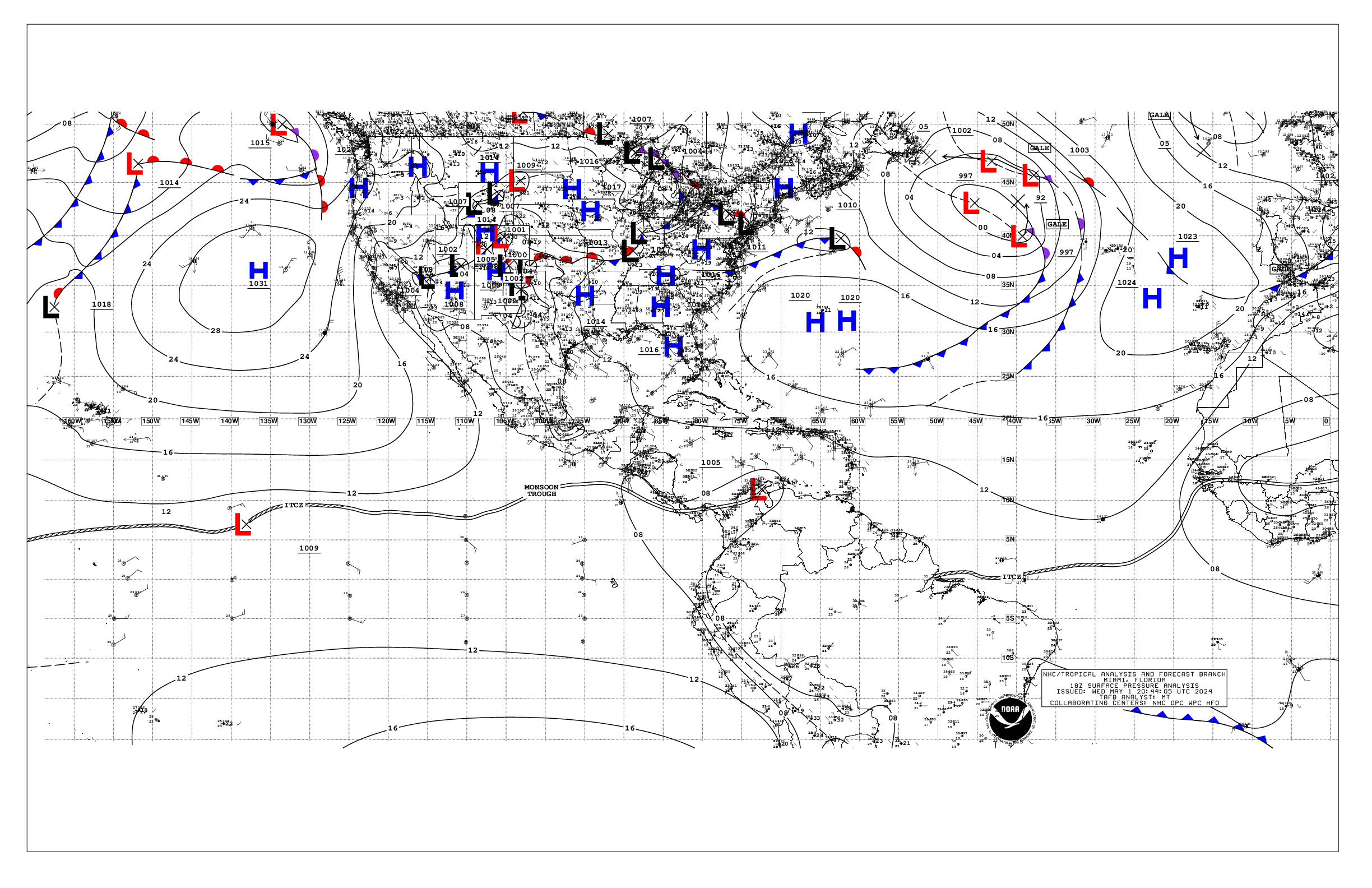
Based on 1800 UTC surface analysis and satellite imagery through
2300 UTC.

...TROPICAL WAVES...

A tropical wave is along 21W and extends from 06N to 17N. The
wave is moving westward at 10 to 15 kt. Scattered moderate to
isolated strong convection is ahead of the wave axis from 08N to
11N between 21W and 30W..

A tropical wave is near 36/37W from 07N to 17N, moving west at
around 15 kt. Scattered moderate to isolated strong convection
is from 08N to 14N between 35W and 44W. Some gradual development
of this system is possible during the early to middle part of
this week while it moves westward across the central tropical
Atlantic. Upper-level winds are expected to become less conducive
for development later in the week when the system approaches the
Lesser Antilles. The latest Tropical Weather Outlook gives this
system a low chance of tropical cyclone formation through 7 days.

A tropical wave is along 49W/50W from 12N to 23N, moving west at
10-15 kt. Saharan Air surrounds this wave, and thus no significant
convection currently accompanies the wave. A swirl of low clouds
is just ahead of the wave axis near 16N51W.

A tropical wave is along 68W and extends from the Mona Passage to
north-central Venezuela, moving west at 15 to 20 kt. The wave is
enhancing convection over parts of Puerto Rico, Dominican Republic,
the eastern Caribbean, and NE and north-central Venezuela.

Looking ahead, another tropical wave is expected to move off the
west coast of Africa early this week. Environmental conditions
are forecast to be conducive for gradual development thereafter,
and a tropical depression could form during the latter half of
this week while the system moves westward to west-northwestward
across the central tropical Atlantic. The latest Tropical Weather
Outlook gives this system a low chance of tropical cyclone formation
through 48 hours, and medium chance through 7 days.

...MONSOON TROUGH/ITCZ...

The monsoon trough enters the Atlantic through the coast of Mauritania
near 19N16W and continues southwestward to 11N45W. The ITCZ extends
from 11N45W to 12N60W. Aside from the convection associated with
the tropical waves, no significant convection is noted elsewhere.

...GULF OF AMERICA...

Showers and thunderstorms continues to dot the Gulf region, mainly
near west Florida and over the NW part of the basin. A diffluent
pattern aloft is helping to induce this convective activity. In
addition, a surface trough extending from near Destin, Florida
to 28N91W and to near 27N94W also supports scattered showers and
isolated thunderstorms. Convection has flared-up over the
Yucatan Peninsula and the NW Caribbean. A surface ridge extends
from the Bermuda High across Florida into the Gulf region, and
supports mostly light to gentle winds and slight to moderate
seas. Gentle to moderate SE winds are evident per scatterometer
data on the east side of a surface trough located over the central
Bay of Campeche.

For the forecast, the aforementioned surface trough that extends
from near Destin, Florida to 27N94W is expected to dissipate as
it moves inland the northern Gulf coast tonight. Otherwise, a
surface ridge will dominate the general wind flow pattern across
basin well into the week, generally supporting gentle to moderate
E to SE winds north of 24N along with slight seas. Pulses of
fresh winds will occur north and west of the Yucatan Peninsula
and into the Bay of Campeche each evening and night as a diurnal
surface trough migrates from the Yucatan Peninsula westward across
the SW Gulf.

...CARIBBEAN SEA...

The pressure gradient between a 1022 mb high pressure located
just south of Bermuda and a 1008 mb Colombian low continues to
promote fresh to strong trade winds over the central Caribbean,
with the strongest winds of 30 kt offshore Colombia. Seas are 8
to 11 ft with these winds. Mainly moderate to fresh winds are
N of 15N associated with the tropical wave located across the
eastern Caribbean. Seas are 4 to 6 ft. Similar winds speeds are
present across the Windward Passage. Gentle to moderate trades
prevail elsewhere, with moderate seas. Aside from the convection
associated with the tropical wave, scattered showers, with
embedded thunderstorms, are occurring over the NW Caribbean and
parts of Cuba.

For the forecast, the pressure gradient between a 1023 mb Bermuda
High and lower pressure in northern South America will continue
to support fresh to strong trades in the south-central and
portions of the SW basin will into the week. The associated ridge
will gradually shift southward to near 28N through midweek
maintaining strong to near-gale winds offshore Colombia and in
the Gulf of Venezuela each night, except Wed night. Winds will
pulse up to fresh to strong speeds during the evenings and at
night in the Gulf of Honduras and Windward Passage through the
forecast period. Otherwise, moderate to fresh trades will prevail
elsewhere. The Atlantic ridge will shift farther southward later
this week, which may act to increase the trades again across the
basin.

...ATLANTIC OCEAN...

Three tropical waves are moving westward between W Africa and the
Lesser Antilles, and the National Hurricane Center is monitoring
a couple of areas with the potential of tropical cyclone formation.
Refer to the tropical wave section above for more details.

A weak trough along the U.S. southeastern coast in combination
with ample deep moisture in place are helping to support a band
of showers and thunderstorms offshore northern Florida east to
near 74W. Otherwise, a ridge dominates the remainder of the
Atlantic forecast waters. This pattern is promoting moderate to
fresh trade winds south of 22N and west of 60W, where seas are 4
to 6 ft. Moderate to fresh winds are near the tropical wave along
36W/37W. Moderate to locally fresh N to NE winds and 5 to 8 ft
seas extend from the Canary Islands southwestward to near 20N.
Elsewhere within the ridge, gentle to moderate winds and moderate
seas prevail.

For the forecast west of 55W, the weak trough offshore the U.S.
southeastern coast will help maintain scattered showers and
thunderstorms offshore northern Florida through tonight. The Atlantic
ridge will drop a bit farther southward later this week, which
may result in stronger easterly winds. Fresh trades will prevail
N of Hispaniola and in the approach to the Windward Passage through
the period, pulsing to strong speeds each evening and night.

Of note, a tropical wave is expected to move off the west coast
of Africa early in the week. Environmental conditions are
forecast to be conducive for gradual development thereafter, and
a tropical depression could form during the latter half of the
week while the system moves generally westward to west-northwestward
across the central tropical Atlantic.

$$
GR


 NHC on Facebook
 NHC on X
 NHC on YouTube
 NHC Blog: