779
AXNT20 KNHC 151700
TWDAT

Tropical Weather Discussion
NWS National Hurricane Center Miami FL
1815 UTC Sun Nov 15 2026

Tropical Weather Discussion for North America, Central America
Gulf of America, Caribbean Sea, northern sections of South
America, and Atlantic Ocean to the African coast from the
Equator to 31N. The following information is based on satellite
imagery, weather observations, radar and meteorological analysis.

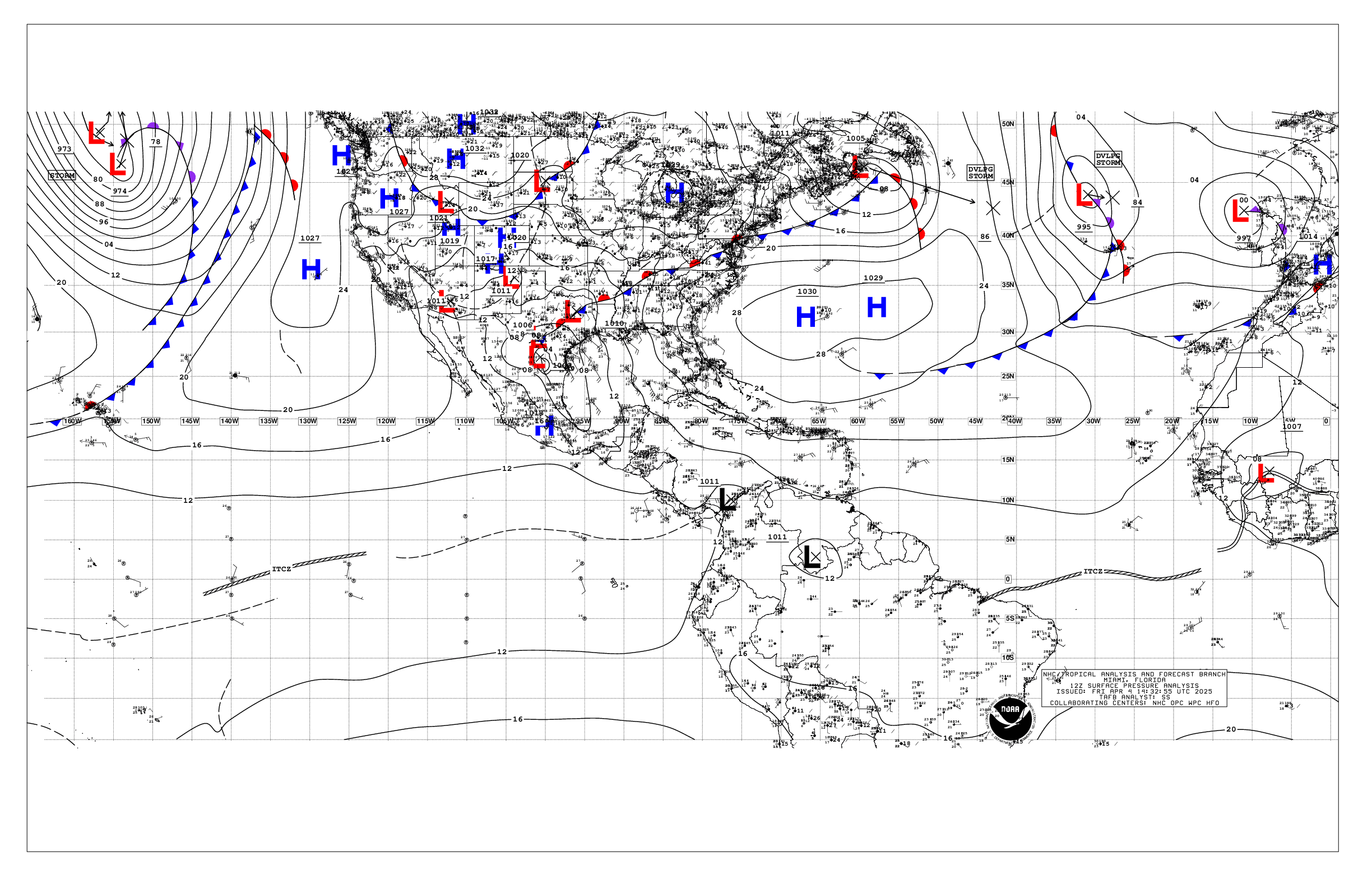
Based on 1200 UTC surface analysis and satellite imagery through
1630 UTC.

...SPECIAL FEATURES...

Gulf of America Gale Warning: A tightening pressure gradient
between high pressure building in from the southeastern U.S. and a
sharp surface trough or possible low pressure in the western Gulf
will lead to gales developing the E winds increasing to gale
force tonight into Mon offshore Texas and Louisiana.

Please, see the latest NWS High Seas Forecast issued by the
National Hurricane Center at website
https://www.nhc.noaa.gov/text/MIAHSFAT2.shtml for further details.

...MONSOON TROUGH/ITCZ...

The monsoon trough extends from 10N14W to 06N21W. The ITCZ
extends from 06N21W to 03N50W. Scattered moderate convection is
noted from 01N to 13N between 20W and 49W.

...GULF OF AMERICA...

Please see SPECIAL FEATURES above for more on a gale warning in
the NW Gulf.

Fresh to strong winds, and building seas of 6 to locally 8 ft,
prevail over the NW Gulf. Moderate to fresh winds and moderate
seas are elsewhere W of 90W, except for the SW part of the basin,
where gentle winds prevail. E of 90W, gentle to moderate winds
and slight to moderate seas are noted. A cluster of moderate
convection is depicted from 26.5N to 28N between 92W and 96.6W.

For the forecast, aside from the area of gale winds, strong to
near- gale force NE to E winds are also expected across much of
the northern basin, with near- gale force northerly winds W of the
trough funneling down the NE coast of Mexico, including offshore
Veracruz, Mon and Tue. Winds will diminish in the western Gulf by
mid-week, but strong winds will prevail over the NE basin through
late week, where the tight pressure gradient will remain. Rough
seas generated by these winds will impact portions of the northern
Gulf much of the week.

...CARIBBEAN SEA...

Moderate to fresh winds, locally strong, and moderate seas cover
the waters east of 75W. Moderate winds and moderate seas are over
the NW Caribbean. Light to gentle winds, and slight to moderate
seas, prevail elsewhere. The tail end of an Atlantic cold front
extends to eastern Cuba, supporting scattered moderate convection
across the Windward Passage.

For the forecast, fresh to strong trades will develop in the
south- central basin tonight, then prevail through at least mid-
week. Moderate to fresh northeast to east winds will prevail over
the northwestern Caribbean through Mon.

...ATLANTIC OCEAN...

A cold front extends from 31N57W to eastern Cuba. Fresh to strong
SW winds and rough seas to near 10 ft, prevail N of 27N and east
of the front to 44W. Gentle to moderate NW to N winds and rough
seas 8 to 10 ft are N of 29N and west of the front to 74W. High
pressure dominates the remainder of the waters N of 15N, anchored
by a 1025 mb high centered near 28N32W. Light to gentle winds and
slight to moderate seas are in the vicinity of the high center.
Moderate to fresh winds and moderate seas generally prevail
elsewhere. Scattered moderate convection is depicted south of 28N
along the frontal boundary.

For the forecast west of 55W, the aforementioned cold front will
slide east while weakening, moving east of the region by Tue. High
pressure building southward toward the region will lead to a
tightening pressure gradient and NE to E winds increasing to
strong S of 28N and W of 65W, including the Bahamas, Mon. These
winds and associated rough seas will expand north and east into
late week.

$$
KRV


 NHC on Facebook
 NHC on X
 NHC on YouTube
 NHC Blog: