000
AXNT20 KNHC 120925
TWDAT

Tropical Weather Discussion
NWS National Hurricane Center Miami FL
1215 UTC Thu Nov 12 2026

Tropical Weather Discussion for North America, Central America
Gulf of America, Caribbean Sea, northern sections of South
America, and Atlantic Ocean to the African coast from the
Equator to 31N. The following information is based on satellite
imagery, weather observations, radar and meteorological analysis.

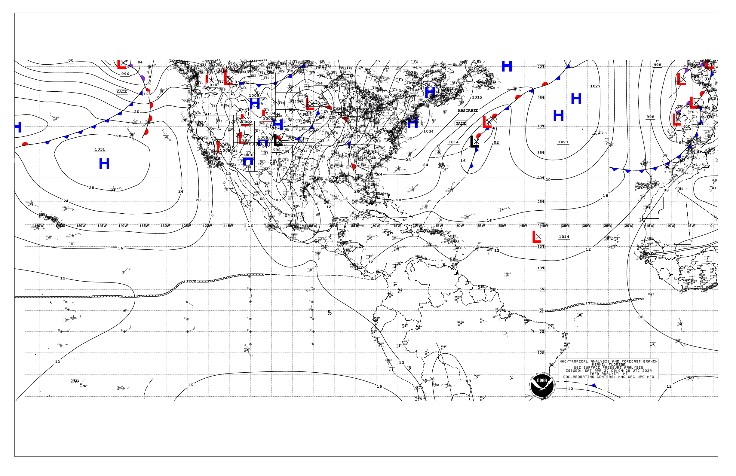
Based on 0600 UTC surface analysis and satellite imagery through
0900 UTC.

...MONSOON TROUGH/ITCZ...

The monsoon trough exits the coast of Senegal near 13N17W and
extends to 06N20W. The ITCZ extends from that point to coastal
French Guiana near 04N52W. Isolated moderate convection is located
from 07N-11N between 20W-53W.

...GULF OF AMERICA...

A 1014 mb low is at 28N96W along the north end of a pre-frontal
trough that reaches to 21N97W. While no significant winds are
associated with the trough, scattered moderate convection is
occurring from 21N-28N between 92W-98W. Winds across the Gulf are
moderate or weaker with seas 1-4 ft.

For the forecast, a strong cold front will reach the Texas coast
tomorrow morning, then sweep across the basin through tomorrow
night exiting the area early on Fri. A pre-frontal trough in the
western Gulf will promote fresh to locally strong N to NW winds
near Tampico and Veracruz tomorrow and Fri. Elsewhere, moderate to
locally fresh N winds are expected in the wake of the cold front.
High pressure will build southward into the region this weekend,
with increasing easterly winds as the high shifts eastward Sun.
Fresh to strong E winds are likely across portions of the northern
Gulf starting on Sun as the pressure gradient increases. Looking
ahead, a second cold front should move offshore the Texas coast
Mon morning. The strong E winds will shift to mostly the NE Gulf
Mon and Mon night as the front translates eastward across the
Gulf.

...CARIBBEAN SEA...

The pressure gradient between the Bermuda High north of the region
and a 1008 mb low near 10N74W is causing fresh to strong trades
over the central Caribbean with seas 6-8 ft. Elsewhere winds are
moderate or weaker with seas 2-5 ft. A trough extends from 21N84W
to 16N86W in the NW Caribbean. This is promoting scattered
moderate and isolated strong convection north of 14N west of 78W.

For the forecast, fresh to strong trades will prevail over the
central and eastern Caribbean into Thu night, with mainly moderate
winds elsewhere. The pressure gradient will diminish starting Fri
as a cold front approaches the Yucatan Channel, leading to a
weakening of the trades. Moderate to fresh NE to E winds are
likely behind this front over the northwestern Caribbean Sat and
Sun. Looking ahead, fresh to strong trades may become
reestablished over the south central Caribbean early next week.

...ATLANTIC OCEAN...

A weak cold front extends from 31N76W to 27N81W along the Florida
peninsula east coast with scattered moderate convection north of
29N between 70W-73W. Winds ahead of the cold front are fresh to
locally strong with seas 4-6 ft. Two weak frontal boundaries
extend across the subtropical north Atlantic - one from 26N66W to
31N39W and one from 21N45W to 30N10W. the former is associated
with scattered moderate convection from 21N-25N between 60W-75W.
These fronts have diminished the typical pressure gradient across
forecast waters, resulting the remainder of winds across the area
being moderate or weaker. Seas are 8-11 ft north of 20N east of
30W due to residual W swell. Elsewhere, seas are 3-7 ft.

For the forecast west of 55W, fresh to strong SW winds ahead of a
weak cold front off the NE Florida coast will diminish later
today as the front dissipates. A new stronger cold front is
expected to move off the southeastern U.S. coast Thu night
accompanied by fresh to strong winds on either side of it. The
front is expected to reach from near 31N66W to the SE Bahamas by
Sat morning, and from near 31N55W to 25N65W and stationary to
eastern Cuba by Sun morning. The cold front portion will shift
east of 55W late Sun while the stationary portion weakens. On Sun,
winds will briefly diminish below fresh over forecast waters.
Looking ahead, a building Bermuda High should increase NE winds up
to fresh to strong south of 27N west of 65W.

$$
Landsea


 NHC on Facebook
 NHC on X
 NHC on YouTube
 NHC Blog: