000
AXNT20 KNHC 070808 CCA
TWDAT

Tropical Weather Discussion...Corrected
NWS National Hurricane Center Miami FL
0615 UTC Tue Jul 7 2026

Corrected forecast for the Gulf of America

Tropical Weather Discussion for North America, Central America
Gulf of America, Caribbean Sea, northern sections of South
America, and Atlantic Ocean to the African coast from the
Equator to 31N. The following information is based on satellite
imagery, weather observations, radar and meteorological analysis.

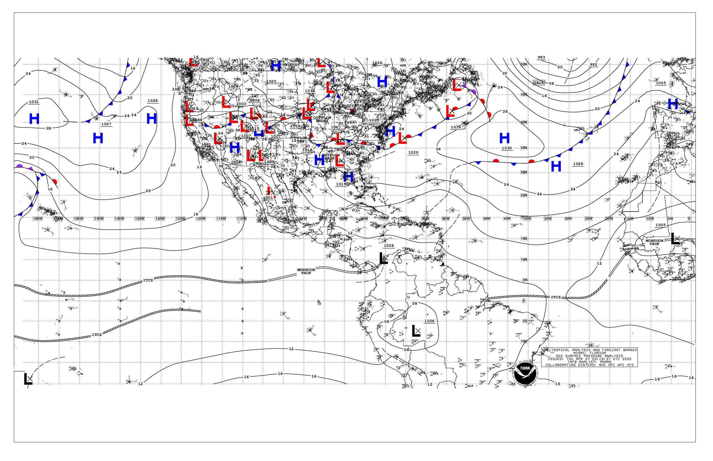
Based on 0000 UTC surface analysis and satellite imagery through
0325 UTC.

...TROPICAL WAVES...

A tropical wave has been introduced in the far eastern Atlantic,
along 24W, south of 13N, based on wave guidance data. The wave is
moving westward at 15-20 kt. No significant convection is noted
near the trough axis.

A central Atlantic tropical wave is along 44W, south of 17N,
moving westward at 15-20 kt. Scattered moderate to isolated strong
convection is present from 02N to 11N and between 33W and 51W.

Another central Atlantic tropical wave is along 57W, south of
18N, moving westward at 15 kt. Scattered moderate to isolated
strong convection is observed from 02N to 13N and between 51W and
59W.

A western Caribbean Sea tropical wave along 84W, south of 18N,
moving westward at 10 kt. No significant convection is noted
near the trough axis.

...MONSOON TROUGH/ITCZ...

The monsoon trough enters the Atlantic through the coast of
Mauritania near 21N16W and continues southwestward to 09N26W. The
ITCZ extends from 09N26W to 07N43W, then continues from 07N45W to
07N56W. Numerous moderate to isolated strong convection is
evident from 06N to 15N and east of 21W.

...GULF OF AMERICA...Corrected

Diurnal storms that formed over the western Yucatan peninsula are
racing westward at about 25-30 kt as a squall line over the
eastern Bay of Campeche. Mariners in these waters can expect
gusty winds to 30 kt, suddenly higher seas and some lightning
strikes. A few showers are also noted in the eastern Gulf waters.

At the surface, a 1018 mb high pressure system situated south of
the mouth of the Mississippi River supports fresh to locally
strong easterly winds and seas of 2-4 ft south of 23N and between
89W and 95W. Elsewhere, moderate or lighter winds and slight seas
prevail.

For the forecast, relatively weak high pressure extending westward
across the basin from the Atlantic will change little through Thu
night, then shift northward to near the northern Gulf coast Fri
through Sat night. The related pressure gradient will generally
maintain east to southeast winds across the Gulf south of about 26N,
and light to gentle southeast to south winds north of about 26N,
except for fresh to strong northeast to east winds offshore the
Yucatan peninsula at night. Slight seas are forecast throughout the
basin for the forecast period.

...CARIBBEAN SEA...

A strong subtropical ridge over the central Atlantic is forcing
strong to near gale-force easterly trade winds and rough seas
across the central Caribbean Sea. The strongest winds and highest
seas are found off NW Colombia. Moderate to fresh easterly breezes
and moderate seas are present in the eastern Caribbean, Windward
Passage and Gulf of Honduras. Elsewhere, moderate or lighter winds
and slight to moderate seas are prevalent.

For the forecast, the pressure gradient between Atlantic high
pressure and relatively lower pressures in Colombia will continue
to support fresh to strong trades across the central Caribbean
through the period, while mostly fresh trades will be elsewhere
south of 18N. Moderate to rough seas will accompany these winds.
Expect winds to pulse to near-gale force at night offshore of
Colombia and in the Gulf of Venezuela through Sat, except on Thu.
Moderate or weaker winds will continue over the northwestern part
of the basin, except in the Gulf of Honduras where fresh to strong
east to southeast winds are forecast at night through the
forecast period. A tropical wave currently near 56W will move
across the eastern Caribbean Wed and Wed night, across the central
Caribbean Thu through Fri night, and across the eastern part of
the western Caribbean Sat and Sat night. Scattered showers and
thunderstorms are expected to accompany the wave.

...ATLANTIC OCEAN...

Divergence aloft is producing isolated showers north of 26N and
west of 44W. The tropical Atlantic is under the influence of a
broad subtropical ridge along 27N. Moderate to fresh easterly
trade winds and seas of 4-8 ft are found south of 24N and west of
30W. However, strong winds are noted off northern Hispaniola.
Moderate to locally strong N-NE winds and seas of 4-8 ft are
evident from 18N to 29N and east of 30W. Elsewhere, moderate or
weaker winds and moderate seas prevail.

For the forecast west of 55W, high pressure over the area will
change little through the forecast period. The associated
gradient will continue to support moderate to fresh trades south
of 23N, and moderate or weaker winds elsewhere. Strong winds along
with moderate to rough seas are expected at night north of
Hispaniola, including approaches to the Windward Passage through
Sat night.

$$
Delgado


 NHC on Facebook
 NHC on X
 NHC on YouTube
 NHC Blog: