669
AXNT20 KNHC 290452
TWDAT

Tropical Weather Discussion
NWS National Hurricane Center Miami FL
0615 UTC Tue Sep 29 2026

Tropical Weather Discussion for North America, Central America
Gulf of America, Caribbean Sea, northern sections of South
America, and Atlantic Ocean to the African coast from the
Equator to 31N. The following information is based on satellite
imagery, weather observations, radar and meteorological analysis.

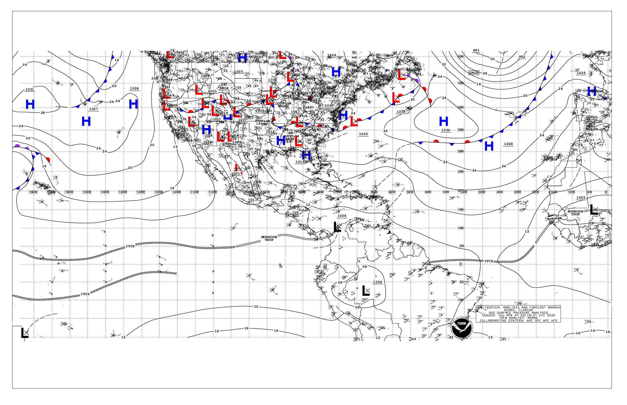
Based on 0000 UTC surface analysis and satellite imagery through
0400 UTC.

...SPECIAL FEATURES...

Fay has strengthened to a Tropical Storm again, and is centered
near 26.0N 45.9W at 29/0300 UTC, or 1200 nm W-SW of the Azores,
moving SW at 9 kt. Estimated minimum central pressure is 1008 mb.
Maximum sustained wind speed is 35 kt with gusts to 45 kt. Seas to
10 ft are within 75 nm in the NW semicircle. Northwesterly
vertical wind shear continues to force convection to the south
and southeast of the center of Tropical Storm Fay. Numerous
moderate to strong convection is occurring from 23N to 26N between
43W and 46W. A general SW to W-SW motion is anticipated over the
next several days. Some minor fluctuations in intensity may occur
through early Wed as convection pulses, before Fay weakens to a
post tropical remnant low Wed morning.

Please read the latest HIGH SEAS FORECAST issued by the National
Hurricane Center at website
- https://www.nhc.noaa.gov/text/MIAHSFAT2.shtml and the latest
Fay NHC Forecast/Advisory and Public Advisory at
www.hurricanes.gov for more details.

...TROPICAL WAVES...

A Caribbean tropical wave is analyzed along 75W, south of 18N
into northwestern Colombia, moving west at 10 kt. Isolated
clusters of moderate convection are found from 14N to 16N between
74W and 76.5W, while scattered moderate convection is found along
the NE coast of Colombia between 73W and 74W.

...MONSOON TROUGH/ITCZ...

The monsoon trough exits Africa along the coast of Mauritania near
21N17W and extends to 1011 mb low pres near 21N25.5W then to
07N39W. The ITCZ extends from 06.5N40W to 09N51W to the coast of
Venezuela near 09N61W. Scattered moderate isolated strong convection
is noted from 10N to 13.5N E of 21N to the African coast, and
within 120 nm NW and 210 nm SE of the monsoon trough between 26W
and 40W. Widely scattered moderate convection is within 75 nm N of
the ITCZ between 45W and 54W and between 60W and 63W.

...GULF OF AMERICA...

Scattered moderate isolated strong convection extends form the
entire Yucatan Peninsula and southeastern Mexico towards the north-
northeast and across the southeastern Gulf waters to the offshore
waters of western Florida near Cedar Key. This activity is
occurring to the east and southeast of an upper level trough
extending from the northeast Gulf through the Bay of
Campeche. Mostly fair skies prevail elsewhere. At the surface, a
weak stationary lingers over the northern coastal waters from
SE Louisiana to near Apalachicola, Florida. Light to gentle winds
south to southeast winds prevail across most of the basin,
yielding slight seas. Moderate to fresh easterly winds across the
northern coastal waters of the Yucatan are producing seas 3 ft and
locally higher.

For the forecast, the weak stationary front over the NE Gulf will
dissipate tonight. High pressure north of the dissipated front
will support gentle to moderate E to SE winds across the Gulf
through Tue. Expect moderate to fresh winds and building seas
over mostly the western Gulf by Tue night, as the high pressure
shifts eastward ahead of a cold front moving through the Southern
Plains. Looking ahead, winds and seas will diminish late in the
week as the front stalls across eastern Texas Fri and Sat.

...CARIBBEAN SEA...

Deep layer troughing extending from the NE Gulf of America
southward across the Yucatan Peninsula and extreme western
Caribbean is supporting scattered clusters of moderate isolated
strong convection across the NW basin, N of 13N and W of 77W, and
extending northeastward into the Bahamas. Weak high pressure
across the western Atlantic has drifted southward to near 27N59W,
and tightened the pressure gradient modestly in the past 24
hours. This is leading to moderate trades across most of the basin
E of 77W, and fresh to locally strong winds S of 14N near the
coast of NE Colombia. Seas are 5 to 6 ft in these strongest winds
and 3 to 5 ft elsewhere E of 77W. Fresh to locally strong E to SE
winds are also occurring across the Gulf of Honduras S of 18N,
where seas are 4 to 5 ft and building. Mainly gentle yo moderate E
to SE trades previal across the remainder of the basin, except
light and variable SW portions.

For the forecast, weak high pressure is slowly building across the
central Atlantic, to the SE of a trough extending from Sw of
Bermuda to the northern Bahamas. This pattern is supporting a
modest pressure gradient over the region tonight. Expect moderate
to fresh E to SE winds and building seas across the basin by
midweek as high pressure builds north of the area, with rough seas
possible in the Yucatan Channel and far NW Caribbean Thu night
through Fri.

...ATLANTIC OCEAN...

Please see the Special Features section above for information on
Tropical Storm Fay.

Ample low level moisture persists to the S and SE of a surface
trough extending from SW of Bermuda to the NW Bahamas. Scattered
moderate isolated strong convection is occurring within 210 nm S
and SE of this trough, where gentle to moderate S to SE winds
prevail at the surface. Similar S to SE winds prevail to the N of
the trough W of 75W. To the S of 22N gentle to moderate easterly
trades prevail W of 60W, except fresh winds along the N coast of
Hispaniola. Seas are generally 4 to 5 ft in northerly swell and 3
ft or less W of 74W. To the E, T.S. Fay is centered near 26.0N
45.9W, and is sandwiched in between two high centers at 28N57W
and 31N44W. This pattern is leading to mainly gentle to locally
moderate NE to E winds S of 22N between 30W and the Lesser
Antilles, with 5 to 7 ft seas. Further east, the 1011 mb remnants
of Gonzalo are near 21N25.5W, and is still producing moderate to
locally fresh cyclonic winds and 5 to 7 ft seas to the N and W of
the center. Elsewhere across the basin, moderate seas dominate.

For the forecast west of 55W, scattered showers and a few
thunderstorms will persist through morning along a trough
reaching from the SW Bermuda adjacent waters to the northern
Bahamas. The trough will dissipate through Tue, allowing high
pressure to build over the western Atlantic. This pattern will
support moderate to fresh E winds and 3-5 ft seas south of 25N by
midweek.

$$
Stripling


 NHC on Facebook
 NHC on X
 NHC on YouTube
 NHC Blog: