431
AXNT20 KNHC 261650
TWDAT

Tropical Weather Discussion
NWS National Hurricane Center Miami FL
1815 UTC Sun Jul 26 2026

Tropical Weather Discussion for North America, Central America
Gulf of America, Caribbean Sea, northern sections of South
America, and Atlantic Ocean to the African coast from the
Equator to 31N. The following information is based on satellite
imagery, weather observations, radar and meteorological analysis.

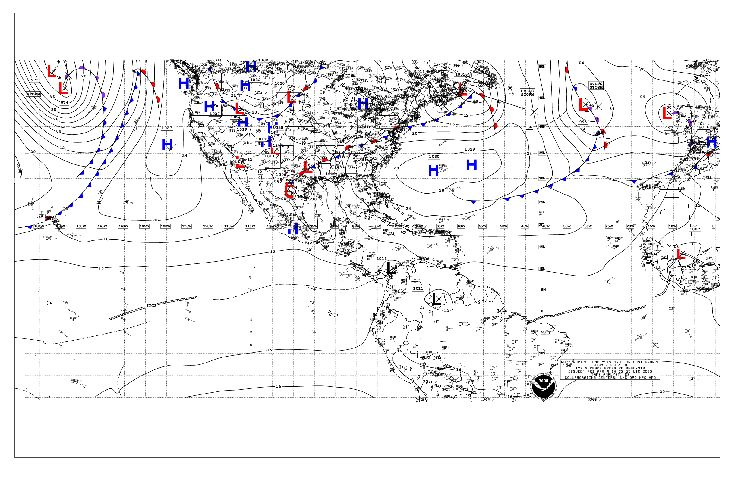
Based on 1200 UTC surface analysis and satellite imagery through
1700 UTC.

...TROPICAL WAVES...

A tropical wave has an axis along 19W from 08N to 17N, moving W
at 10-15 kt. Scattered moderate convection is noticed from 08N to
18N and E of 22W.

A central Atlantic tropical wave has an axis along 49W, from 06N
to 22N, moving W at around 15-20 kt. Scattered showers are seen
near the wave axis.

An eastern Caribbean tropical wave has an axis along 65W, from
the 17N65W southward into Venezuela, moving W at around 15 kt.
Scattered showers and isolated thunderstorms are seen near the
wave axis.

A central Caribbean tropical wave has an axis along 75W, moving W
at around 15 kt. No convection is currently associated with this
wave.

...MONSOON TROUGH/ITCZ...

The monsoon trough enters the Atlantic near 21N16W and continues
to 11N42W. The ITCZ extends from 11N42W to 08N47W where it is
broken by a tropical wave, and then resumes from 07N49W to
06N55W. Scattered moderate convection is seen from 06N to 14N
between 22W and 45W.

...GULF OF AMERICA...

A 1018 mb high pressure is centered over the Gulf near 26N87W. A
surface trough extending off the SW FL coast near Naples is
generating scattered moderate convection over the nearshore
waters. A surface trough over the Bay of Campeche is generating
scattered showers and isolated thunderstorms over the SW basin.
Gentle to moderate anticyclonic winds dominate much of the basin.
Seas are 1-3 ft basin-wide.

For the forecast, high pressure centered over the Gulf will bring
gentle to moderate winds and slight to moderate seas to the basin
into mid-week. Pulsing fresh NE to E winds are likely each
afternoon and evening along and just north of the Yucatan
Peninsula beginning on Mon as a trough develops daily and drifts
westward.

...CARIBBEAN SEA...

The pressure gradient between low pressure over NW Colombia and
the Atlantic ridge is forcing fresh to locally strong trades over
the central to SW Caribbean, generally S of 15N, where seas are 6-8
ft. Moderate to locally fresh easterly trade winds and 3-6 ft
seas prevail in the eastern Caribbean as well as the Gulf of
Honduras. Across the NW Caribbean, NE to E winds are moderate or
weaker, with slight seas. In the SW Caribbean, scattered moderate
convection is occurring along the coasts of Panama, Costa Rica,
and Nicaragua, enhanced by the East Pacific monsoon trough.

For the forecast, the pressure gradient between the Atlantic
ridge and the Colombian low will support fresh to strong winds
with moderate to locally rough seas across the south-central
Caribbean today, with fresh winds in the Gulf of Honduras. The
ridge will weaken and shift east tonight, allowing winds and seas
to diminish over the central Caribbean into mid week. Looking
ahead, winds and seas will increase again across the central
Caribbean starting Wed as the ridge builds north of the area.

...ATLANTIC OCEAN...

A pair of surface troughs in the western Atlantic are facilitating
the development of scattered moderate convection N of 27N and W of
65W, with more widely scattered showers and thunderstorms
impacting the Bahamas. Moderate to fresh SW winds are seen in this
region as well. In the central Atlantic, an upper- level trough
is aiding in the development of scattered moderate convection NE
of the Lesser Antilles from 16N to 22N between 54W and 60W.
Another area of scattered showers and thunderstorms are seen along
and near a surface trough in the central Atlantic analyzed from
31N44W to 26N54W. Surface ridging prevails across much of the
remaining Atlantic, supporting moderate to fresh trades and
moderate seas across much of the basin. Scatterometer data from
this morning indicate fresh to strong NE winds in the vicinity of
the Canary Islands. Gentle to moderate or weaker winds and slight
to moderate seas prevail elsewhere.

For the forecast west of 55W, a cold front will move offshore the
SE U.S. today, then stall. SW winds will increase and seas will
build N of 25N through the middle of the week between this front
and the Atlantic ridge to the east.

$$
Adams


 NHC on Facebook
 NHC on X
 NHC on YouTube
 NHC Blog: