314
AXNT20 KNHC 271012
TWDAT

Tropical Weather Discussion
NWS National Hurricane Center Miami FL
1215 UTC Thu Aug 27 2026

Tropical Weather Discussion for North America, Central America
Gulf of America, Caribbean Sea, northern sections of South
America, and Atlantic Ocean to the African coast from the
Equator to 31N. The following information is based on satellite
imagery, weather observations, radar and meteorological analysis.

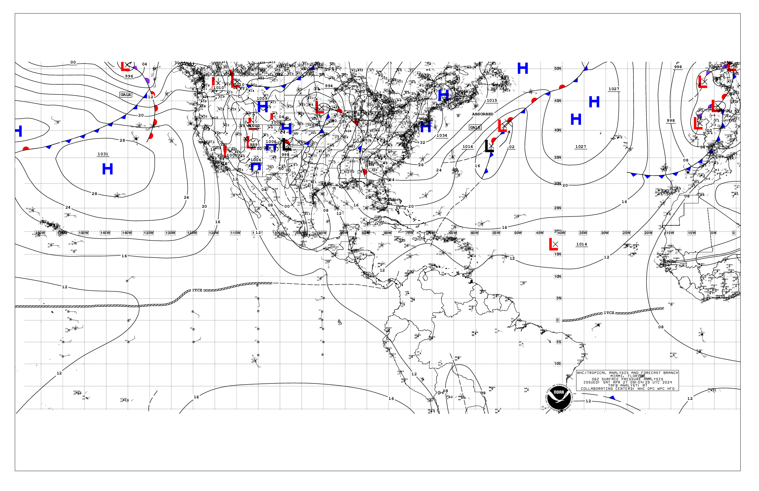
Based on 0600 UTC surface analysis and satellite imagery through
1005 UTC.

...SPECIAL FEATURES...

Eastern Tropical Atlantic (Invest AL96): satellite imagery
indicate that showers and thunderstorms associated with an area
of low pressure, located several hundred miles west-southwest of
the Cabo Verde Islands, have become better organized tonight. If
the current trends continue, advisories could be initiated on a
short-lived tropical depression or storm later today. However,
environmental conditions are expected to become hostile beginning
on Friday, likely ending its chances for development. This system
has a high chance of tropical cyclone formation through the next
48 hours and 7 days.

Please refer to the latest NHC Tropical Weather Outlook issued by
the National Hurricane Center at website:
https://www.hurricanes.gov/text/MIATWOAT.shtml for more details on
this feature.

Caribbean Gale Warning: A tight pressure gradient between the
subtropical ridge north of the area and the Colombian low will
support fresh to strong easterly trade winds and rough to very
rough seas through the forecast period. Winds will pulse to gale-force
tonight off Colombia.

Please refer to the latest HIGH SEAS FORECAST issued by the National
Hurricane Center at website -
https://www.nhc.noaa.gov/text/MIAHSFAT2.shtml for more details.

...TROPICAL WAVES...

An eastern Caribbean Sea tropical wave is along 64W, south of
21N, moving westward at 15-20 kt. No significant convection is
observed with this wave.

A central Caribbean Sea tropical wave is along 80W, south of 20N,
moving westward at 15-20 kt. No significant deep convection is
occurring with this wave.

...MONSOON TROUGH/ITCZ...

The monsoon trough extends from the coast of Mauritania near
19N16W to 11N38W. The ITCZ continues from 11N38W to 10N59W.
Scattered moderate to isolated strong convection is occurring from
04N to 15N and east of 23W.

...GULF OF AMERICA...

A few showers and isolated thunderstorms are noted in the northern
Gulf waters and off western Florida. A weak pressure gradient
across the basin supports light to gentle winds and moderate
seas.

For the forecast, weak high pressure will persist across the Gulf
waters through early next week, supporting moderate or weaker
winds and slight seas. Winds will pulse to fresh to locally strong
with moderate seas off western Yucatan during the evenings due to
a diurnal surface trough moving west off the peninsula each
night. A frontal boundary will meander near the northern Gulf
waters during the next few days producing scattered showers and
isolated thunderstorms. Mariners can expect gusty winds and higher
seas associated with these storms.

...CARIBBEAN SEA...

Please see the Special Features section above for details on the
Gale Warning in effect for the waters off Colombia.

A few showers and isolated thunderstorms are evident in the Gulf
of Honduras, SE Caribbean and off Panama and Costa Rica. Drier
conditions are noted elsewhere. Outside of the Gale Warning area,
fresh to strong easterly trade winds and moderate seas are present
in the north-central Caribbean. Moderate to locally fresh trades
and moderate seas are occurring in the Windward Passage and the
rest of the Caribbean south of 18N. North of 18N, light to gentle
winds and slight seas are prevalent.

For the forecast, a tight pressure gradient between the subtropical
ridge north of the area and the Colombian low will support fresh
to strong easterly trade winds and rough seas to locally very
rough seas in the south-central Caribbean through the forecast
period. Winds will pulse to gale-force tonight off Colombia.
Winds will pulse to fresh to locally strong in the Windward
Passage at night. An area of low pressure, Invest AL96, currently
located in the eastern Atlantic has a high chance of tropical
development over the next couples of days. The system will bring
increasing winds and seas to portions of the Tropical N Atlantic
this weekend.

...ATLANTIC OCEAN...

Please refer to the Special Features section for more details on
an area of low pressure, Invest AL96, that has a high chance of
tropical cyclone formation.

A surface trough located SE of Bermuda is producing a few showers
north of 26N and between 58W and 63W. Similar convection is found
in the waters off NE Florida. The SW North Atlantic is dominated
by a weak high pressure area that supports moderate or lighter
winds and moderate seas, west of 60W.

A cold front extends from Morocco to 26N22W to 28N34W, followed by
a stationary front north of our area. Broad high pressure also
prevails across the central and eastern tropical Atlantic,
maintaining moderate to locally fresh easterly winds and moderate
seas.

For the forecast west of 55W, the subtropical ridge will dominate
the SW N Atlantic waters over the next several days supporting
mainly moderate or weaker winds and slight to moderate seas. Winds
will pulse to fresh to locally strong off northern Hispaniola at
night. An area of low pressure, Invest AL96, currently located in
the eastern Atlantic has a high chance of tropical development
over the next couple of days. The system will bring increasing
winds and seas to portions of the southeast waters this weekend.

$$
Delgado


 NHC on Facebook
 NHC on X
 NHC on YouTube
 NHC Blog: