000
AXNT20 KNHC 180849
TWDAT

Tropical Weather Discussion
NWS National Hurricane Center Miami FL
1215 UTC Fri Sep 18 2026

Tropical Weather Discussion for North America, Central America
Gulf of America, Caribbean Sea, northern sections of South
America, and Atlantic Ocean to the African coast from the
Equator to 31N. The following information is based on satellite
imagery, weather observations, radar and meteorological analysis.

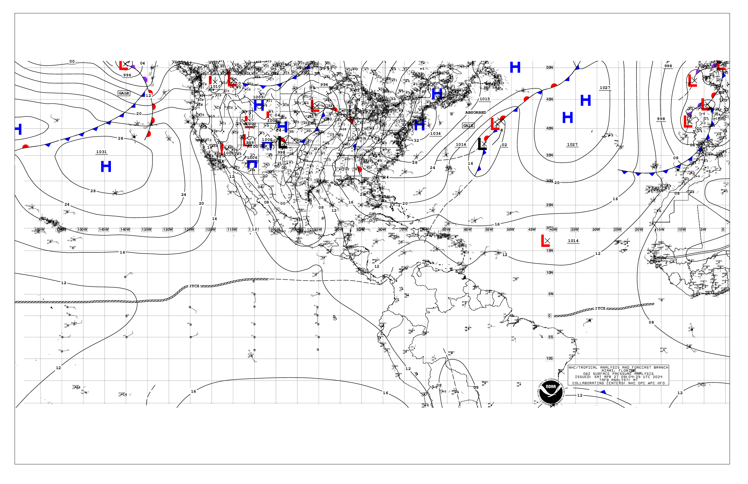
Based on 0600 UTC surface analysis and satellite imagery through
0810 UTC.

...TROPICAL WAVES...

A central Atlantic tropical wave has its axis along 37W from 02N
to 17N, moving westward around 10 kt. Scattered moderate isolated
strong convection is from 06N to 175N between 29W and 42W.

A central Caribbean tropical wave has its axis along 73W from
portions of Haiti southward to near the border of Colombia and
Venezuela, moving westward at around 10 kt. Scattered moderate
convection is noted from 16N to 19N between 69W and 77W.

...MONSOON TROUGH/ITCZ...

The monsoon trough enters the Atlantic near 18N16W and continues
southwestward to 10N39W, where it transitions to the ITCZ to
the border of French Guiana and Suriname at 06N54W. Aside from
convection associated to the tropical waves as described above,
scattered moderate isolated strong is evident south of the monsoon
trough to 04N between 18W and 29W.

...GULF OF AMERICA...

A frontal trough continues to be analyzed from the NW Bahamas
southwestward to across the Florida Keys and into the SE Gulf to
the north of the Yucatan Peninsula. Scattered moderate convection
is noted from 19N to 25N to the east of 90W. Moderate to fresh
easterly winds are across the Gulf waters north of 24.5N, along
with 4-7 ft seas. Gentle to moderate easterly winds are south of
24.5N, along with 2-4 ft seas. A weak diurnal surface trough is
noted west of the Yucatan Peninsula with another trough offshore
SE Texas and NE Mexico, supporting scattered showers and
thunderstorms within 90 nm of Veracruz, Mexico.

For the forecast, the pressure gradient between high pressure
over the southeastern U.S. and a weakening frontal trough over the
SE Gulf supports fresh NE to E winds and moderate seas over the
northern Gulf. These conditions will gradually improve later today
into Sat. Meanwhile, a rather broad upper-level low will move
towards Florida from the western Atlantic today, and into the NE
Gulf on Sat. This feature will lead to increasing shower and
thunderstorm activity over Florida, and then over the eastern and
central Gulf waters. Fairly tranquil marine conditions are
forecast by the end of the weekend into early next week.

...CARIBBEAN SEA...

Please refer to the tropical wave section for details on a wave in
the central Caribbean including associated convection.

The pressure gradient between weakening high pressure over the
western Atlantic and relatively lower pressure in northern South
America is allowing for fresh to strong trades over the central
Caribbean from 11N to 18N between 64W and 76W, where seas are 6-9
ft. Moderate to fresh trades are found elsewhere from 10N to 19N
to the east of 80W, along with 4-7 ft seas. Gentle to moderate
winds and 2-5 ft seas prevail across the remainder of the basin.
Upper-level divergence east of an upper-level low that is over the
northern Yucatan Peninsula is supporting scattered showers and
isolated thunderstorms over the northwestern Caribbean. An upper-
level disturbance riding along a jet stream branch is keeping
active weather in the form of numerous moderate convection over
the waters from 16N to 20N west of 76W.

For the forecast, the pressure gradient between high pressure
over the western Atlantic and the Colombian Low will generally
maintain fresh to strong trades along with moderate to locally
rough seas over most of the central Caribbean through Sat. Winds
will diminish to moderate to fresh speeds thereafter as the
pressure gradient relaxes across the area. Moderate or weaker
winds and slight to moderate seas are forecast elsewhere.

...ATLANTIC OCEAN...

A stationary front extends from near 31N72W southwestward to
across the NW Bahamas and to the Florida Keys. Moderate to locally
fresh northeast winds and 4-6 ft seas are north of of the front.
Scattered moderate convection is seen north of about 23N and east
of the front to around 68W. Well to the east, fresh to strong N-NE
winds and 6-9 ft seas are found from 17N to 22N between Africa
and 21W due to a tight pressure gradient, with moderate to fresh
N-NE winds and 6-9 ft seas elsewhere from 16N to 31N to the east
of 28W. Moderate or weaker winds and moderate seas dominate the
remainder of the tropical Atlantic waters.

Other than the convection described above with the tropical wave
in the central Atlantic and the monsoon trough, scattered moderate
isolated strong is found from 22N to 26N between 29W and 42W, and
from 25N to 31N between 41W and 54W where a couple of surface
troughs are present.

For the forecast west of 55W, a stationary front that extends
from near Bermuda to the NW Bahamas will gradually wash out today.
Conditions will improve early on Fri as high pressure becomes the
dominant feature across the basin into the weekend into early
next week. Meanwhile, abundant tropical moisture, combined with an
upper- level low located east of Florida, will continue to
support scattered to numerous showers and thunderstorms, mainly W
of 70W, through at least Sun.

$$
Lewitsky


 NHC on Facebook
 NHC on X
 NHC on YouTube
 NHC Blog: