000
AXNT20 KNHC 230337
TWDAT

Tropical Weather Discussion
NWS National Hurricane Center Miami FL
0615 UTC Fri Oct 23 2026

Tropical Weather Discussion for North America, Central America
Gulf of America, Caribbean Sea, northern sections of South
America, and Atlantic Ocean to the African coast from the
Equator to 31N. The following information is based on satellite
imagery, weather observations, radar and meteorological analysis.

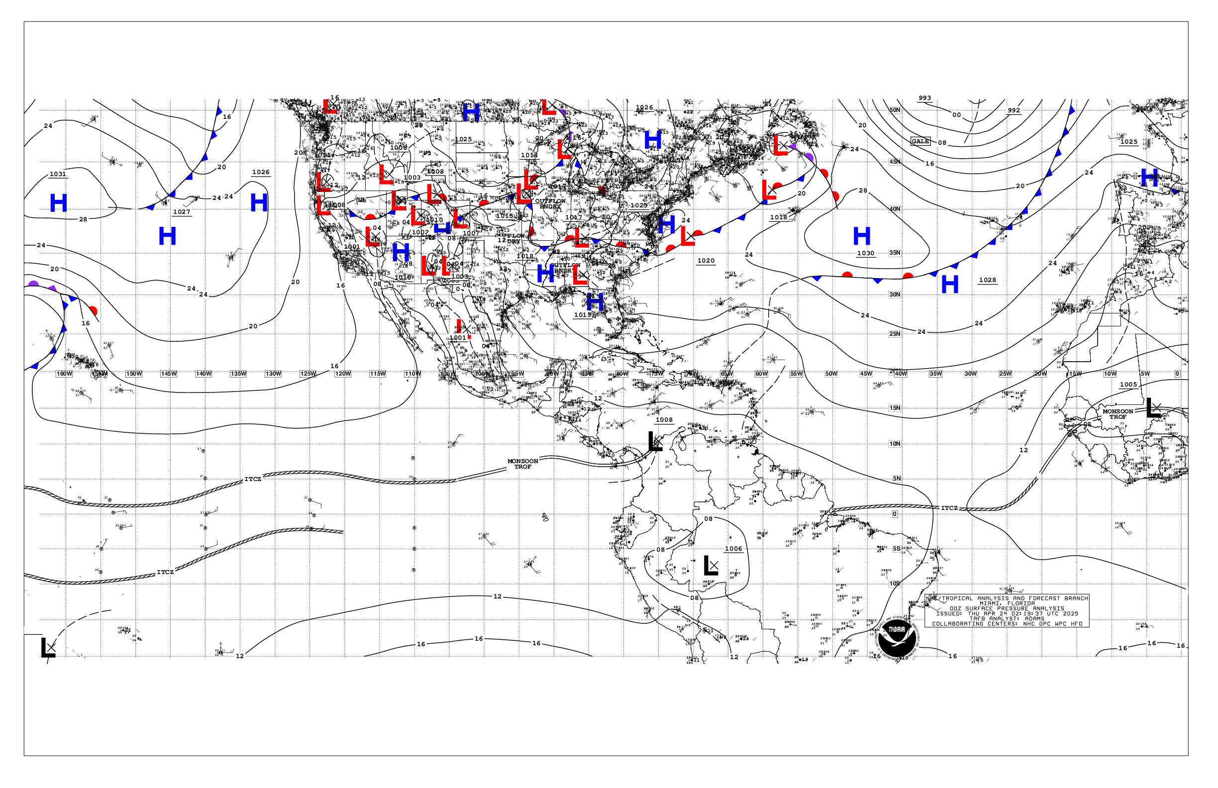
Based on 0000 UTC surface analysis and satellite imagery through
0330 UTC.

...SPECIAL FEATURES...

Heavy Rainfall in the North Caribbean: A broad upper-level
trough extends from the United States into the NW Caribbean,
while deep moisture convergence is ongoing at lower levels in the
southern Caribbean. A broad plume of very moist air will interact
with the upper level trough in the NW Caribbean, sustaining
moisture into Hispaniola, Jamaica, Cuba, and the Bahamas over the
next several days. Low-level winds will also lead to moist onshore
flow entering along the southern coasts of east Cuba and Haiti,
where heavy precipitation is expected through Sunday. Expect the
heaviest precipitation to occur across all other aforementioned
areas on Sat and Sun. Heavy rainfall will raise concerns for
dangerous and life-threatening flash flooding.

Please refer to your local weather services and the International
Desk at the Weather Prediction Center for more information.

...MONSOON TROUGH/ITCZ...

The monsoon trough extends off the coast of Africa near 07N12W
and extends to 07N18W. The ITCZ extends from 07N18W to 08N27W. It
resumes from 08N33W to 06N54W. Scattered moderate convection is
noted from 02N to 09N between 16W and 27W.

...GULF OF AMERICA...

High pressure over the eastern of the United States supports
moderate to fresh NE to E winds across the Gulf region. Slight to
moderate seas are noted.

For the forecast, a tightening pressure gradient between the high
pressure and a low pressure forecast to develop near the Bahamas
will bring fresh to strong NE winds and rough seas over the
eastern Gulf, including the Florida Straits, Fri night through
early next week.

...CARIBBEAN SEA...

An upper level trough over NW Caribbean supports scattered to
numerous showers and thunderstorms over the north-central
Caribbean and Windward Passage. A weak pressure gradient over the
area is generating moderate or weaker winds, and slight to
moderate seas, over the basin.

For the forecast, scattered to numerous showers and thunderstorms
over the north-central Caribbean and Windward Passage will
prevail through Sat. Meanwhile, a broad trough over the central
and western Caribbean will support light winds and slight to
moderate seas west of 75W through Sat, and moderate to fresh E to
SE winds and moderate seas east of 75W. Fresh N to NE winds
across the western Caribbean with building seas west of 80W are
expected by early next week as high pressure builds north of the
area. Expect rough seas and large swell across the Yucatan Channel
Mon and Tue. Little change is expected elsewhere.

...ATLANTIC OCEAN...

A 1011 mb low is centered to the northe of the area, with a
trough extending from the low to 24N53W. Scattered moderate
convection is in the vicinity of the trough. Fresh to strong
southerly winds, and moderate to rough seas are east of the trough
between 44W and 51W. Large northerly swell generated from Post-
Tropical Josephine north of the area is generating rough seas N of
25N and W of 65W. Elsewhere, moderate or weaker winds, and
moderate seas prevail as surface ridging dominates the area.

For the forecast west of 55W, large northerly swell will continue
to propagate across the forecast region W of 65W and NE of the
Bahamas through Fri. A tightening pressure gradient will develop
beginning late Fri as high pressure builds southward over the
western Atlantic and low pressure deepens near the Bahamas along a
trough or developing frontal boundary. This setup is expected to
induce widespread fresh to strong NE to E winds and rough to very
rough seas, with winds likely reaching gale-force over much of the
waters north of 27N and W of 60W Sat night through Sun night.
Mariners are urged to remain alert to these dangerous marine
conditions, and take the necessary precautions to avoid the
affected areas.

$$
ERA


 NHC on Facebook
 NHC on X
 NHC on YouTube
 NHC Blog: