000
AXNT20 KNHC 111012
TWDAT

Tropical Weather Discussion
NWS National Hurricane Center Miami FL
1215 UTC Wed Nov 11 2026

Tropical Weather Discussion for North America, Central America
Gulf of America, Caribbean Sea, northern sections of South
America, and Atlantic Ocean to the African coast from the
Equator to 31N. The following information is based on satellite
imagery, weather observations, radar and meteorological analysis.

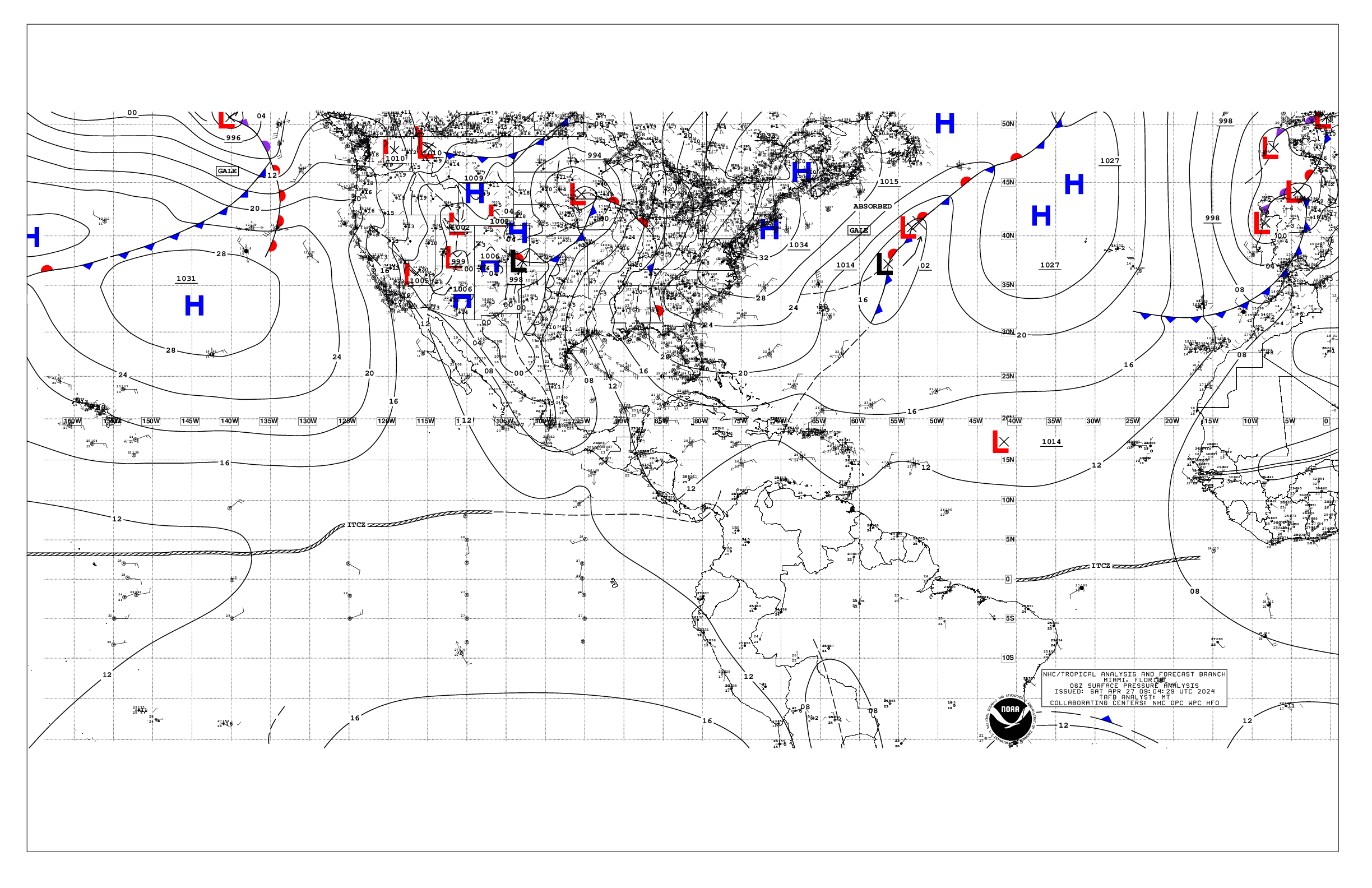
Based on 0600 UTC surface analysis and satellite imagery through
0900 UTC.

...SPECIAL FEATURES...

Meteo-France Eastern Atlantic Gale Warning: SW winds to gale-force
will persist through this morning from the waters north of the
Canary Islands to off Agadir, Morocco, with 12 to 18 ft seas.
These gales and rough to very rough seas are ahead of a complex
pair of low pressure systems west and northwest of the Canary
Islands moving rapidly to the northeast. Winds and seas will start
to diminish after 12 UTC.

Please read the latest High Seas Forecast issued by Meteo-France
at website: https://wwmiws.wmo.int for more details.

...MONSOON TROUGH/ITCZ...

The monsoon trough extends from 11N15W to 08N21W. The ITCZ
extends from 08N21W to 07N53W. Scattered moderate convection is
from 06N to 09N between 21W and 42W.

...GULF OF AMERICA...

Weak low pressure that has formed just offshore Texas is inducing
scattered moderate convection offshore the Middle and Upper-Texas
coast. Elsewhere, mainly high pressure dominates, with gentle NE
winds prevail, along with seas of less than 3 ft.

For the forecast, a cold front will exit Texas tonight, then
sweep across the basin through Thu night and depart by Fri,
leading fresh to locally strong N winds and building seas in its
wake. High pressure will build southward into the region this
weekend, with increasing easterly winds as the high shifts
eastward Sun. Strong E winds are likely across portions of the
northern Gulf starting Sun as the pressure gradient increases
ahead of a low pressure and attendant cold front that will
approach the NW Gulf for the start of next week.

...CARIBBEAN SEA...

The pressure gradient between high pressure centered north of
the region and lower pressure over South America is leading to
fresh to strong trades over the south central basin, with moderate
to fresh trades elsewhere, except weaker near the coast of Central
America and in the NW Caribbean. Seas are 6 to 8 ft in the south-
central Caribbean and 4 to 6 ft elsewhere, except 2-4 ft over the
northwest Caribbean. Scattered moderate convection is noted in the
NW basin due to upper-level divergence.

For the forecast, fresh to strong trades and locally rough seas
will prevail over the south-central Caribbean into Thu night, with
mainly moderate winds and seas elsewhere. The pressure gradient
will weaken starting Fri as a cold front approaches the Yucatan
Channel, weakening the trades. Moderate north winds and slightly
building seas are likely behind this front over the northwestern
Caribbean this weekend.


...ATLANTIC OCEAN...

Please see the Special Features section for information on a Gale
Warning for portions of the Meteo-France High Seas Forecast area.

A cold front extends from 29N55W to 27N62W. Scattered moderate
convection is associated with a pre-frontal trough N of 29N
around 45W, otherwise little sensible weather is associated with
this front. To the east, a cold front extends from 31N22W to
26W40W. Ahead of this front, fresh to strong SW winds prevail,
with rough seas. Very rough seas in NW swell, and fresh winds are
N of the boundary. Upper-level divergence is leading to scattered
moderate convection N of the Greater Antilles to 22N, between 65W
and 75W. Elsewhere, weak high pressure is leading to moderate or
weaker winds and mainly moderate seas.

For the forecast west of 55W, the cold front in the NE waters
will exit to the east later today. Another cold front is expected
to move off the southeastern U.S. coast Thu, accompanied by fresh
to strong winds and building seas on both sides of it. These
conditions are expected to persist through Sat night. By Sat
night, the front will stall from near 28N55W to the vicinity of
the Turks and Caicos.

$$
Konarik


 NHC on Facebook
 NHC on X
 NHC on YouTube
 NHC Blog: