000
AXNT20 KNHC 291042
TWDAT

Tropical Weather Discussion
NWS National Hurricane Center Miami FL
1215 UTC Thu Oct 29 2026

Tropical Weather Discussion for North America, Central America
Gulf of America, Caribbean Sea, northern sections of South
America, and Atlantic Ocean to the African coast from the
Equator to 31N. The following information is based on satellite
imagery, weather observations, radar and meteorological analysis.

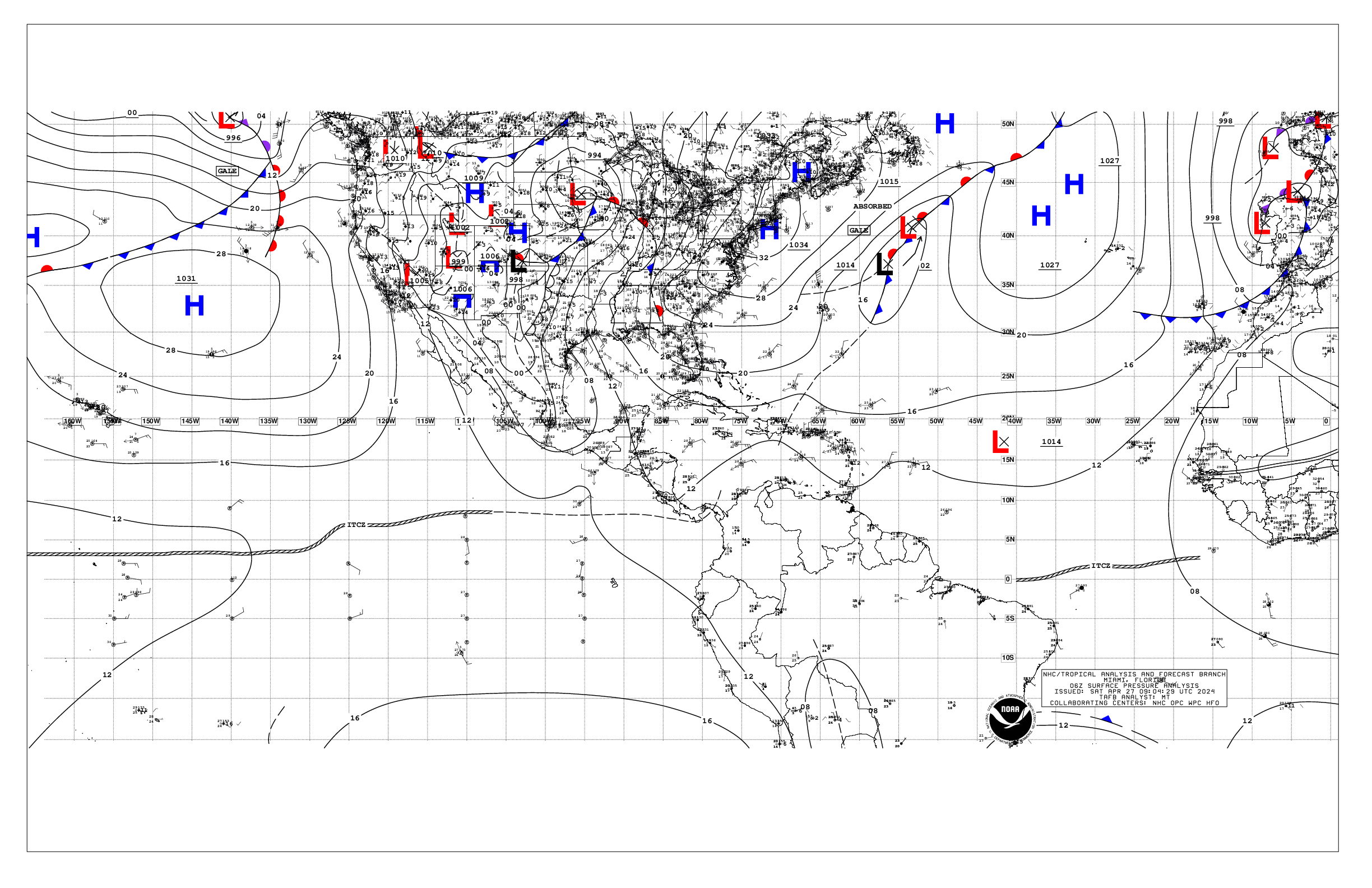
Based on 0600 UTC surface analysis and satellite imagery through
1020 UTC.

...SPECIAL FEATURES...

Gales N of Bahamas: A tight pressure gradient between a 1028 mb
high pressure system offshore New England, and a stationary front
extending from S of Bermuda across the northern Bahamas to a 1012
mb low in the Straits of Florida, is supporting fresh to near
gale-force NE winds and rough seas N of the front and W of 57W.
Winds are reaching minimal gale force in zones AMZ064 and AMZ065.
Winds will diminish below gale force later this morning, however
fresh to strong NE winds will prevail through late Fri as the low
in the Straits tracks northeastward N of the area dragging a cold
front forecast to extend from Bermuda to the central Bahamas by
Fri morning, and moving east of 55W by Sun morning. Mariners are
urged to remain alert to these dangerous marine conditions and
take the necessary precautions to avoid these affected areas.

Please, see the latest NWS High Seas Forecast issued by the
National Hurricane Center at website
https:www.nhc.noaa.gov/text/MIAHSFAT2.shtml for further details.

...MONSOON TROUGH/ITCZ...

The monsoon trough reaches the Atlantic through the coast of
Africa near 15N16W and continues to 14N20W to 08N26W. The ITCZ
extends from 08N26W to 05N44W to 07N58W. Scattered moderate to
isolated strong convection is noted from 05N to 13N between 16W
and 38W.

...GULF OF AMERICA...

A broad ridge over the eastern CONUS and the NW Atlantic extends a
ridge across the Gulf. The pressure gradient tightens over the
eastern half of the Gulf due to the presence of a stationary front
N of the Bahamas. This is resulting in moderate to fresh NE winds
E of 90W along with moderate to rough seas.

For the forecast, a tight pressure gradient between a high
pressure system over New England and a stationary front over the
offshores NE of the Bahamas will continue to support fresh to
locally strong NE to E winds and rough seas in the E Gulf into Mon
night. Winds and seas will gradually diminish into Sat as the
ridge slides eastward. Looking ahead, another robust high pressure
system will reach New England late this weekend and early next
week allowing winds and seas to increase in the NE Gulf.
Elsewhere, gentle to moderate winds and moderate seas will prevail
into early next week. Otherwise, expect fresh SE to S winds over
much of the Gulf by Mon between high pressure over the western
Atlantic and a cold front moving through the Southern Plains.

...CARIBBEAN SEA...

The passage of a stationary front over the SW N Atlantic waters is
supporting a weak gradient over the Caribbean waters W of 76W,
thus leading to light to gentle winds and slight seas. Moderate to
fresh trades and moderate seas are elsewhere.

For the forecast, moderate to locally fresh trade winds will
continue south of 15N through the eastern, central and portions of
the SW Caribbean through Sun night. Moderate or weaker winds are
forecast elsewhere and through the remainder forecast period.

...ATLANTIC OCEAN...

Please see the Special Features section above for information on
a Gale warning north of the Bahamas.

A tight pressure gradient between a high pressure system over New
England and a stationary front extending across the offshore
zones N of 27N, across the northern Bahamas to a 1012 mb low in
the Florida Straits supports strong to gale-force NE winds and
rough seas north of the front. Scattered showers and isolated
thunderstorms are occurring across the offshores between 55W and
77W. The aforementioned stationary front connects to a cold front
near 28N49W and extends NE to 31N31W. Scattered showers and tstms
are N of 25N and ahead of the front to 25W. Moderate to fresh
winds are ahead and behind the front with seas to 7 ft. Otherwise,
moderate or weaker winds and moderate seas are elsewhere.

For the forecast west of 55W, the gales will end later this
morning, however fresh to strong NE winds will prevail through
late Fri as the low in the Straits tracks northeastward N of the
area dragging a cold front forecast to extend from Bermuda to the
central Bahamas by Fri morning, and moving east of 55W by Sun
morning. Expect fresh to strong NE-E winds and rough seas N of the
front through early next week.

$$
Ramos


 NHC on Facebook
 NHC on X
 NHC on YouTube
 NHC Blog: