000
AXNT20 KNHC 090621
TWDAT

Tropical Weather Discussion
NWS National Hurricane Center Miami FL
0615 UTC Mon Nov 9 2026

Tropical Weather Discussion for North America, Central America
Gulf of America, Caribbean Sea, northern sections of South
America, and Atlantic Ocean to the African coast from the
Equator to 31N. The following information is based on satellite
imagery, weather observations, radar and meteorological analysis.

Based on 0000 UTC surface analysis and satellite imagery through
0550 UTC.

...SPECIAL FEATURES...

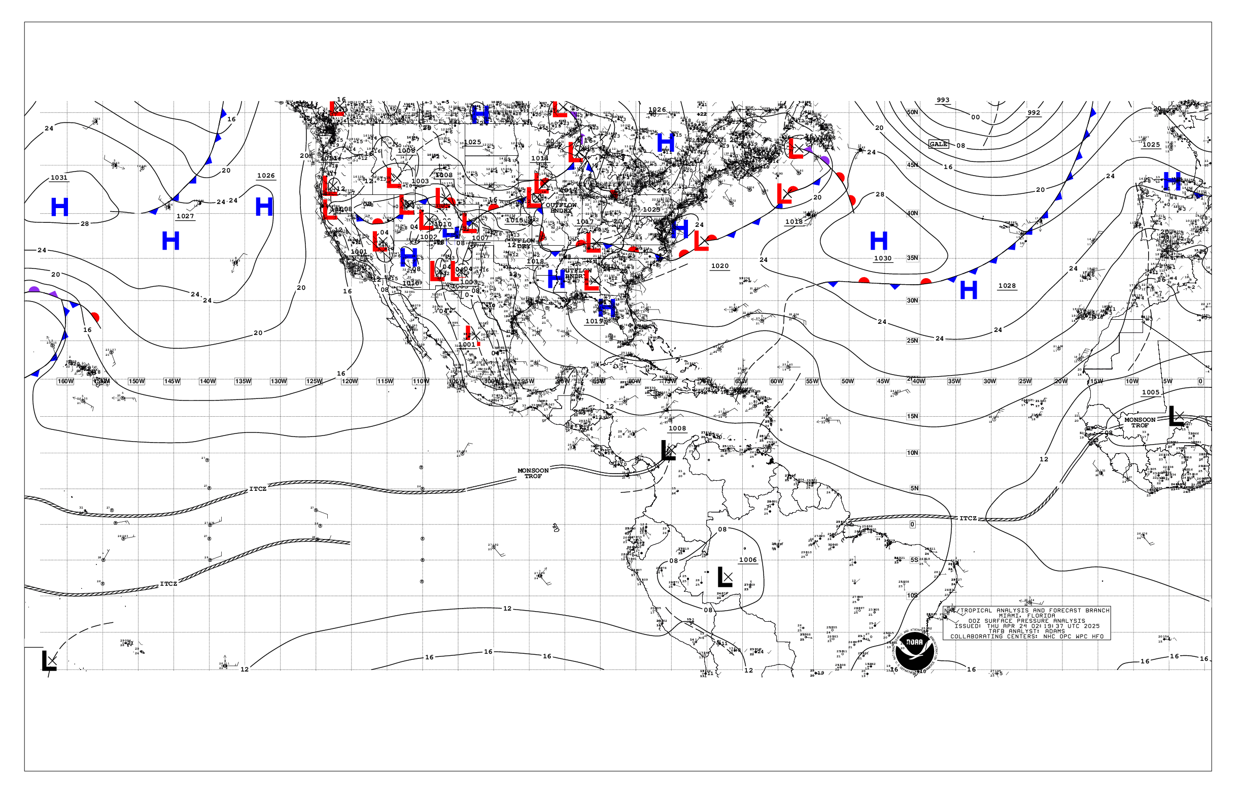
Western Atlantic Gale Warning: A 998 mb low pressure is centered
near 28N51W, moving NE at 10-15 kt. A warm front extends from
the low to 24N32W. Recent satellite scatterometer data showed
gale force SW winds occurring in the SE quadrant of the low,
where buoy and altimeter data indicated seas of 8 to 15 ft in
mixed swell. Across the remainder quadrants of the low, a broad
zone of strong to near-gale force winds cover a region from 20N
to 31N between 37W and 58W. Buoy and altimeter data suggest that
seas in this area are 8 to 13 ft in mixed NE and SW swell.
Scattered to numerous moderate to strong convection is occurring
mostly to east of this deep- layered low pressure system, from 25N
to 31N between 40W and 50W. The low will move east-northeastward,
and accelerate, moving east of 35W by Tue night. The broad zone
of strong to gale force SW winds occurring with the low will
shift in synch with the low through Tue, generating very rough to
high seas to around 20 ft before exiting the forecast area.

Please read the latest High Seas Forecast issued by the National
Hurricane Center at website:
https://nhc.noaa.gov/text/HSFAT2.html

...MONSOON TROUGH/ITCZ...

The monsoon trough enters the Atlantic waters near 09.5N13.5W to
06N19W. The ITCZ extends from 05.5N22W to 03.5N48W. Scattered
moderate convection is from 04N to 06.5N east of 35W and from
03.5N to 10N between 35W and 53W.

GULF OF AMERICA...

A former weakening stationary front has dissipated and in its
place a remnant trough extends from the Florida Straits to the
northern Yucatan offshore waters. High pressure is building in the
wake of the front, with a weakeness analyzed as a surface trough
extending along the NE Mexico offshore waters, and generating
scattered showers in that area. Moderate to fresh ESE winds and
moderate seas in the 4 to 7 ft range are W of 90W while light to
gentle winds and slight seas are elsewhere E of 90W.

For the forecast, the frontal remnant trough will dissipate by
late Mon. High pressure will continue to build across the area,
with winds diminishing to gentle to moderate. The next cold front
will move into the NW Gulf on Thu and rapidly shift across the
Gulf basin, moving SE of the area Fri. The front will be followed
by fresh to strong winds and building seas.

...CARIBBEAN SEA...

Due to the gale-force low northeast of the Caribbean, the pressure
gradient across forecast waters remains weak, promoting only
gentle to moderate trade winds across the basin and seas of 2-4
ft. A surface trough remains offshore NE Honduras, generating
scattered heavy showers over the eastern Honduras offshore waters.

For the forecast, a weak pressure gradient across the basin will
result in moderate or weaker trade winds, along with slight to
moderate seas, through Mon. Winds will strengthen over the central
Caribbean by Tuesday and then prevail through the week. A cold
front may enter the NW Caribbean Fri, followed by moderate to
fresh winds and building seas.

...ATLANTIC OCEAN...

Please see the Special Features section for information on a Gale
Warning.

A cold front extends from Bermuda to the NW Bahamas where it
transitions to a surface trough to the Florida Straits. West of
62W, winds are light to gentle and seas are moderate to 7 ft.
Otherwise, a cold front is moving across the Canary Islands to
23N29W where it becomes warm to the low center in the Special
Features. Only moderate to locally fresh NW winds and seas to 11
ft are behind this front to 35W.

For the forecast west of 55W, the gale-force low that has
impacted the region the past several days has shifted east of the
area. Strong to near-gale-force winds, and rough to very rough
seas near 14 ft, cover the remainder of the waters east of 62W.
These winds and seas will decrease from west to east through
midweek as the low shifts further from the forecast waters.
Elsewhere, the stationary portion of the front will dissipate by
Mon while the cold front will move eastward over the waters N of
25N through the middle of the week. Another, stronger, cold front
will enter the NW waters the end of the week, ushering in fresh to
strong winds and building seas.

$$
Ramos


 NHC on Facebook
 NHC on X
 NHC on YouTube
 NHC Blog: