000
AXNT20 KNHC 101738
TWDAT

Tropical Weather Discussion
NWS National Hurricane Center Miami FL
1815 UTC Tue Nov 10 2026

Tropical Weather Discussion for North America, Central America
Gulf of America, Caribbean Sea, northern sections of South
America, and Atlantic Ocean to the African coast from the
Equator to 31N. The following information is based on satellite
imagery, weather observations, radar and meteorological analysis.

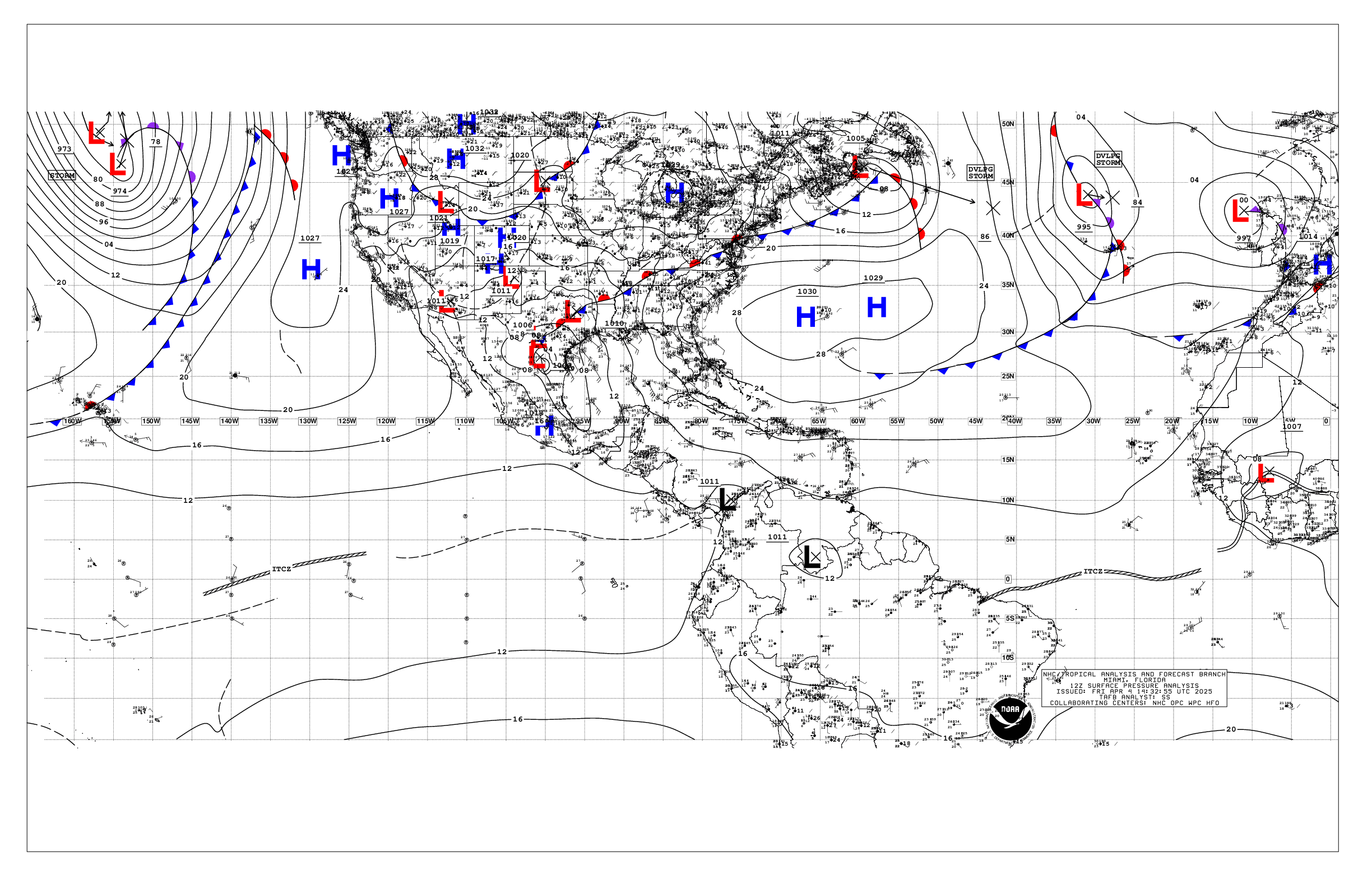
Based on 1200 UTC surface analysis and satellite imagery through
1700 UTC.

...SPECIAL FEATURES...

Eastern Atlantic Gale Warning: A cold front extends from near
30N34W to 21N49W. Ahead of this front, gale-force southwesterlies
are present N of 27N and E of 33W, extending to about 28W. Very
rough seas of up to 20 ft extend beyond this area of gales
southward to 22W and westward to 43W. This low pressure and cold
front will move rapidly east, ending gales west of 35W later this
morning. However, very rough seas will prevail into tonight, with
rough seas decaying below 8 ft Wed evening.

Please read the latest High Seas Forecast issued by the National
Hurricane Center at website:
https://nhc.noaa.gov/text/HSFAT2.html

...MONSOON TROUGH/ITCZ...

The monsoon trough extends from 12N16W to 09N21W. The ITCZ
extends from 09N21W to 07N35W to 06N55W. Scattered moderate
convection is from 03N to 07N east of 48W.

GULF OF AMERICA...

1022 mb high pressure is centered over the lower Mississippi
Valley. This is supporting mainly gentle to moderate winds and
slight seas through the basin. A surface trough has moved into the
Gulf, extending from near Corpus Christi down to the coastal
waters of Mexico, producing scattered moderate convection within
60 nm either side of its axis.

For the forecast, Broad high pressure across the area supports
gentle to moderate winds and slight seas. Winds will diminish
further until Wed night, when a cold front will exit the Texas
coast and move SE through the basin, exiting by Fri. The front
will bring fresh to locally strong winds and building seas. High
pressure will settle in in the wake of the front this weekend with
moderate to fresh easterly winds expected.

...CARIBBEAN SEA...

The pressure gradient between high pressure centered north of
the region and lower pressure over South America is leading to
fresh to strong trades over the south central basin, with moderate
to fresh trades elsewhere. Seas are 6 to 8 ft in the south-central
Caribbean and 3 to 6 ft elsewhere. Moderate convection is noted
in and near the Gulf of Honduras, where trade winds are
converging near a surface trough and producing localized rough
seas.

For the forecast, Fresh to strong trades and locally rough seas will
prevail over the south-central Caribbean through Thu, with mainly
moderate winds and seas elsewhere. The pressure gradient will
weaken Thu night into Fri as a cold front approaches the Yucatan
Channel, weakening the trades. Moderate to fresh NW winds and
building seas are possible behind this front in the NW basin into
the weekend.

...ATLANTIC OCEAN...

Please see the Special Features section for information on a Gale
Warning for waters N of 25N and E of 40W.

In addition to the gale center listed in the Special Features
section, a weak 1016 mb low pressure is centered near 28N65W. A
stationary front extends from 31N51W to the low pressure to the
SE Bahamas. Outside the area of winds and seas described in the
Special Features near the gale center, gentle to moderate winds
and moderate seas in a mix of swell.

For the forecast west of 55W, A cold front extends from 31N56W
through a 1016 mb low centered near 27N67W to the SE Bahamas. This
front and low will move east through tonight and exit the region
by Wed. Another front will move off the SE U.S. coast Thu,
bringing fresh to strong winds and building seas on both sides of
it, that will prevail into the weekend. By early Sat, the front
will extend from Bermuda to the SE Bahamas.

$$
Adams/Juliano


 NHC on Facebook
 NHC on X
 NHC on YouTube
 NHC Blog: