000
AXNT20 KNHC 312157
TWDAT

Tropical Weather Discussion
NWS National Hurricane Center Miami FL
0015 UTC Sat Nov 1 2026

Tropical Weather Discussion for North America, Central America
Gulf of America, Caribbean Sea, northern sections of South
America, and Atlantic Ocean to the African coast from the
Equator to 31N. The following information is based on satellite
imagery, weather observations, radar and meteorological analysis.

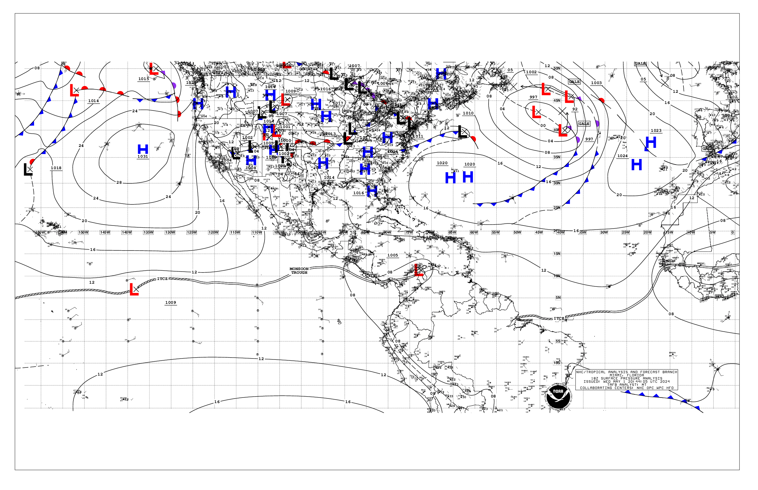
Based on 1800 UTC surface analysis and satellite imagery through
2300 UTC.

...MONSOON TROUGH/ITCZ...

The monsoon trough axis reaches the Atlantic through the coast of
W Africa near 13N17W, and continues southwestward to 08N30W,
where it transitions to the ITCZ. The ITCZ then continues to
09N58W. Scattered moderate convection is depicted from 06N to
12N and E of 30W. Similar convection is also depicted from 06N
to 13N between 40W and 58W.

...GULF OF AMERICA...

The pressure gradient between high pressure over the southeastern
United States and relatively lower pressure to its south is
supporting moderate to fresh east winds and moderate seas across
the northeast and eastern Gulf. Light to gentle winds and seas 2
to 5 ft previal elsewhere. Convergent surface winds across the
eastern Gulf support scattered showers and thunderstorms.

For the forecast, between high pressure over the southeastern
U.S. and relatively lower pressure off of southern Central
America and northern South America, mariners in the northeast and
north-central Gulf can expect moderate to fresh northeast-to-
east winds and periods of moderate seas through Mon night. A cold
front will move into the NW Gulf Tue as a warm front develops
over the NE Gulf. The warm front will slowly move northeast away
from the area Tue through Wed as the cold front slowly moves east
across the Gulf, providing for areas of moderate winds and seas.
The cold front weakens over the E Gulf Thu and Thu night while
weak high pressure then builds over the W Gulf.

...CARIBBEAN SEA...

The pressure gradient between higher pressure over the Gulf of
America and the western Atlantic, and lower pressure over
Colombia supports fresh to strong trades along with seas of
6 to 9 ft in the south-central Caribbean offshore Colombia.
Moderate to fresh trades and 3 to 6 ft seas prevail across the
remainder of the central and eastern Caribbean. Moderate or weaker
winds and slight seas are elsewhere. Otherwise, scattered
moderate convection is noted over the SW part of the basin in
association with the eastern end of the Pacific monsoon trough.
An upper level trough is supporting isolated moderate convection
over the central and eastern Caribbean.

For the forecast, moderate to fresh trades over the central and
eastern Caribbean, and moderate to rough seas, will continue
through Mon, with some areas of strong winds near the coast of
Colombia and NW Venezuela. Winds and seas are expected to
diminish basin-wide late Mon through Thu as broad low pressure
with a relaxed pressure gradient gradually develops and then
persists across the Atlantic NE of the Bahamas.

...ATLANTIC OCEAN...

A frontal boundary extends from 31N54W to 23N70W while high
pressure to its northwest builds southward across the western
Atlantic. A warm front is analyzed from 31N46W to 25N44W.
Scattered showers and thunderstorms are along and just ahead of
the cold front. Fresh to locally strong SW winds are ahead of
the frontal boundary to near 50W and north of 29N. Seas of 6 to
8 ft are with these winds. Moderate to fresh north- northeast
winds are in the wake of the front to the east coast of Florida
along with seas 6 to 9 ft. Over the far eastern part of the
basin, a cold front extends from a 1012 mb low that is near
33N21W, south- southwestward to 20N36W. Moderate to fresh north
to northeast winds are west of the front to near 40W and north of
23N. Seas are 8 to 13 ft with these winds. Scattered moderate
convection is noted north of 24N between the coast of Morocco
and the cold front.

For the forecast west of 55W, a secondary cold front off of the
southeast U.S. coast along and just north of 30N will weaken as
it moves south tonight. Otherwise, the southern part of a cold
front from near 30N55W to 25N62W to 23N70W will continue to move
east tonight as high pressure to its northwest builds south and
east across the western Atlantic. To the south of the high,
mariners can expect widespread areas of fresh to locally strong
northeast- to-east winds, and rough seas to near 10 feet, through
Monday night and into Tue. The front will become nearly
stationary near 25N Sun through Mon night. A warm front will
develop over the NE Gulf Tue and move northeast across the SW
north Atlantic Wed. As the high off of the U.S. east coast
gradually shifts east, a weakening cold front will approach from
the E Gulf Thu and move offshore of Florida late Thu night.

$$
Adams


 NHC on Facebook
 NHC on X
 NHC on YouTube
 NHC Blog: