000
AXNT20 KNHC 060830
TWDAT

Tropical Weather Discussion
NWS National Hurricane Center Miami FL
1215 UTC Sun Sep 6 2026

Tropical Weather Discussion for North America, Central America
Gulf of America, Caribbean Sea, northern sections of South
America, and Atlantic Ocean to the African coast from the
Equator to 31N. The following information is based on satellite
imagery, weather observations, radar and meteorological analysis.

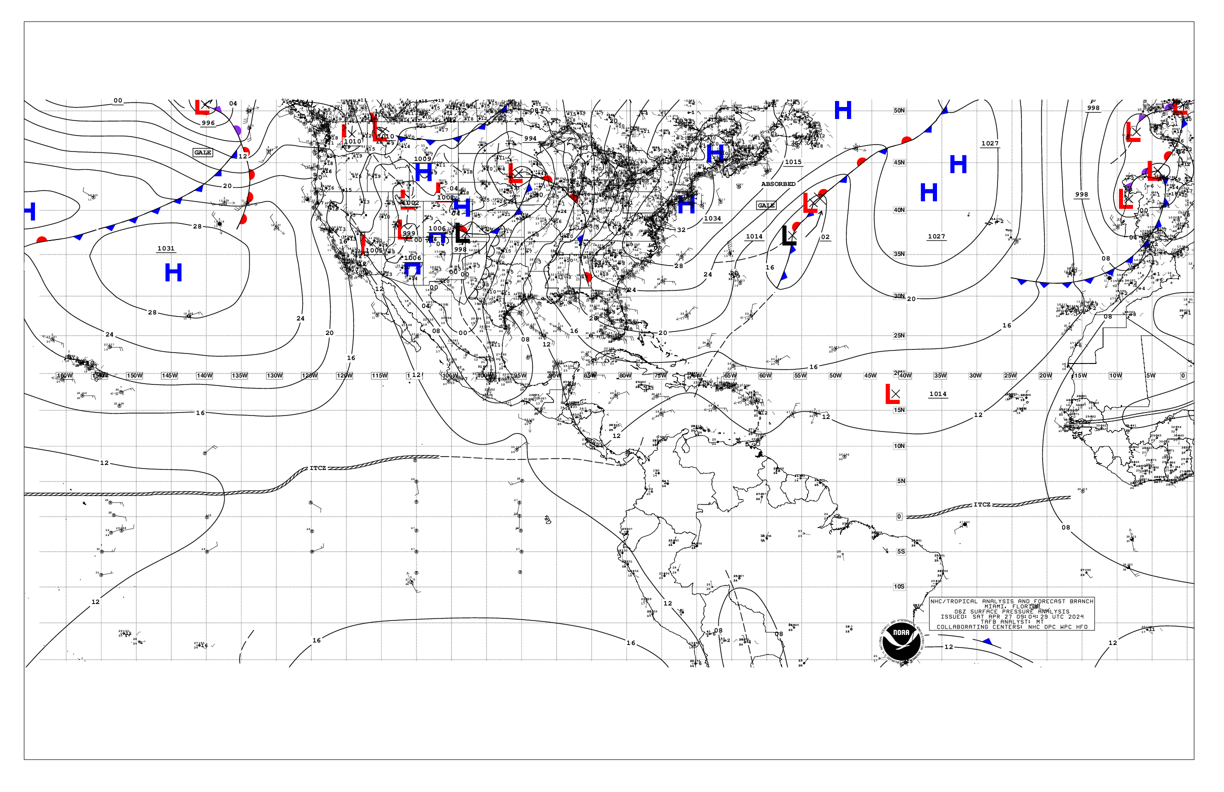
Based on 0600 UTC surface analysis and satellite imagery through
0830 UTC.

...TROPICAL WAVES...

The axis of a tropical wave is near 22W, south of 20N, moving W
at 10 to 15 kt. Scattered moderate convection is noted from 08N to
12N between 22W and 25W.

The axis of a tropical wave is near 37N, south of 20N, moving W
at around 10 to 15 kt. Scattered showers are seen near the wave
axis and S of 15N.

The axis of a tropical wave is near 68W, south of 20N, moving W
at around 10 to 15 kt. Scattered showers are near the northern end
of the wave axis mainly between 65W and 70W.

The axis of a tropical wave is near 79W, and extends from central
Cuba southward into the far eastern Pacific. No significant
convection is noted in the Caribbean waters with this wave.

...MONSOON TROUGH/ITCZ...

The monsoon trough enters the Atlantic through the coast of
Mauritania near 18N16W and continues southwestward to 08N28W, then
westward to near 07N43W. The ITCZ continues from 07N43W to near
08N58W. Convection is limited across the area, aside from the
areas noted in the tropical waves section above.

...GULF OF AMERICA...

High pressure prevails across the Gulf region, anchored by a 1014
mb high pressure centered near 26N87W. Light to gentle winds are
in the vicinity of the high center. Gentle to moderate winds are
over the SW Gulf. Mainly gentle winds prevail elsewhere. Slight
seas dominate the forecast waters.

For the forecast, a weak pressure gradient will support light to
gentle winds and slight seas over much of the waters into late
next week. Winds will pulse to fresh with moderate seas off
western Yucatan during the evenings due to a diurnal surface
trough moving west off the peninsula each night.

...CARIBBEAN SEA...

The pressure gradient between high pressure to the north and the
Colombian low is supporting fresh to locally strong trade winds
and moderate seas offshore Colombia, and in the Gulf of
Venezuela. Moderate to fresh winds are elsewhere over the central
Caribbean. Gentle to moderate winds and slight to moderate seas
prevail elsewhere.

For the forecast, the pressure gradient between the subtropical
ridge and the Colombian low is supporting fresh to locally strong
trades along with moderate seas over the central Caribbean. The
pressure gradient will tighten starting Mon, leading to a broader
area of strong, locally near-gale force, winds and rough seas,
early next week. Elsewhere, moderate or weaker winds and slight to
moderate seas will prevail through the middle of next week.

...ATLANTIC OCEAN...

A pair of surface troughs are over the far western Atlantic
waters. One off the coast of Florida, and the other surface
trough extends from 26N71W to the Turks and Caicos Islands. These
feature are producing scattered showers and thunderstorms. The
remainder of the Atlantic forecast region is under the influence
of high pressure, anchored by a 1017 mb high centered near 25N54W.
Light to gentle winds prevail near the high center, as well as
along the ridge extending from the high along 26N. A stronger area
of high pressure, 1025 mb, is centered north of the area near
35N22W. The pressure gradient between this area of high pressure,
and the monsoon trough is supporting fresh to strong winds N of
the monsoon trough and east of 25W. Elsewhere, moderate winds
prevail. Seas across the forecast area are in the moderate range.

For the forecast west of 55W, high pressure will generally
prevail across the area into the middle of next week, producing a
weak pressure gradient. The weak pressure gradient will support
moderate or weaker winds and moderate seas. A weak cold front will
approach the northern waters then stall along 31N for the first
part of next week.

$$
AL


 NHC on Facebook
 NHC on X
 NHC on YouTube
 NHC Blog: