000
AXNT20 KNHC 262327
TWDAT

Tropical Weather Discussion
NWS National Hurricane Center Miami FL
0015 UTC Thu Aug 7 2026

Tropical Weather Discussion for North America, Central America
Gulf of America, Caribbean Sea, northern sections of South
America, and Atlantic Ocean to the African coast from the
Equator to 31N. The following information is based on satellite
imagery, weather observations, radar and meteorological analysis.

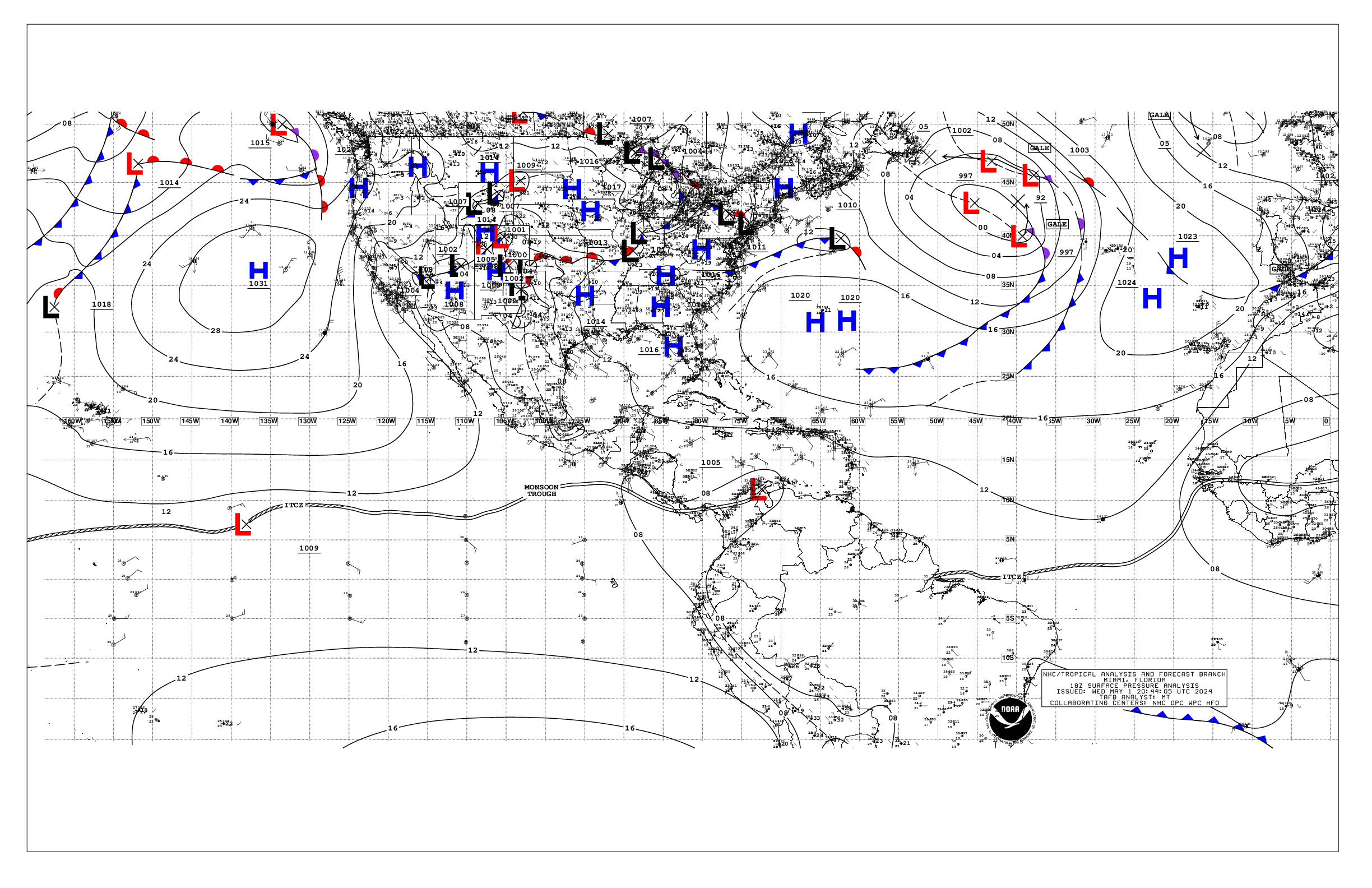
Based on 1800 UTC surface analysis and satellite imagery through
2230 UTC.

...SPECIAL FEATURES...

Eastern Tropical Atlantic (Invest AL96): An 1008 mb area of low
pressure, associated with a tropical wave, is located a few
hundred nautical miles west-southwest of the Cabo Verde Islands
near 12.5N31W. Showers and thunderstorms associated with this
system have changed little in organization over the past several
hours. Scattered to numerous moderate to strong convection is
noted within roughly 150 nm of the center of AL96. Associated
winds and seas will spread west of 35W into the High Seas Forecast
area overnight into early Thu. Environmental conditions are
somewhat favorable for development over the next couple of days,
and a tropical depression could form over the next day or two as
the system moves westward to west- northwestward near 20 mph
across the eastern and central tropical Atlantic. Environmental
conditions are forecast to become less conducive by this weekend,
potentially ending its chances for development. This system has a
medium chance of tropical cyclone formation through the next 48
hours and 7 days. Please refer to the latest NHC Tropical Weather
Outlook at website:
https://www.hurricanes.gov/text/MIATWOAT.shtml for more details on
this feature.

Caribbean Gale Warning: A tight pressure gradient between the
subtropical ridge north of the area and the Colombian low will
support fresh to strong easterly trade winds and rough seas
through the forecast period. Winds will pulse to gale-force
tonight and Thu night off Colombia and in the Gulf of Venezuela,
along with locally very rough seas. Please refer to the latest
HIGH SEAS FORECAST issued by the National Hurricane Center at
website - https://www.nhc.noaa.gov/text/MIAHSFAT2.shtml for more
details.

...TROPICAL WAVES...

An eastern Atlantic tropical wave is along 31W west of the Cabo
Verde Islands, south of 21N, and is associated with Invest AL96.
Please refer to the Special Features section above for more
details and the potential for tropical cyclone formation.

A Tropical N Atlantic tropical wave is along 61W moving across the
Lesser Antilles and into the far eastern Caribbean Sea, south of
22N, moving quickly westward at around 25 kt. No significant deep
convection is occurring in association with this wave over water,
but it may be assisting with some convection over portions of
Venezuela.

A central Caribbean Sea tropical wave is along 77W, south of 21N
over eastern Cuba to portions of Jamaica to near the border of
Colombia and Panama, moving quickly westward around 20 kt. No
significant deep convection is occurring in association with this
wave over water.

A tropical wave has departed the NW Caribbean Sea, now over the
central Yucatan Peninsula to the far eastern Pacific Ocean, and is
helping to enhance convection over portions of the peninsula to
near the coast of the NW Caribbean Sea.

...MONSOON TROUGH/ITCZ...

The monsoon trough extends southwestward from 18N17W to 1008 mb
low pressure, Invest AL96, near 12.5N31W to 10.5N45W. The ITCZ
extends from 10.5N45W to 13N60W. Other than the convection
described above with Invest AL96, no significant deep convection
is present near the monsoon trough and ITCZ.

...GULF OF AMERICA...

Isolated to widely scattered showers prevail north of mainly 23N,
while generally dry conditions are present in the remainder of
the Gulf waters, except in the Bay of Campeche where a weak
surface trough is supporting scattered showers and isolated
thunderstorms. Weak ridging prevails across the remainder of the
basin at the surface supporting mainly gentle winds, to moderate
in the Bay of Campeche and the Straits of Florida. Seas are slight
across the basin.

For the forecast, a weak pressure pattern will persist across the
Gulf waters through the forecast period, supporting moderate or
weaker winds and slight seas. Winds will pulse to fresh to locally
strong with moderate seas off western Yucatan during the evenings
due to a diurnal surface trough moving west off the peninsula
each night.

...CARIBBEAN SEA...

Please see the Special Features section above for details on the
Gale Warning in effect for the waters off Colombia and in the Gulf
of Venezuela.

Divergence aloft and tropical moisture combine to produce
scattered showers and isolated thunderstorms over the Gulf of
Honduras, Costa Rica and Panama nearshore waters. Dry conditions
prevail elsewhere over water, while diurnal thunderstorm activity
is over portions of Cuba and Hispaniola. Outside of the Gale
Warning area, fresh to strong easterly trade winds and moderate
seas are noted elsewhere from 11N to 18N between 68W and 80W with
6 to 9 ft seas. Moderate to locally fresh trades prevail across
the remainder of the waters from 11N to 18N, with gentle to
locally moderate trades elsewhere. Seas are slight in the NW
Caribbean, and moderate across the remainder of the waters.

For the forecast, a tight pressure gradient between the
subtropical ridge north of the area and the Colombian low will
support fresh to strong easterly trade winds and rough seas
through the forecast period. Winds will pulse to gale-force
tonight and Thu night off Colombia and in the Gulf of Venezuela,
along with locally very rough seas. Winds will pulse to fresh to
locally strong in the Windward Passage at night. An area of low
pressure, Invest AL96, currently located in the eastern Atlantic
has a medium chance of tropical development over the next 7 days.
The system may bring increasing winds and seas to portions of the
Tropical N Atlantic this weekend.

...ATLANTIC OCEAN...

Please refer to the Special Features section for more details on
an area of low pressure, Invest AL96, that has a medium chance of
tropical cyclone formation.

Divergence aloft supports scattered showers and isolated
thunderstorms from roughly 27N to 31N between 64W and 77W, and is
also enhancing diurnal activity over portions of the western
Bahamas and Florida Peninsula. A weak surface trough runs from
north of the waters through 31N58W to 25N63W. Scattered showers
and isolated thunderstorms are found within 90-120 nm either side
of the trough. To the east, a cold front extends from the Iberian
Peninsula to just northwest of the Canary Islands to 30N35W with
no noticeable convective activity near the boundary. Fresh to
strong winds associated with Invest AL96 are found from 10N to 22N
between 27W and 36W, with rough to very rough seas from 09N to 19N
between 26W and 33W. Moderate to fresh winds are elsewhere north
of the monsoon trough to 24N between 26W and 40W, with fresh
northerly winds funneling along the coast of Africa from 18N to
26N to the east of 23W. Moderate or weaker winds dominate the
remainder of the offshore and open waters. Mainly slight seas are
west of 70W, with mainly moderate seas across the remainder of the
waters, except also slight withing about 150 nm ahead/south of the
cold front mentioned.

For the forecast west of 55W, the subtropical ridge, and
associated weak pressure gradient, will dominate the SW N Atlantic
waters over the next several days. This will support mainly
moderate or weaker winds and slight to moderate seas. Winds will
pulse to fresh to locally strong off northern Hispaniola at night.
An area of low pressure, Invest AL96, currently located in the
eastern Atlantic has a medium chance of tropical development over
the next 7 days. The system may bring increasing winds and seas to
portions of the southeast waters this weekend.

$$
Lewitsky


 NHC on Facebook
 NHC on X
 NHC on YouTube
 NHC Blog: