011
AXNT20 KNHC 150238
TWDAT

Tropical Weather Discussion
NWS National Hurricane Center Miami FL
0615 UTC Sun Nov 15 2026

Tropical Weather Discussion for North America, Central America
Gulf of America, Caribbean Sea, northern sections of South
America, and Atlantic Ocean to the African coast from the
Equator to 31N. The following information is based on satellite
imagery, weather observations, radar and meteorological analysis.

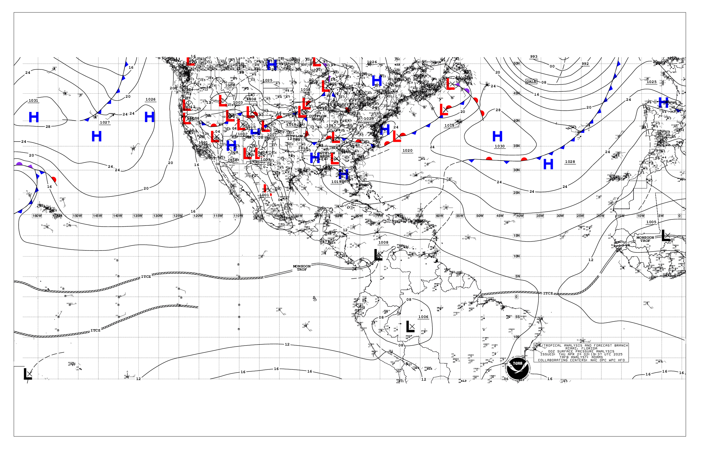
Based on 0000 UTC surface analysis and satellite imagery through
0230 UTC.

...MONSOON TROUGH/ITCZ...

The monsoon trough remains mostly over Africa. The ITCZ extends
from 10N16W to 06N20W to 03N50W. Scattered moderate convection is
noted from 06N to 11N between 20W and 40W.

...GULF OF AMERICA...

A stationary front extends from southwest Florida through the
central Gulf into south Texas. Farther south, a trough extends
eastward into the Yucatan Peninsula. Recent scatterometer data and
buoy observations are showing moderate to fresh E to SE winds over
the northwest Gulf north of 22N and west of 90W, where seas are
4-6 ft. Gentle to moderate NE to E winds and 3-5 ft seas are noted
elsewhere.

For the forecast, a tightening pressure gradient between high
pressure building southward toward the basin and possible low
pressure developing in the west- central or NW Gulf Sun will lead
to increasing NE to E winds over the northern Gulf. Winds will
increase to near gale- force over portions of the NW and north-
central basin through Mon. Strong to near gale- force N winds will
also funnel down the NE coast of Mexico, including offshore
Veracruz, for the start of next week. Fresh to strong NE to E
winds are then likely to continue across the NE Gulf into the
middle of next week as a tight pressure gradient prevails. Rough
seas will build in association with these strong winds, and may
impact portions of the northern and western basin well into next
week.

...CARIBBEAN SEA...

Moderate to fresh E to SE winds and 4-6 ft seas are observed
across the eastern Caribbean, generally east of 70W, as a tight
pressure gradient prevails between low pressure over northern
Colombia and strong high pressure over the central Atlantic.
Moderate to fresh winds and 3-5 ft seas are evident over the
northwest Caribbean north of 20N. This is mostly north of a
stationary front over the northwest Caribbean. Scattered showers
and a few thunderstorms are noted along the front. Light to gentle
NE to E winds and 2-4 ft seas are noted elsewhere.

For the forecast, fresh to locally strong winds in the southeastern
Caribbean will slowly diminish into Monday. Fresh to strong
trades will develop in the south- central basin Sun night.
Moderate to fresh northeast to east winds will prevail over the
northwestern Caribbean into Mon.

...ATLANTIC OCEAN...

A cold front extends from 31N60W to the central Bahamas to central
Cuba. A second front extends from Bermuda the northwest Bahamas
to South Florida. Scattered showers and thunderstorms persist
within 180 nm east of the front from 20N to 26N. Fresh to strong
SW winds and 8 to 12 ft seas are also noted within 180 nm east of
the front, north of 17N, and fresh to strong NE winds follow the
second front east of 65W, along with combined seas of 7 to 11 ft
in moderate NW swell. Elsewhere, the Atlantic is dominated by a
broad ridge anchored by 1025 mb high pressure centered near
29N35W. This pattern is supporting moderate to fresh trade winds
and 5-7 ft seas south of 20N, and gentle breezes and 3-5 ft seas
in NW and N swell elsewhere.

For the forecast west of 55W, by Mon, the front will begin
to weaken over SE portions of the waters. High pressure building
southward toward the region will lead to a tightening pressure
gradient and increasing NE to E winds in the vicinity of the
Bahamas Mon. These winds and associated rough seas will expand in
area, especially northward and eastward, through the middle of
next week.

$$
Christensen


 NHC on Facebook
 NHC on X
 NHC on YouTube
 NHC Blog: