000
AXNT20 KNHC 042238
TWDAT

Tropical Weather Discussion
NWS National Hurricane Center Miami FL
0015 UTC Wed Aug 5 2026

Tropical Weather Discussion for North America, Central America
Gulf of America, Caribbean Sea, northern sections of South
America, and Atlantic Ocean to the African coast from the
Equator to 31N. The following information is based on satellite
imagery, weather observations, radar and meteorological analysis.

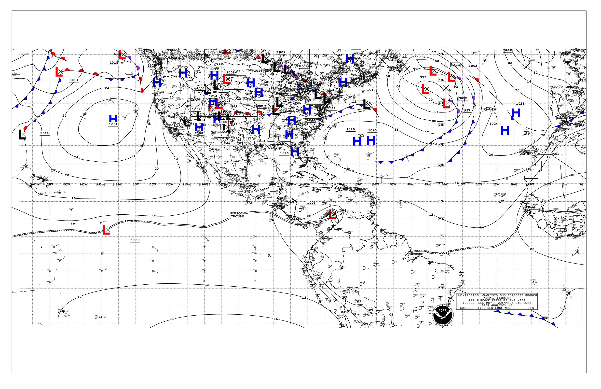
Based on 1800 UTC surface analysis and satellite imagery through
2200 UTC.

...TROPICAL WAVES...

An east Atlantic tropical wave is along 23W from 08N to 12N,
moving west at around 10 kt. Scattered to numerous moderate
convection is noted from 06N to 14N between 17W and 29W.

A central Atlantic tropical wave is along 41W from 03N to 19N,
moving west at 5 to 10 kt. There is no convection in association
with this wave at this time.

A western Caribbean tropical wave has an axis along 78W, from
eastern Panama to Jamaica, moving west at 10 to 15 kt. Scattered
moderate convection active off western Panama.

...MONSOON TROUGH/ITCZ...

The monsoon trough enters the Atlantic near 22N16W and continues
southwestward to 14N20W to 07N45W. The ITCZ extends from 07N45W
to 06N57W. Scattered moderate convection is depicted from 06N to
09N between 25W and 35W.

...GULF OF AMERICA...

A 1018 mb high pressure is centered near 25N87W, supporting light
to gentle winds across most of the basin except for moderate SE
winds off the Tamaulipas coast of northeast Mexico. Seas are 1-3
ft across the basin. Scattered showers and a few thunderstorms are
active off southwest Florida and over the south-central Gulf.

For the forecast, the high pressure will generally dominate,
promoting gentle winds and slight to moderate seas into the
upcoming weekend. Pulses of fresh winds will occur of the Yucatan
Peninsula each night, locally strong Wed night, along with
moderate seas.

...CARIBBEAN SEA...

Fresh to strong E trade winds and 7-9 ft seas persist across the
south-central Caribbean, between high pressure north of area and
lower pressure over northern South America. Moderate E winds and
5-7 ft seas are noted elsewhere except for gentle E winds and 2-4
ft over the far northwest Caribbean. Scattered showers and
thunderstorms are active near the Yucatan Channel.

For the forecast, the pattern will continue to support fresh to
strong trades over the central basin into the weekend, with rough
seas there, and near gale force winds at times. Fresh to locally
strong winds will also pulse in the Gulf of Honduras and Windward
Passage. Otherwise, mainly moderate or weaker winds and seas will
prevail.

...ATLANTIC OCEAN...

Scattered showers and thunderstorms are active northeast of the
Leeward Islands from 20N to 27N between 55W and 65W, associated
with an upper low centered near 25N60W, and a related surface
trough along 60W from 20N to 28N. Additional showers and
thundersotrms are active from 22n to 27N between 65W and 75W, and
over the northern Bahamas. Moderate to fresh and 5-6 ft seas are
noted either side of the trough from 22N to 27N between 50W and
65W, south of 1025 mb surface high pressure centered northeast of
Bermuda near 34N60W. Moderate to fresh E winds are noted from the
coast of Hispaniola through the southern Bahamas. In the far NE
Atlantic, strong to near- gale N-NE winds and moderate to rough
seas are evident off Morocco and in the water passages of the
Canary Islands. Elsewhere, gentle to moderate winds and moderate
seas are prevalent.

For the forecast west of 55W, the aforementioned mid to upper level
trough along the SE U.S. coast will keep scattered thunderstorms
ongoing offshore Florida and in the vicinity of the Bahamas into
Wed. Locally strong trades will continue pulsing offshore
Hispaniola to near the Windward Passage. A westward moving trough
will pass north of Puerto Rico and Hispaniola into mid-week, then
approach the Bahamas by late week before shifting west of the
area, bringing fresh to locally strong winds and locally rough
seas. Weak ridging settles across the northern and central waters
this weekend, bringing tranquil marine conditions.

$$
Christensen


 NHC on Facebook
 NHC on X
 NHC on YouTube
 NHC Blog: