Tropical Cyclone Advisory Graphic Examples
Overview
In 2017, the National Weather Service made changes to the appearance of the graphics accompanying tropical cyclone advisory packages. These changes were required for the NHC and CPHC to begin issuing forecasts and watches/warnings for potential tropical cyclones. A summary of these changes is available in NWS Public Information Statment 17-10.
New in 2018
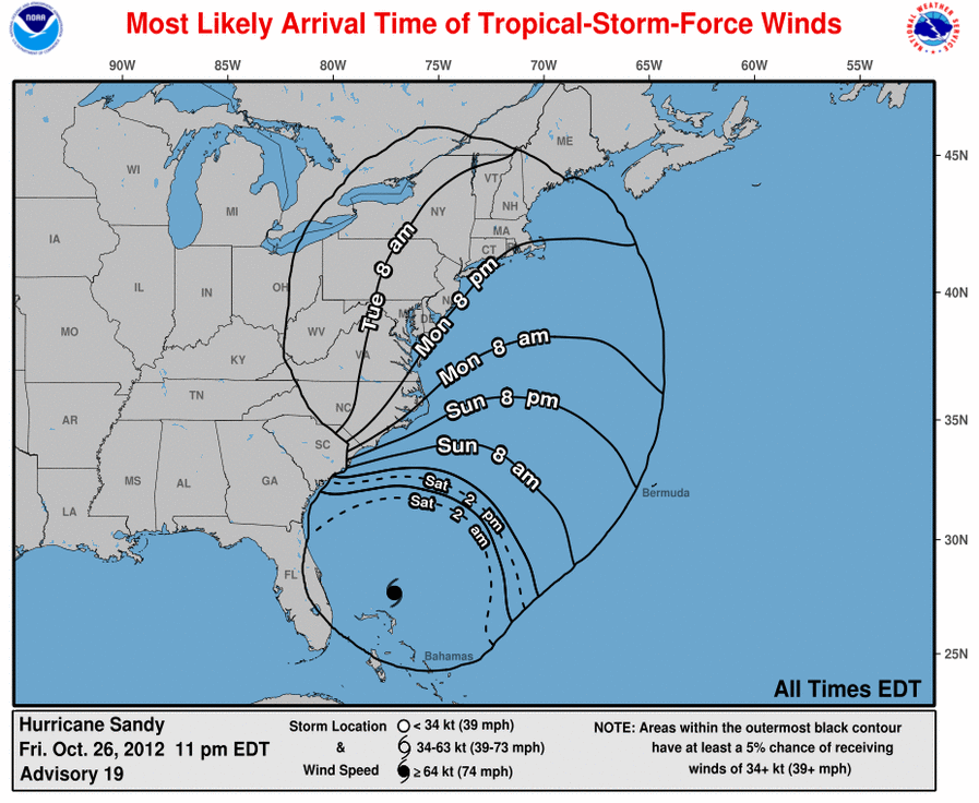
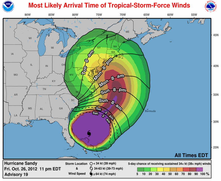
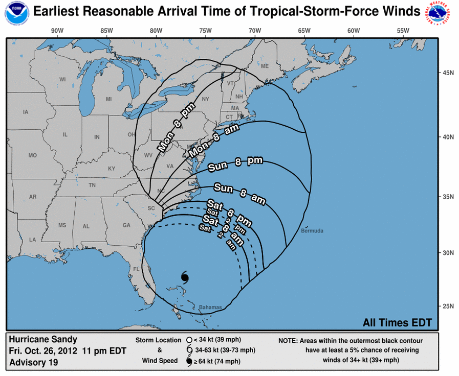
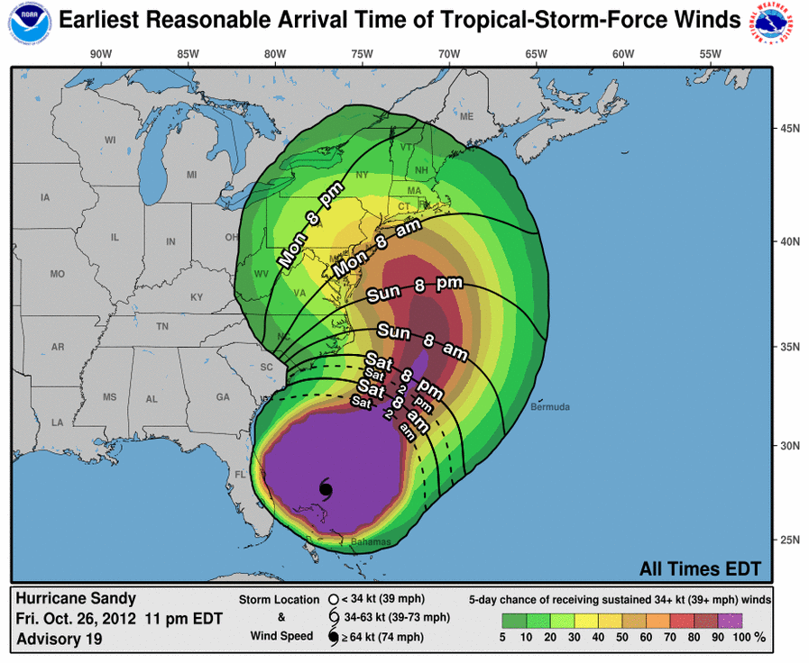
The National Hurricane Center has proposed the that the arrival time of tropical-storm-force winds graphics transition to operational status for the 2018 hurricane season. Examples of these products are included in the table below.
GIS products
Examples of all NHC GIS products, including the new Arrival Time of Tropical-Storm-Force Winds, are available on our GIS page (www.hurricanes.gov/gis).
Examples and urls
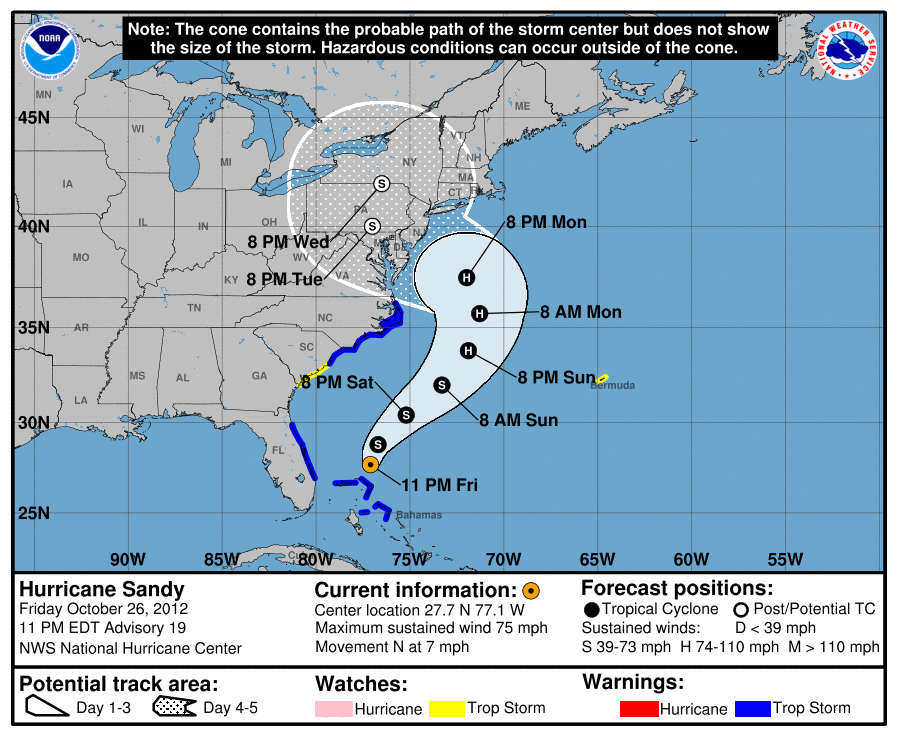
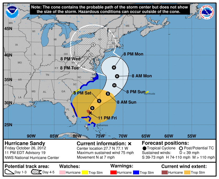
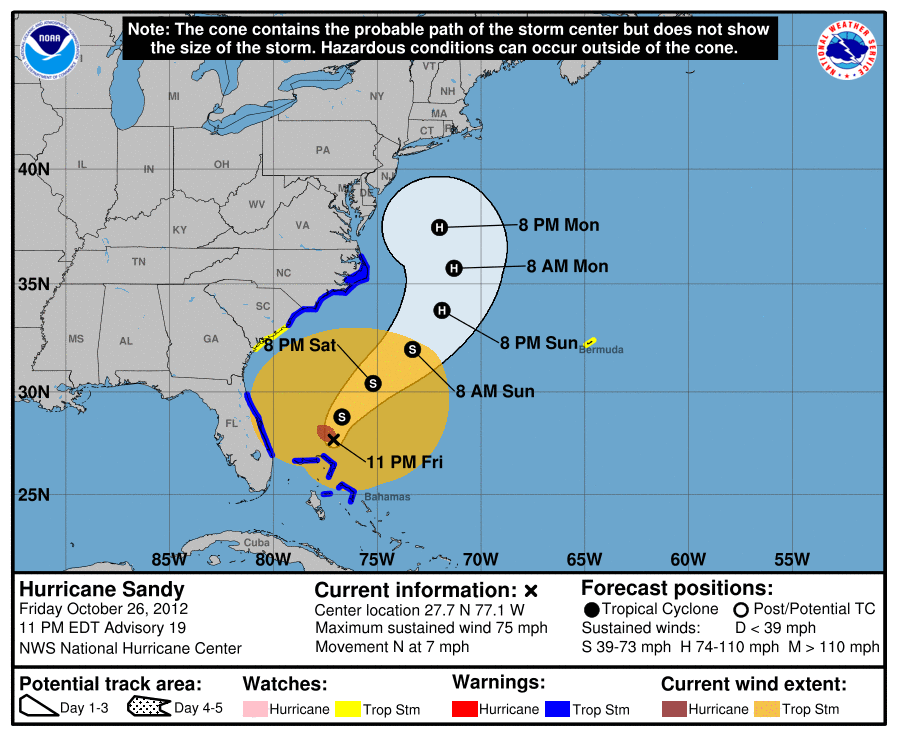
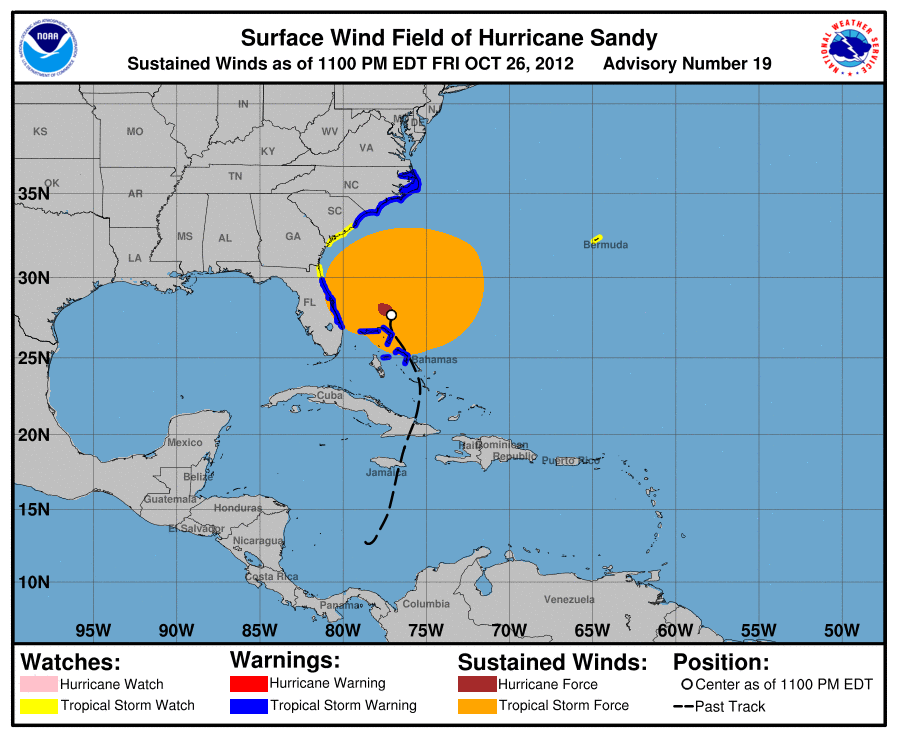
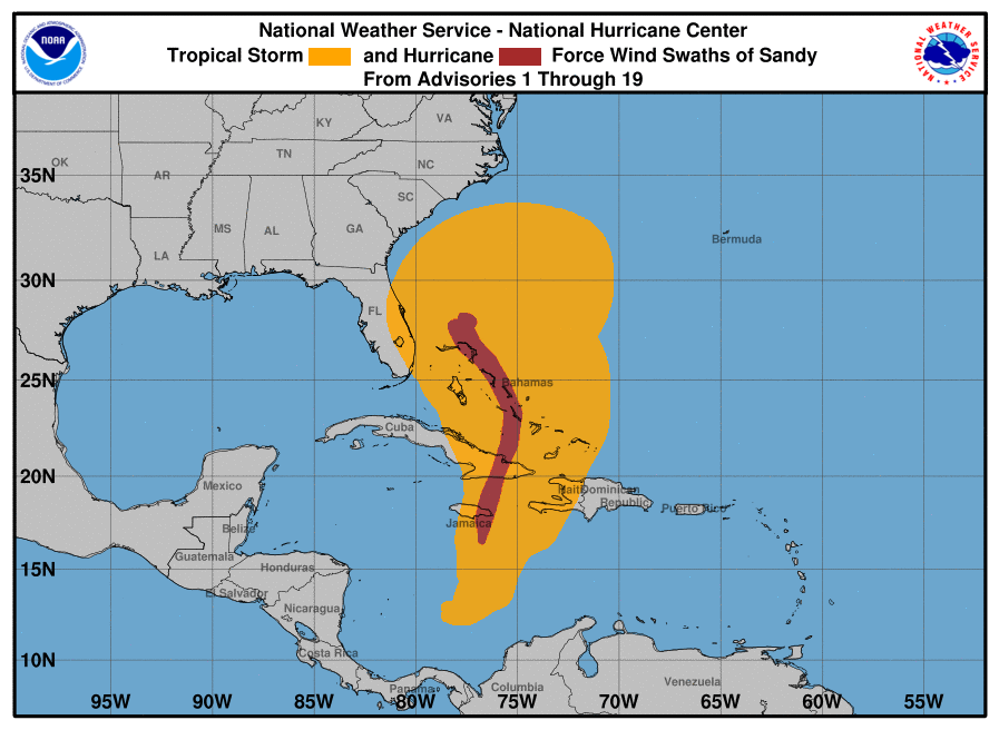
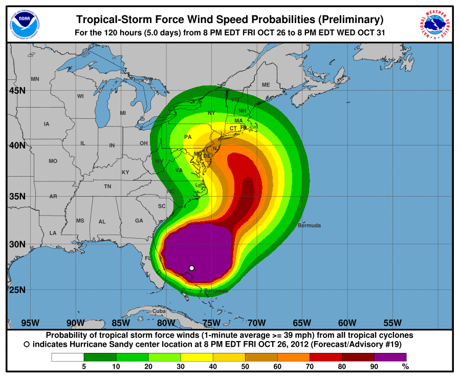
Static versions of the latest tropical cyclone advisory graphics are available in the table below. Clicking on the thumbnail images in the table will bring you to a full-resolution example of the graphic.
Please note that "www.hurricanes.gov/storm_graphics/BBNN/" preceeds all of the static graphic urls, where BBNN is the storm basin and number (examples: AT09, EP02, AT11). A complete key is available below the table.

* Table Key
- All urls are preceeded by "www.hurricanes.gov/storm_graphics/BBNN/"
- BB: 2-digit basin id (capital letters, AT or EP)
- NN: 2-digit storm number (examples: 01, 09, 21)
- YYYY: 4-digit year (examples: 2015, 2016, 2017)
- fff: 3-digit forecast hour (examples: 000, 012, 024, 108, 120)