NHC Graphical Outlook Archive (Text)
Standard version of this page
« Earliest Available ‹ Earlier Later › Latest Available »
Place your mouse cursor over areas of interest for more information
Graphical TWO atl
ZCZC MIATWOAT ALL
TTAA00 KNHC DDHHMM
TROPICAL WEATHER OUTLOOK
NWS NATIONAL HURRICANE CENTER MIAMI FL
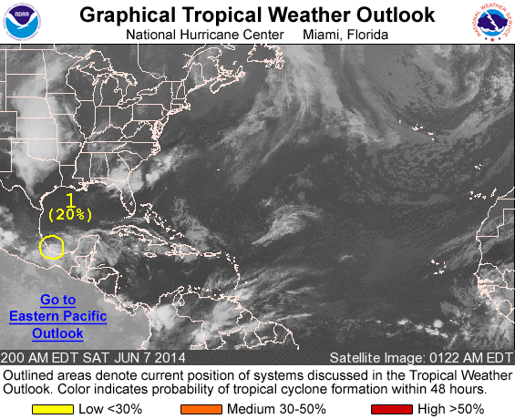
200 AM EDT SAT JUN 7 2014
For the North Atlantic...Caribbean Sea and the Gulf of Mexico:
1. Surface observations indicate that a well-defined low pressure
system has remained nearly stationary near Vera Cruz, Mexico. During
the past few hours, associated thunderstorm activity has decreased
significantly, and unfavorable upper-level winds and proximity to
land should inhibit any further development of this disturbance.
However, this system will continue to produce gusty winds and heavy
rains, along with life-threatening flash floods and mud slides, over
portions of southeastern and eastern Mexico during the next day or
two.
* Formation chance through 48 hours...low...20 percent.
* Formation chance through 5 days...low...20 percent.
Forecaster Stewart
List of all Atlantic Outlooks
List of all East Pacific Outlooks