NATIONAL HURRICANE CENTER and
CENTRAL PACIFIC HURRICANE CENTER

HOME | ARCHIVES | FORECASTS | IMAGERY | ABOUT NHC | RECONNAISSANCE

NHC Graphical Outlook Archive (Text)


« Earliest Available         ‹ Earlier         Later ›         Latest Available »
Place your mouse cursor over areas of interest for more information
Graphical TWO atl Click for Eastern Pacific

ZCZC MIATWOAT ALL
TTAA00 KNHC DDHHMM
TROPICAL WEATHER OUTLOOK
NWS TPC/NATIONAL HURRICANE CENTER MIAMI FL
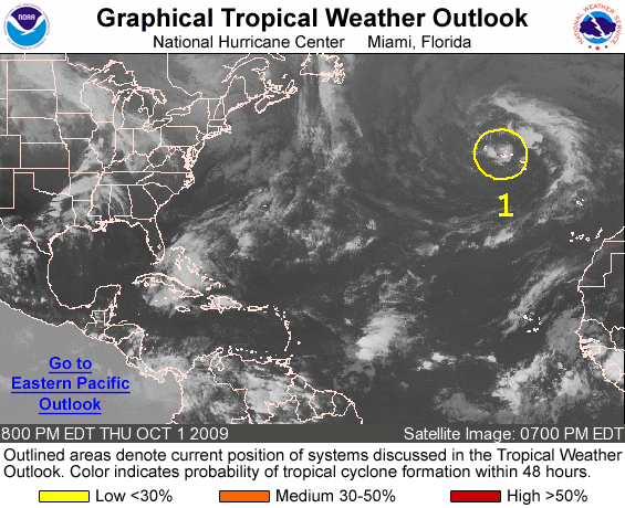
800 PM EDT THU OCT 1 2009

FOR THE NORTH ATLANTIC...CARIBBEAN SEA AND THE GULF OF MEXICO...

1. A NON-TROPICAL LOW PRESSURE AREA LOCATED NEAR THE CENTRAL AZORES IS
MOVING SLOWLY NORTHWARD.  DEVELOPMENT OF THIS SYSTEM IS NOT
ANTICIPATED...AND THERE IS A LOW CHANCE...LESS THAN 30 PERCENT...OF
THIS SYSTEM BECOMING A SUBTROPICAL OR TROPICAL CYCLONE DURING THE
NEXT 48 HOURS.

ELSEWHERE...TROPICAL CYCLONE FORMATION IS NOT EXPECTED DURING THE
NEXT 48 HOURS.

$$
FORECASTER BLAKE
NNNN


List of all Atlantic Outlooks
List of all East Pacific Outlooks

Standard version of this page

Alternate Formats
About Alternates - E-Mail Advisories - RSS Feeds

Cyclone Forecasts
Latest Advisory - Past Advisories - About Advisories

Marine Forecasts
Latest Products - About Marine Products

Tools & Data
Satellite Imagery - US Weather Radar - Aircraft Recon - Local Data Archive - Forecast Verification - Deadliest/Costliest/Most Intense

Learn About Hurricanes
Storm Names Wind Scale - Prepare - Climatology - NHC Glossary - NHC Acronyms - Frequently Asked Questions - AOML Hurricane-Research Division

About Us
About NHC - Mission/Vision - Other NCEP Centers - NHC Staff - Visitor Information - NHC Library

Contact Us


NOAA/ National Weather Service
National Centers for Environmental Prediction
National Hurricane Center
11691 SW 17th Street
Miami, Florida, 33165-2149 USA
nhcwebmaster@noaa.gov

Disclaimer | Privacy Policy | Credits | About Us | Glossary | Career Opportunities