NHC Graphical Outlook Archive (Text)
Standard version of this page
« Earliest Available ‹ Earlier Later › Latest Available »
Place your mouse cursor over areas of interest for more information
Graphical TWO atl
ZCZC MIATWOAT ALL
TTAA00 KNHC DDHHMM cca
TROPICAL WEATHER OUTLOOK...corrected
NWS NATIONAL HURRICANE CENTER MIAMI FL
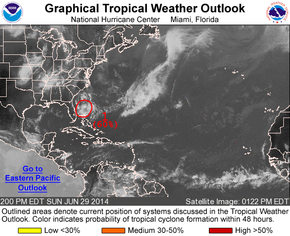
200 PM EDT SUN JUN 29 2014
corrected tropical depression development status
For the North Atlantic...Caribbean Sea and the Gulf of Mexico:
1. Satellite wind data and surface observations indicate that the low
pressure system located about 230 miles east of St. Augustine,
Florida, is gradually becoming better defined as it moves slowly
southward to southwestward. Although upper-level winds are only
marginally favorable, a tropical depression is expected to form
during the next day or two. However, the system's proximity to dry
air could inhibit significant development until environmental
conditions become more conducive by late Tuesday while the low
meanders offshore of the Florida east coast. The Air Force Reserve
reconnaissance aircraft that was scheduled to investigate the
disturbance this afternoon has been canceled, and the flight has
been rescheduled for Monday morning, if necessary.
* Formation chance through 48 hours...high...60 percent.
* Formation chance through 5 days...high...80 percent.
Forecaster Stewart
List of all Atlantic Outlooks
List of all East Pacific Outlooks