NATIONAL HURRICANE CENTER and
CENTRAL PACIFIC HURRICANE CENTER

HOME | ARCHIVES | FORECASTS | IMAGERY | ABOUT NHC | RECONNAISSANCE

NHC Analysis Tools (Text)


Satellite | Radar | Aircraft Recon | GIS Data | Analysis Tools

Below are tools and data made available for the web.


Atlantic East Pacific
Hovmöller Diagram
(5 day Satellite)
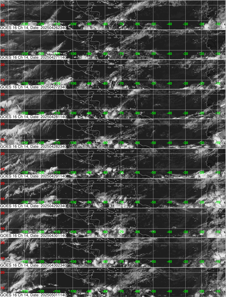
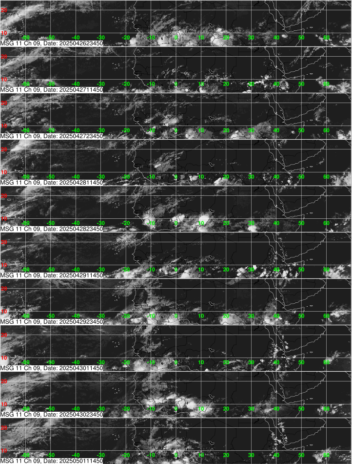
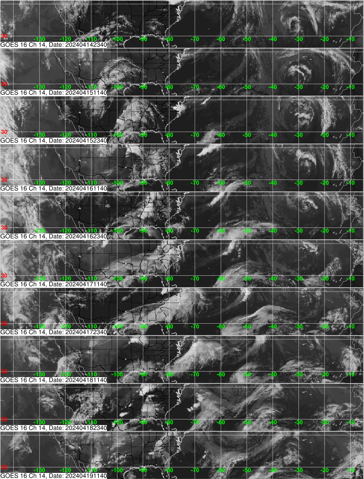
Tropical Atlantic and Caribbean (GOES-E)

Gulf of America and subtropical Atlantic

Eastern Atlantic and Africa (METEOSAT-10)

Southern CONUS
and subtropical
Atlantic (GOES-E)
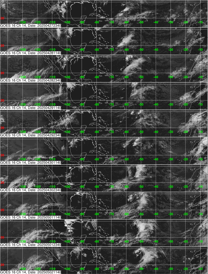
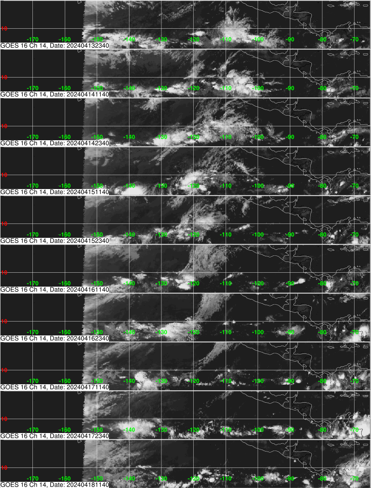
East Pacific (GOES-W)
Upper-Air Time Sections
Selected Observing Stations
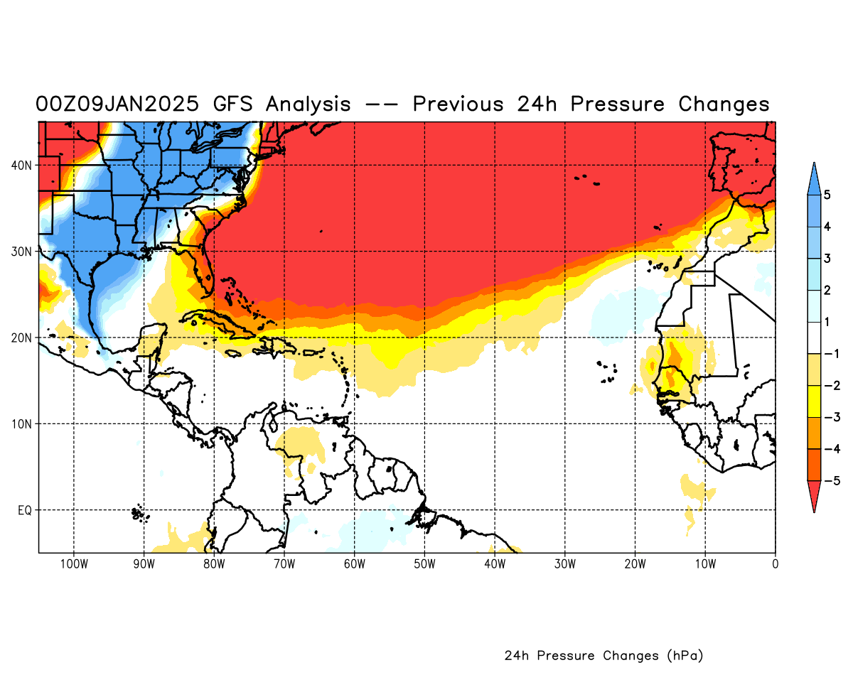
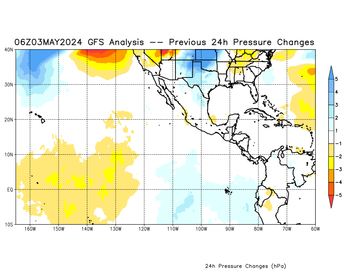
GFS Pressure Change Analysis
See image See image
ASCAT Ocean Wind Data
See recent data
Streamlines
NCEP Model Analyses & Guidance
Sea Surface Temperature
Analysis and Anomalies
Tropical Rainfall
Experimental Text & Graphics

Standard version of this page

Alternate Formats
About Alternates - E-Mail Advisories - RSS Feeds

Cyclone Forecasts
Latest Advisory - Past Advisories - About Advisories

Marine Forecasts
Latest Products - About Marine Products

Tools & Data
Satellite Imagery - US Weather Radar - Aircraft Recon - Local Data Archive - Forecast Verification - Deadliest/Costliest/Most Intense

Learn About Hurricanes
Storm Names Wind Scale - Prepare - Climatology - NHC Glossary - NHC Acronyms - Frequently Asked Questions - AOML Hurricane-Research Division

About Us
About NHC - Mission/Vision - Other NCEP Centers - NHC Staff - Visitor Information - NHC Library

Contact Us


NOAA/ National Weather Service
National Centers for Environmental Prediction
National Hurricane Center
11691 SW 17th Street
Miami, Florida, 33165-2149 USA
nhcwebmaster@noaa.gov

Disclaimer | Privacy Policy | Credits | About Us | Glossary | Career Opportunities