Skip Navigation Links
NOAA NOAA United States Department of Commerce

NHC Graphical Outlook Archive


« Earliest Available         ‹ Earlier         Later ›         Latest Available »
GIS Shapefiles
Central Pacific Eastern Pacific Atlantic

View 2-Day Graphical Tropical Weather Outlook
Click for Eastern North Pacific Click for Eastern North Pacific

Tropical Weather Outlook Text

ZCZC HFOTWOCP ALL
TTAA00 PHFO DDHHMM

Tropical Weather Outlook
NWS Central Pacific Hurricane Center Honolulu HI
200 AM HST Thu Sep 21 2023

For the central North Pacific...between 140W and 180W:

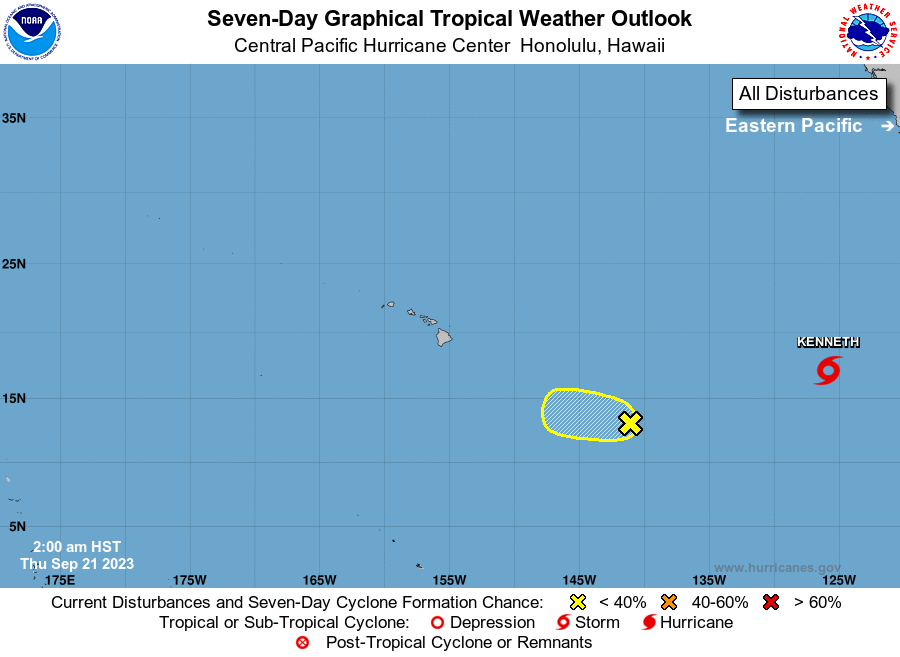
1. Approximately 1100 miles east-southeast of Hilo, Hawaii (CP91): 
An area of low pressure continues to produce disorganized showers 
and thunderstorms. Some gradual development of this system is 
possible during the next few days before environmental conditions 
become less conducive while it moves westward to west-northwestward 
at 10 to 15 mph. 
* Formation chance through 48 hours...low...20 percent.
* Formation chance through 7 days...low...30 percent.

Elsewhere, no tropical cyclones are expected during the next 7 days.

Forecaster Gibbs


List of Atlantic Outlooks (May 2023 - Present)
List of East Pacific Outlooks (May 2023 - Present)
List of Central Pacific Outlooks (May 2023 - Present)
List of Atlantic Outlooks (July 2014 - April 2023)
List of East Pacific Outlooks (July 2014 - April 2023)
List of Central Pacific Outlooks (June 2019 - April 2023)
List of Atlantic Outlooks (June 2009 - June 2014)
List of East Pacific Outlooks (June 2009 - June 2014)