Skip Navigation Links
NOAA NOAA United States Department of Commerce

NHC Graphical Outlook Archive


« Earliest Available         ‹ Earlier         Later ›         Latest Available »
GIS Shapefiles
Central Pacific Eastern Pacific Atlantic

View 2-Day Graphical Tropical Weather Outlook
Click for Eastern North Pacific Click for Eastern North Pacific

Tropical Weather Outlook Text

ZCZC HFOTWOCP ALL
TTAA00 PHFO DDHHMM

Tropical Weather Outlook
NWS Central Pacific Hurricane Center Honolulu HI
800 PM HST Sat Sep 16 2023

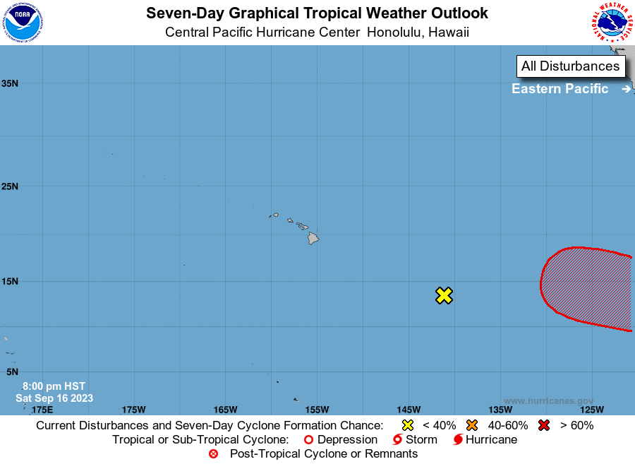
For the central North Pacific...between 140W and 180W:

1. Tropical Depression Twelve-E has weakened into a post tropical 
remnant low roughly 1000 miles east of Hilo, Hawaii. This low will 
continue to weaken as it moves west at 10 to 15 mph. Redevelopment 
of this system is not expected.
* Formation chance through 48 hour...low...near 0 percent.
* Formation chance through 7 days...low...near 0 percent.

Elsewhere, no tropical cyclones are expected during the next 7 days.

Forecaster Bohlin


List of Atlantic Outlooks (May 2023 - Present)
List of East Pacific Outlooks (May 2023 - Present)
List of Central Pacific Outlooks (May 2023 - Present)
List of Atlantic Outlooks (July 2014 - April 2023)
List of East Pacific Outlooks (July 2014 - April 2023)
List of Central Pacific Outlooks (June 2019 - April 2023)
List of Atlantic Outlooks (June 2009 - June 2014)
List of East Pacific Outlooks (June 2009 - June 2014)