ZCZC HFOTWOCP ALL
TTAA00 PHFO DDHHMM
Tropical Weather Outlook
NWS Central Pacific Hurricane Center Honolulu HI
200 AM HST Fri Sep 15 2023
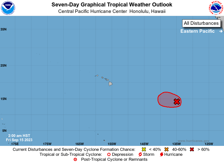
For the central North Pacific...between 140W and 180W:
1. Western East Pacific (EP94):
A broad area of low pressure located well to the west-southwest of
the southern tip of the Baja California peninsula, or roughly 1500
miles east of Hilo, continues to produce showers and thunderstorms
with some signs of organization. Environmental conditions appear
conducive for development of this system, and a short-lived tropical
depression is likely to form during the next day or so while it
moves generally west-northwestward at about 10 mph over the western
portion of the eastern Pacific basin. Environmental conditions are
expected to become unfavorable over the weekend, ending the system's
chances for additional development.
* Formation chance through 48 hours...high...90 percent.
* Formation chance through 7 days...high...90 percent.
Forecaster Bohlin