ZCZC HFOTWOCP ALL
TTAA00 PHFO DDHHMM
Tropical Weather Outlook
NWS Central Pacific Hurricane Center Honolulu HI
800 AM HST Tue Sep 12 2023
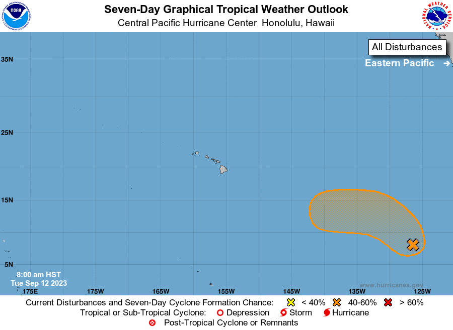
For the central North Pacific...between 140W and 180W:
1. Approximately 2100 miles east-southeast of Hilo, Hawaii:
Shower and thunderstorm activity associated with a tropical wave
located well southwest of the southern tip of the Baja California
peninsula has increased today, but remains disorganized. Some
additional development of this system is expected during the next
few days as the system moves generally northwestward, and a
tropical depression could form later this week. The system is then
forecast to turn westward over the weekend, at which time further
development is not anticipated.
* Formation chance through 48 hours...medium...40 percent.
* Formation chance through 7 days...medium...60 percent.
Elsewhere, no tropical cyclones are expected during the next 7 days.
Forecaster Kodama