ZCZC HFOTWOCP ALL
TTAA00 PHFO DDHHMM
Tropical Weather Outlook
NWS Central Pacific Hurricane Center Honolulu HI
800 AM HST Tue Aug 29 2023
For the central North Pacific...between 140W and 180W:
Active Systems:
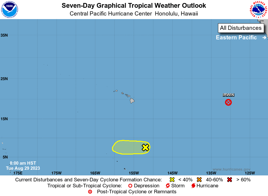
The National Hurricane Center in Miami, Florida is issuing
advisories on Tropical Storm Irwin, centered around 1700 miles
east of Hilo, Hawaii. Irwin is forecast to move into the Central
Pacific Hurricane Center area of responsibility as a post-tropical
remnant low on Friday.
1. Approximately 750 miles south-southeast of Hilo, Hawaii (CP90):
A broad area of low pressure is producing disorganized showers and
thunderstorms. This system is moving west-southwestward at 10 to 15
mph into unfavorable environmental conditions, and tropical cyclone
formation is becoming less likely.
* Formation chance through 48 hours...low...10 percent.
* Formation chance through 7 days...low...10 percent.
Elsewhere, no tropical cyclones are expected during the next 7 days.
Public Advisories on Tropical Storm Irwin are issued under WMO
header WTPZ35 KNHC and under AWIPS header MIATCPEP5.
Forecast/Advisories on Tropical Storm Irwin are issued under
WMO header WTPZ25 KNHC and under AWIPS header MIATCMEP5.
Forecaster Shigesato