ZCZC HFOTWOCP ALL
TTAA00 PHFO DDHHMM
Tropical Weather Outlook
NWS Central Pacific Hurricane Center Honolulu HI
200 PM HST Sun Aug 13 2023
For the central North Pacific...between 140W and 180W:
Active Systems:
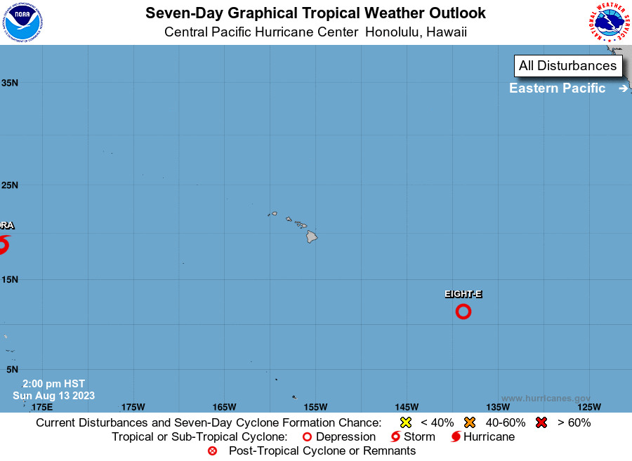
The National Hurricane Center in Miami, Florida is issuing
advisories on Tropical Storm Fernanda, located about 2600 miles
east-southeast of Hilo, Hawaii. Fernanda may cross into the
Central Pacific basin next Thursday or Friday.
1. Approximately 1300 miles east-southeast of Hilo, Hawaii (EP99):
Satellite-derived winds indicate that the area of low pressure
has a well-defined circulation. Showers and thunderstorms continue
to show signs of organization and any increase in this activity is
likely to lead to the formation of a tropical depression either
tonight or on Monday. The system is expected to move westward to
west-northwestward, crossing into the Central Pacific basin late
tonight.
* Formation chance through 48 hours...high...90 percent.
* Formation chance through 7 days...high...90 percent.
Elsewhere, no tropical cyclones are expected during the next 7 days.
Forecaster M Ballard