ZCZC HFOTWOCP ALL
TTAA00 PHFO DDHHMM
Tropical Weather Outlook
NWS Central Pacific Hurricane Center Honolulu HI
800 AM HST Sun Aug 13 2023
For the central North Pacific...between 140W and 180W:
Active Systems:
The National Hurricane Center in Miami, Florida is issuing
advisories on Tropical Storm Fernanda, located about 2600 miles
east-southeast of Hilo, Hawaii. Fernanda may cross into the
Central Pacific basin next Thursday or Friday.
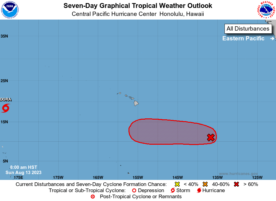
1. Approximately 1400 miles east-southeast of Hilo, Hawaii (EP99):
Showers and thunderstorms are becoming better organized in
association with an area of low pressure. Environmental conditions
appear conducive for continued development, and a tropical
depression is likely to form during the next day or so as it moves
westward or west-northwestward at 10 to 15 mph. The system is
forecast to cross into the Central Pacific basin late tonight.
* Formation chance through 48 hours...high...90 percent.
* Formation chance through 7 days...high...90 percent.
Elsewhere, no tropical cyclones are expected during the next 7 days.
Forecaster M Ballard