ZCZC HFOTWOCP ALL
TTAA00 PHFO DDHHMM
Tropical Weather Outlook
NWS Central Pacific Hurricane Center Honolulu HI
800 PM HST Sat Aug 12 2023
For the central North Pacific...between 140W and 180W:
Active Systems:
The National Hurricane Center in Miami, Florida is issuing
advisories on recently upgraded Tropical Storm Fernanda, located
over 2600 hundred miles east-southeast of Hilo, Hawaii. Fernanda
may cross into the Central Pacific basin next Thursday or Friday.
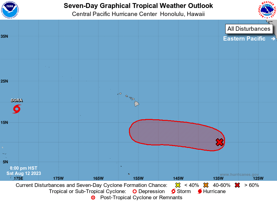
1. Approximately 1500 miles east-southeast of Hilo, Hawaii (EP99):
A broad area of low pressure continues to produce disorganized
showers and thunderstorms. Environmental conditions are expected to
remain conducive for development, and a tropical depression is
likely to form within the next couple of days. The system is
forecast to move west or west-northwestward at about 10 mph across
the far western portion of the East Pacific basin through Sunday,
and then cross into the Central Pacific basin Sunday night.
* Formation chance through 48 hours...high...70 percent.
* Formation chance through 7 days...high...80 percent.
Elsewhere, no tropical cyclones are expected during the next 7 days.
Forecaster Gibbs