ZCZC HFOTWOCP ALL
TTAA00 PHFO DDHHMM
Tropical Weather Outlook
NWS Central Pacific Hurricane Center Honolulu HI
200 PM HST Sat Aug 12 2023
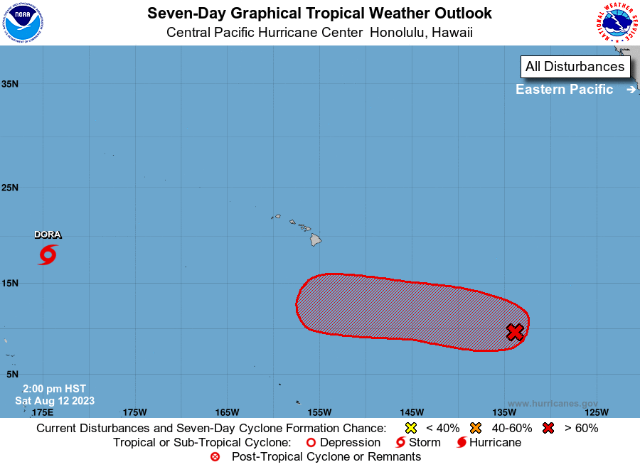
For the central North Pacific...between 140W and 180W:
Active Systems:
The National Hurricane Center is issuing advisories on Tropical
Depression Seven-E, located over 2700 hundred miles east-southeast
of Hilo, Hawaii. This system, depending on the development over the
coming days, may cross into the Central Pacific basin next Thursday
or Friday.
1. Approximately 1500 miles east-southeast of Hilo, Hawaii (EP99):
A broad area of low pressure associated with a tropical wave is
producing a large area of disorganized showers and thunderstorms
well to the east-southeast of the Hawaiian Islands. Conditions
appear conducive for development of this system, and a tropical
depression is likely to form during the next few days while moving
toward the west or west-northwest at about 10 mph across the far
East Pacific basin, crossing into the Central Pacific basin late
Sunday.
* Formation chance through 48 hours...medium...60 percent.
* Formation chance through 7 days...high...80 percent.
Elsewhere, no tropical cyclones are expected during the next 7 days.
Forecaster Kino