ZCZC HFOTWOCP ALL
TTAA00 PHFO DDHHMM
Tropical Weather Outlook
NWS Central Pacific Hurricane Center Honolulu HI
800 PM HST Wed Aug 9 2023
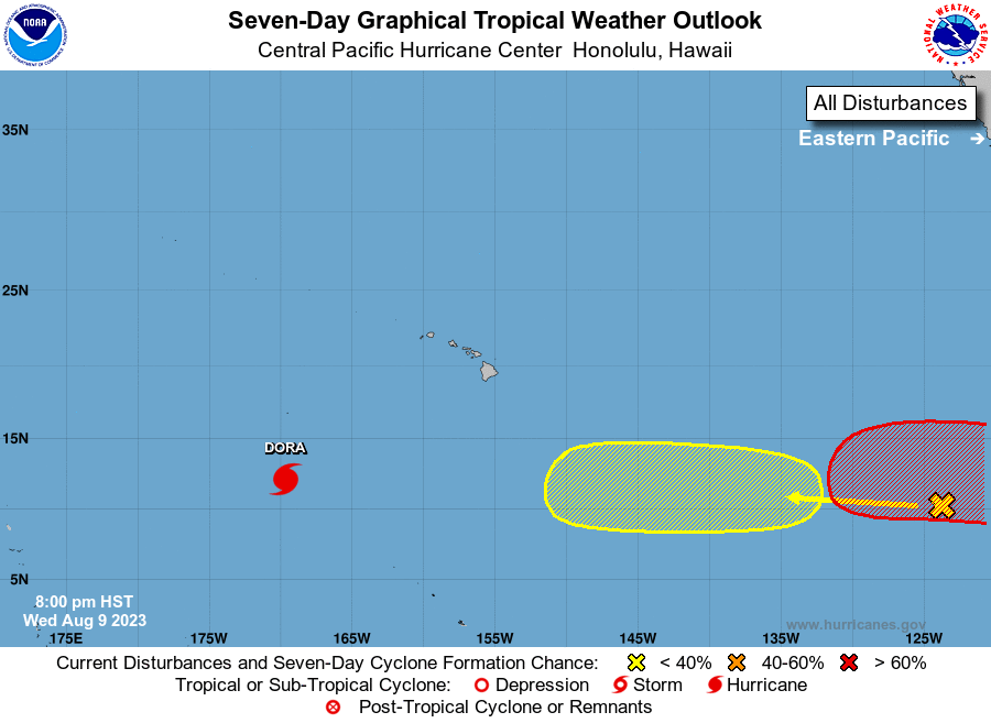
For the central North Pacific...between 140W and 180W:
Active Systems:
The Central Pacific Hurricane Center in Honolulu, Hawaii is issuing
advisories on Hurricane Dora, located around 900 miles southwest of
Honolulu, Hawaii, and 350 miles south-southeast of Johnston Island.
1. Approximately 2200 miles southeast of Hilo, Hawaii:
A tropical wave is producing a few disorganized showers and
thunderstorms. Environmental conditions could support some gradual
development of this system during the next several days while it
moves generally westward at 10 to 15 mph across the far western
portion of the East Pacific basin and into the Central Pacific
basin.
* Formation chance through 48 hours...low...near 0 percent.
* Formation chance through 7 days...low...20 percent.
Elsewhere, no tropical cyclones are expected during the next 7 days.
Public Advisories on Hurricane Dora are issued under WMO header
WTPA32 PHFO and AWIPS header HFOTCPCP2.
Forecast Advisories on Hurricane Dora are issued under WMO header
WTPA22 PHFO and AWIPS header HFOTCMCP2.
Forecaster Gibbs