ZCZC MIATWOAT ALL
TTAA00 KNHC DDHHMM
Tropical Weather Outlook
NWS National Hurricane Center Miami FL
100 AM EST Sat Nov 25 2023
For the North Atlantic...Caribbean Sea and the Gulf of Mexico:
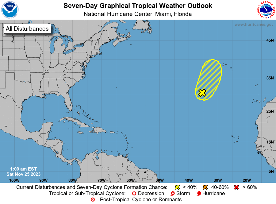
1. Eastern Subtropical Atlantic (AL90):
Showers and thunderstorms remain disorganized in association with a
non-tropical area of low pressure located over the eastern
subtropical Atlantic, and recent satellite-derived wind data
indicate that the circulation is broad and elongated. This system
is forecast to move north-northeastward at 20 to 25 mph toward much
colder waters and develop more pronounced frontal features during
the next day or so, and its chances of acquiring subtropical or
tropical characteristics appear to be decreasing.
* Formation chance through 48 hours...low...10 percent.
* Formation chance through 7 days...low...10 percent.
Forecaster Berg