Skip Navigation Links
NOAA NOAA United States Department of Commerce

NHC Graphical Outlook Archive


« Earliest Available         ‹ Earlier         Later ›         Latest Available »
GIS Shapefiles
Central Pacific Eastern Pacific Atlantic

View 2-Day Graphical Tropical Weather Outlook
Click for Eastern Pacific Click for Eastern Pacific

Tropical Weather Outlook Text

ZCZC MIATWOAT ALL
TTAA00 KNHC DDHHMM

Tropical Weather Outlook
NWS National Hurricane Center Miami FL
700 AM EST Fri Nov 24 2023

For the North Atlantic...Caribbean Sea and the Gulf of Mexico:

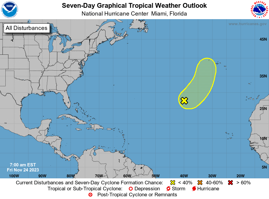
1. Central Subtropical Atlantic (AL90):
A non-tropical area of low pressure located over the central 
subtropical Atlantic is producing disorganized shower and 
thunderstorm activity.  This system could acquire some subtropical 
or tropical characteristics during the next day or two while it 
moves northeastward at 15 to 20 mph.  The chance for subtropical or 
tropical development is likely to end by Sunday as the low moves 
over much colder waters.
* Formation chance through 48 hours...low...30 percent.
* Formation chance through 7 days...low...30 percent.

Forecaster Kelly


List of Atlantic Outlooks (May 2023 - Present)
List of East Pacific Outlooks (May 2023 - Present)
List of Central Pacific Outlooks (May 2023 - Present)
List of Atlantic Outlooks (July 2014 - April 2023)
List of East Pacific Outlooks (July 2014 - April 2023)
List of Central Pacific Outlooks (June 2019 - April 2023)
List of Atlantic Outlooks (June 2009 - June 2014)
List of East Pacific Outlooks (June 2009 - June 2014)